Every One of the 13 Original Colonies
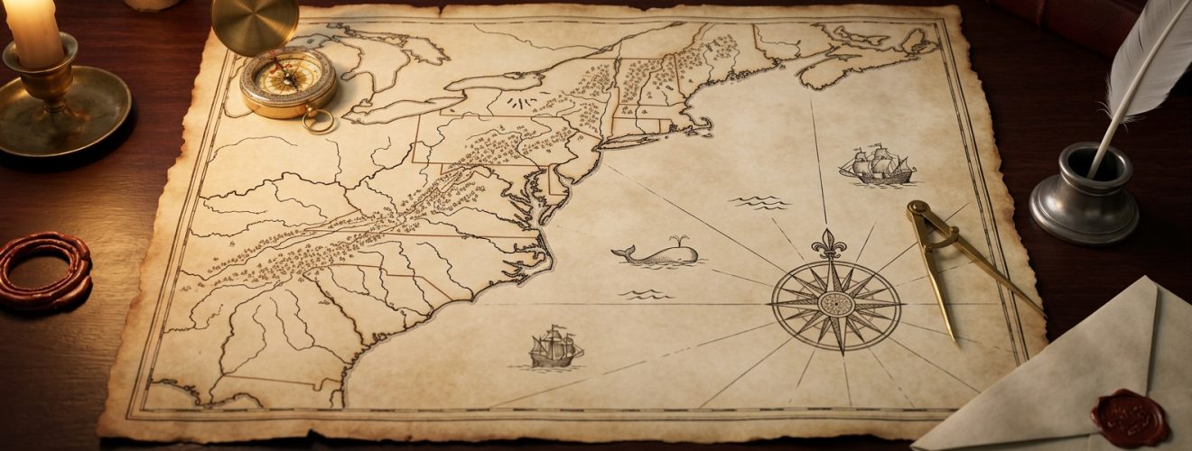
One hundred and twenty-six years separate the first of these colonies from the last. Virginia’s settlers landed in 1607; Georgia’s did not arrive until 1733. The gap shows. When the First Continental Congress met in Philadelphia on 5 September 1774, twelve of the thirteen sent delegates. Georgia stayed home, judging a quarrel with Britain a poor trade for British help against neighboring Native nations.
The other thing the list hides is which countries did the founding. Two of them were started by Sweden: Fort Christina in 1638 and Tinicum Island in 1643, on ground that became Delaware and Pennsylvania. Two more were Dutch, Fort Orange in 1624 and Bergen in 1660, which became New York and New Jersey. Neither country had anything left on the North American mainland by 1674. The Dutch lost New Netherland to England in 1664, took it back briefly, and gave it up under the Treaty of Westminster; the Swedes had surrendered Fort Christina to Peter Stuyvesant in 1655. This list ranks them by first permanent European settlement, no exceptions, which is why the Dutch and Swedish foundings count.
What follows is every one of them in that order, Jamestown to Savannah, with the arguments the dates conceal. The number was settled before the country had a name: the engrossed Declaration of Independence is headed “The unanimous Declaration of the thirteen united States of America,” the lower-case “united” being the document’s own, and the men who signed the Declaration of Independence were signing for exactly these thirteen.
Thirteen British colonies became the original United States: Virginia, Massachusetts, New Hampshire, New York, Maryland, Connecticut, Rhode Island, Delaware, Pennsylvania, North Carolina, New Jersey, South Carolina and Georgia. They are listed here in the order Europeans first settled permanently in each, from Jamestown in 1607 to Savannah in 1733.
Virginia
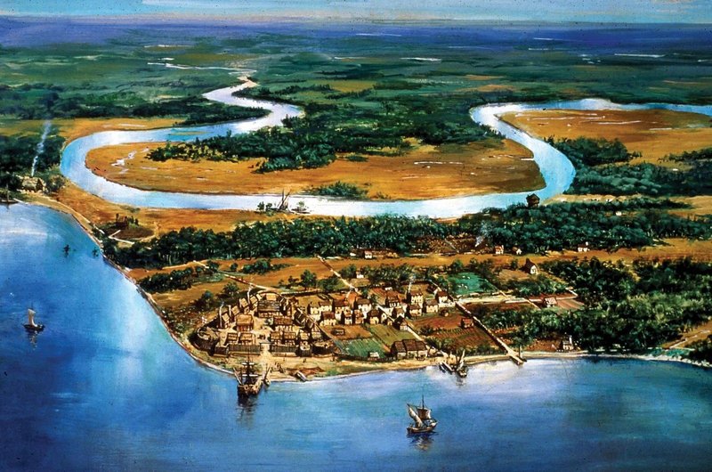
On 13 May 1607 about 104 English men and boys went ashore on a marshy peninsula in the James River, nearly five months out of London aboard the Susan Constant, the Godspeed and the Discovery. They chose the spot to defend against a Spanish attack that never came, and had a triangular fort standing by 15 June.
The charter of 10 April 1606 says what the investors expected: one-fifth of any gold or silver mined would go to the Crown. There was no gold. During the Starving Time of 1609-1610 the population fell from almost 400 the previous August to as few as 60 by spring, a mortality the Park Service puts at 80 to 90 percent, and the survivors ate shoe leather and, in one documented case, a dead companion. In 1611 the incoming deputy governor Sir Thomas Dale found those left “at their daily and usuall works, bowling in the streetes.”
Two things arrived in 1619 that outlasted everyone involved. On 30 July Governor George Yeardley convened the House of Burgesses, the first representative assembly in English America. In late August the privateer White Lion put in at Point Comfort and, in John Rolfe’s account, “brought not any thing but 20. and odd Negroes,” whom officials “bought for victualle” – the first documented Africans in Virginia, and the start of the labor system that would in time supply the country with presidents who owned slaves while in office. Neither was in the charter.
Massachusetts
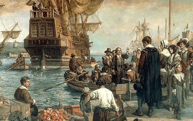
No document written by anyone who was there mentions a rock. The Mayflower left Plymouth, England on 6 September 1620 carrying 102 passengers, blown well off course near the Hudson, and anchored in Provincetown Harbor by 11 November, where 41 of them signed the Mayflower Compact, agreeing to “covenant and combine ourselves together into a civil Body Politick.” The landing stone entered the story in 1741, when 94-year-old Elder Thomas Faunce had himself carried by chair to the shore to identify it, 121 years on.
The settlement began on 25 December 1620, a date the passengers attached no significance to, having rejected the keeping of Christmas on principle. Nearly half of the 102 were dead within six months, two or three a day at the worst of it, and only 52 saw the first anniversary. In March 1621 the survivors made a mutual-defense treaty with Massasoit; that autumn he and about 90 of his men joined them for a three-day harvest, the load-bearing kernel of every Thanksgiving since.
The rock has had the worse century. Estimated at 40 to more than 200 tons, it split in half in 1774 when patriots tried to drag it uphill by ox team, and souvenir hunters have reduced it to roughly 10 tons. The passengers fared better. Nine men on the list of every U.S. president descend from someone aboard, by the Mayflower Society’s reckoning, starting with John Adams.
New Hampshire
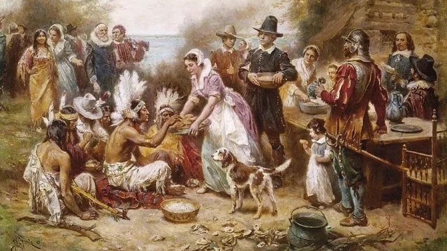
David Thomson was an apothecary, which is not the trade the story usually gives him. In November 1622 he took a patent from three Plymouth investors promising 6,000 acres and an island of his choosing for five years of profitable fishing and trading. He arrived in spring 1623 aboard the Jonathan at the mouth of the Piscataqua River, now Odiorne Point in Rye, and built a stockaded post called Pannaway.
The compound was “a strong and large home” behind a fence mounted with guns, “a terror to the Indians.” Thomson’s own assessment, in a letter of 1625, was gloomier: the place was “like a body without a head, none to rule us.” His household came to his wife Amias, their four-year-old son John, and between seven and ten fishermen nobody troubled to name. When Myles Standish came up from Plymouth in 1623 looking for food, Thomson sent him home with a shipload of salted cod.
He left in 1626 for a 170-acre island in Boston Harbor and died two years later at 36; Pannaway was abandoned by 1630. Later governors did better. Benning Wentworth chartered 131 townships west of the Connecticut River between 1749 and 1764, on ground New York also claimed; the settlers there ended the argument in 1777 by declaring themselves a republic. New Hampshire’s paperwork thereby produced one of the states that were independent countries before they joined the United States, and not one acre for the apothecary.
New York
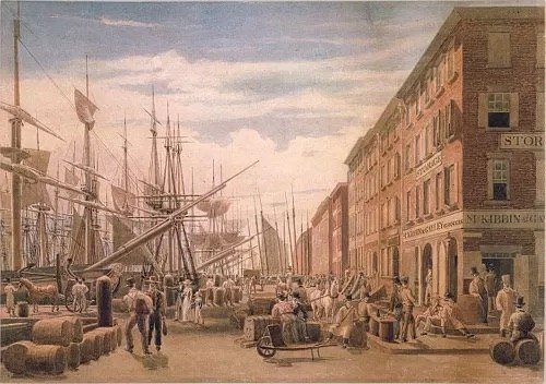
Fort Orange went up in 1624 on the Hudson, at the place where, as the New Netherland Institute puts it, “the choicest product of the American wilderness – the beaver pelt – was transferred to European markets.” It was a Dutch West India Company post, and Walloon families settled it – the Rapaljes and the du Trieux among them, Protestants who had fled Spanish rule once.
The date is less settled than a numbered list makes it look. The New York State Museum’s own exhibits disagree. Its Fort Orange page states the fort was “built... in 1624,” while its archaeology exhibit says in one place that “a permanent settlement was established in 1614 on Castle Island” and elsewhere that “continuous settlement began in 1624.” Pieter Schagen’s letter of November 1626 reports colonists had “purchased the Island of Manhattan from the Natives for the value of 60 guilders,” the only contemporary record of the deal. The conversion of that sum into 24 dollars was a nineteenth-century addition, done, a New York City archaeology summary notes, “probably inaccurately.”
The English took the colony in September 1664 after landing 400 troops in Brooklyn. Peter Stuyvesant tore up the ultimatum in front of the city officials, then signed terms anyway when the inhabitants would not fight. Not a shot was fired. Fort Orange vanished so thoroughly it was not relocated until a 1970 rescue dig ahead of Interstate 787 turned up some 36,000 artifacts. The state museum took possession of them in 2016.
Maryland
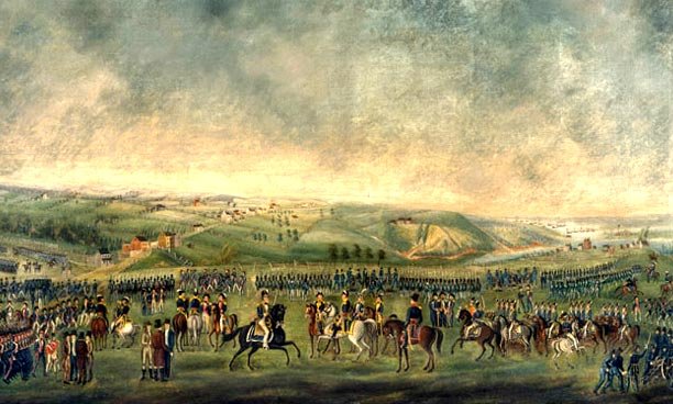
Maryland’s first permanent settlement was planted by a man who then spent two decades fighting Maryland. The Maryland Manual’s foreword records that “William Claiborne, had established on Kent Island in 1631 the first permanent settlement in what was to become Maryland” – three years before Lord Baltimore’s colonists arrived, and as a Virginia trading post. He had bought it from the Susquehannock for axes, knives, combs, bells, beads and cloth valued at twelve pounds sterling, about what two farmhands earned in a year.
The proprietary colony began with Cecilius Calvert’s charter in 1632. His brother Leonard sailed from the Isle of Wight on 22 November 1633 with 140 to 150 colonists aboard the Ark and the Dove. Three days out a storm separated the ships. The Dove fired distress signals and vanished; she reappeared six weeks later in Barbados. They founded St Mary’s City on the Potomac in March 1634, on a palisaded site about the size of a football field.
Kent Island proved harder to absorb than the Calverts expected. On 30 December 1637 Leonard Calvert commissioned George Evelin its Commander, empowered to “elect and chuse any six or more able and sufficient men inhabitants of the said Iland,” and by 16 April 1647 was still pardoning eleven named islanders for “all Crimes of Rebellion, or other offences whatsoever.” Two years later Maryland’s General Assembly passed the Toleration Act, on 21 April 1649. It protected Trinitarian Christians only, and it was repealed in 1692.
Connecticut
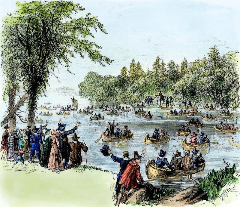
In September 1633 a Plymouth Colony captain named William Holmes sailed up the Connecticut River with a house in the hold. It had been framed in advance and stowed aboard in pieces, so that when he passed the Dutch fort at present-day Hartford and was told he would be fired on, he could keep going, land where the Farmington meets the Connecticut, and raise a finished trading post before anyone could stop him. The site was known as Matianuck.
The Dutch had arrived first, barely. That same year Wouter van Twiller had sent Jacob van Curler to build Huys de Hoop, the House of Hope, at the Little River, meant as the commercial capital of Dutch Connecticut. They sent about seventy armed men to remove him. It did not work. Holmes reportedly told their commander, “I am here, in the name of the King of England, whose servant I am, and here I will remain,” and the Dutch went home.
Holmes held the ground four years, until Dorchester Puritans, arrived in 1635, bought him out in May 1637; the town took the name Windsor that year. The House of Hope did worse. By 1639 a Dutch visitor found it manned by fourteen or fifteen soldiers, and the 1650 boundary settlement drew the line fifty miles west of it, conceding the valley. Nothing of it survives but two Hartford street names, Dutch Point and Huyshope Avenue. Connecticut’s State Capitol carries a marble vignette of the men who displaced it.
Rhode Island
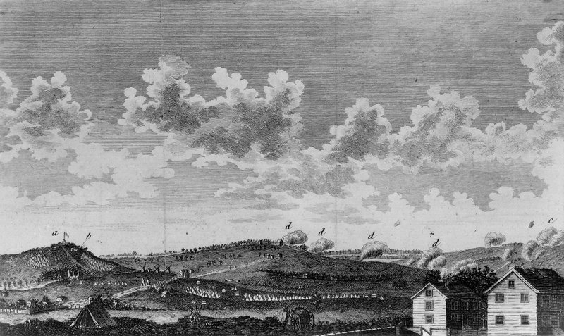
Roger Williams was banished from Massachusetts Bay in the winter of 1636 for preaching “New and Dangerous Opinions,” tried the banks of the Seekonk, was warned he was still inside Plymouth’s jurisdiction, and paddled on. Narragansett people met his canoe near Slate Rock with the greeting “What Cheer, Netop!” He crossed the water and built beside a spring, naming it Providence “in a sense of God’s merciful providence unto me in my distress,” and meant it as “a shelter for persons distressed for conscience.”
The land came from the Narragansett sachems Canonicus and Miantonomi, not from any English authority, which was the point. On 20 August 1637 the settlers adopted Williams’s civil compact, agreeing that their government held authority over “civil things” only. The town’s earliest surviving record is dated in the old Puritan style as “16 die m Month,” the sixteenth day of the fourth month, June 1636.
The legal footing took longer. Williams obtained a parliamentary patent dated, in the Old Style convention that turned the year on 25 March rather than 1 January, “March 14, 1643/44” – both years correct readings of the same day. It carried no royal seal, Charles I having begun to lose his kingdom to the men who issued it, and Williams did not reach Providence with it until September 1644. A sealed charter took until 1663. The Great Salt Cove he settled beside had been supplying salmon, ducks, geese, eels, lobsters and shellfish for roughly 5,000 years.
Delaware
The queen Sweden named the fort for was twelve years old. Peter Minuit’s expedition came ashore aboard the Kalmar Nyckel and the Fogel Grip at what Delaware’s marker calls “the natural wharf of rocks at the riverside about March 29, 1638,” and built Fort Christina where Wilmington stands. Delaware Public Archives calls it “the first permanent European settlement in what is now the State of Delaware”; the National Park Service calls it the first in the Delaware Valley.
Minuit had form. He had run Dutch New Netherland from 1626 to 1631, the tenure associated with the Manhattan purchase, and here he was planting a Swedish colony on ground the Dutch still considered theirs. He left a garrison of about 24 men under Lieutenant Mans Kling, and twelve more expeditions followed over seventeen years, bringing roughly 600 Swedes and Finns. The Kalmar Nyckel herself, an ordinary Dutch pinnace of about 300 tons, crossed the Atlantic eight times between 1637 and 1644.
New Sweden did not last. In 1655 a Dutch force under Peter Stuyvesant besieged Fort Christina and took its surrender, a year after the Swedish governor had done the same to the Dutch at Fort Casimir. The colonists kept their land, their possessions and their customs, and when the English took the river in 1664, the National Park Service notes, “it was the Swedish settlement that remained the heart of the village.” Three empires took turns owning the place, and none managed to move anybody out.
Pennsylvania
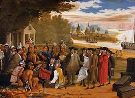
Johan Printz weighed about four hundred pounds. Penn State University Libraries gives him “dark, unforgiving eyes, a protruding jaw, and a girth of approximately four hundred pounds,” and Native Americans called him Mighty Belly. He arrived on the Delaware in 1643 aboard the Fama and the Swan with about 50 settlers and built Fort New Gothenburg on Tinicum Island, named for the port most of them had sailed from, along with a manor house, the Printzhof.
Pennsylvania’s own markers are unusually blunt about it. One reads: “First permanent settlement in present-day Pennsylvania, founded 1643 by Col. Johan Printz, governor of New Sweden. Seized by the Dutch in 1655, and by the English in 1664.” Tinicum genuinely was an island then; the channel was filled in later, which is why the site sits on the mainland now.
Printz governed ten years, longer than anyone else who held the job, building Fort Elfsborg across the river and Fort Korsholm near present-day Chester in 1647. He kept an estate in Sweden the whole time, Gunillaberg Manor, granted by the Crown in 1642, the year he was knighted. The site outlasted the colony by a wide margin: a 1976 excavation at the Printzhof turned up a glass witch bottle made around 1740, stoppered with a whittled plug and packed with six pins, a bird bone and a pottery sherd. The state itself did not put up a marker until 1947. The Swedish Colonial Society had done it in 1923.
North Carolina
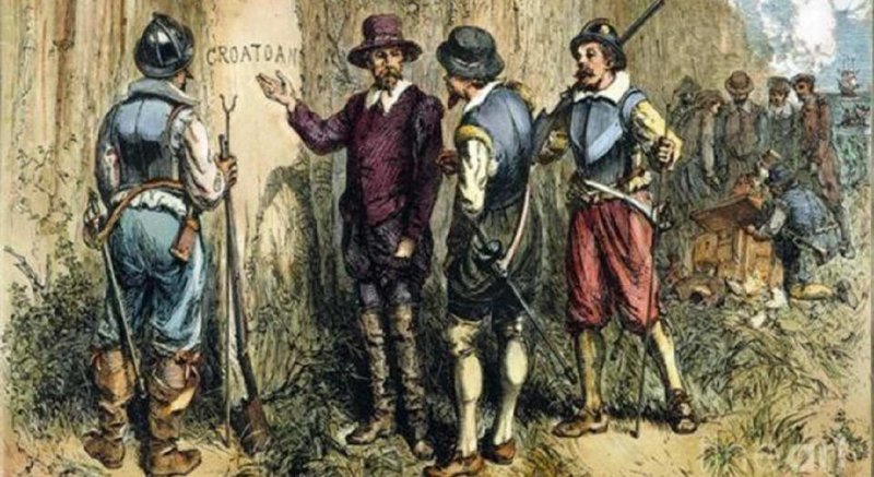
North Carolina’s founding date rests on a lawsuit about an unpaid carpenter. On 15 November 1655 Robert Bodnam sued Colonel Francis Yeardley’s estate in the Lower Norfolk County court in Virginia for money owed on a house “twenty feet square with a lodging chamber, and a Buttery, and a chimney,” which he had spent five months building “to the Southward” for Nathaniel Batts. The court awarded him “One Thousand weight of Tob. And Caske.”
That house is the first documented dwelling in what became North Carolina, and it is unusually well attested for a building nobody has ever found. It stood on the south bank of Salmon Creek near Albemarle Sound and appears on Nicholas Comberford’s map of 1657 labelled “Batts House” – the earliest, and probably only, seventeenth-century building in the colony with a contemporary drawing. Around 1708 the explorer John Lawson described it as “a House made of Logs, (such as the Swedes in America very often make, and are very strong).”
Batts kept a family home and some 900 acres in Virginia and used the Albemarle house mainly in fur-trading season. On 24 September 1660 Batts bought land on the Pasquotank River from Kiscutanewh of the Yeopim, witnessed by George Durant and entered in a Virginia deed book. It is the earliest known recorded deed in North Carolina, and it sat in that book unnoticed until it surfaced, to headlines, in 1966.
New Jersey
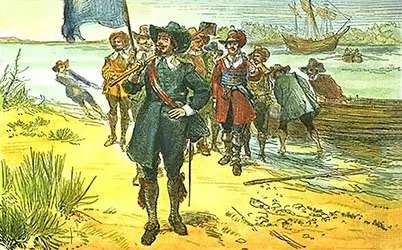
Bergen was laid out as a square 800 feet on a side. Dutch colonists set it out in 1660 behind a palisade of tall pointed stakes with a gate on each side, on ground that was still New Netherland. The State of New Jersey’s own timeline marks that year as the moment “Bergen, now Jersey City, becomes the first permanent town in New Jersey,” and Britannica agrees.
Peter Stuyvesant had ordered the palisade so that settlers “could defend themselves with a militia against the Indians,” and it came down again once, in the record’s own phrasing, “the cessation of Indian hostilities” arrived. He granted the village limited self-government and a Court of Inferior Justice on 5 September 1661, making Bergen the first local civil government in New Jersey as well as its first town. The English took the province in 1664; the Dutch disputed the claim for another nine years.
The proprietors’ founding document, the Concessions and Agreement, was signed by John Berkeley and George Carteret and dated “the Tenth day of February” 1664 in the Old Style, which is February 1665 once the year is counted from January. In 1676 the province was cut in two and stayed that way until 1702. The 800-foot square outlasted all of it: Tuers Avenue, Newkirk Street, Van Reypen Street and Vroom Street still run the line of the palisade, and in 2024 Jersey City finished turning the crossroads inside them into 5,400 square feet of park.
South Carolina
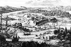
Three ships left England for Carolina on 17 August 1669 and one of them arrived. The Albemarle was destroyed by storms and the Port Royal wrecked in the Bahamas, leaving the Carolina to reach Port Royal Sound in March 1670. The colonists settled at Albemarle Point on the west bank of the Ashley River that April and called the place Charles Town, after Charles II.
How many of them there were depends on who is counting. The South Carolina Historical Society puts about 150 people on the voyage out with only two deaths in transit; the Post and Courier describes roughly 130 free men and women, indentured servants and enslaved people reaching Albemarle Point. What they brought is better recorded than who they were: nails, hoes, shovels, pots, kettles, hinges, wheelbarrows and bricks, and seed stock of cotton, indigo, sugarcane, grapevines and olive cuttings, on the theory that something would grow.
The colony’s framework of government, the Fundamental Constitutions of Carolina, is usually handed to John Locke, though the sources describe his scope rather than sole authorship. The Avalon Project’s text calls the scheme one “framed by John Locke... and amended by the Earl of Shaftesbury.” The South Carolina Encyclopedia holds that Ashley Cooper was the chief author and Locke his secretary and copyist. The demographic question resolved faster than the constitutional one: South Carolina had a Black majority by 1708, and about sixty percent by 1715.
Georgia
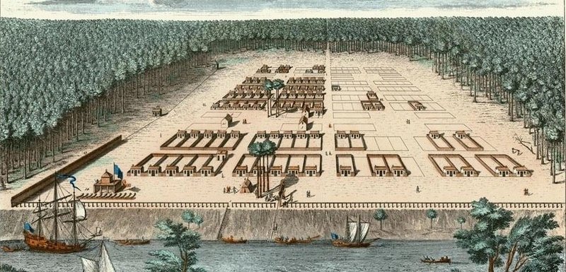
Georgia was founded as a military buffer with a charitable cover story. The Trustees who received the royal charter in 1732 meant to resettle England’s “worthy poor” as farmers, merchants and artisans, and Parliament put up 5,000 pounds; the colony was also, in the New Georgia Encyclopedia’s account, “a military buffer designed to protect Britain’s southern colonies” against Spanish Florida. Both were true at once, and the charter named 21 Trustees to manage them.
The charter itself has two dates, depending on which record you open. The New Georgia Encyclopedia has George II signing it on 21 April 1732; the Georgia Historical Society, citing the document in the Georgia Archives, gives 9 June 1732, and the Library of Congress also says June. James Oglethorpe sailed that November with 114 colonists aboard the Anne and landed at Yamacraw Bluff on 12 February 1733, forty feet above the Savannah River and fifteen miles inland.
Savannah was built on a repeating unit: a ward 600 feet to a side, eight blocks apiece, four of them held in trust for public buildings and churches. The city kept copying it from the Revolution to the Civil War until there were 28 wards; 22 of the original squares are still there. The Trustees lasted twenty years before Georgia reverted to the Crown, handing the youngest of the thirteen colonies to royal government just in time for the quarrel that produced the 14 men who were president before George Washington.
Frequently Asked Questions
Why is New York fourth on this list?
New York ranks fourth because the Dutch built Fort Orange, at what is now Albany, in 1624, and Walloon families settled around it. England seized New Netherland in September 1664 but did not found it. Britannica’s own founding-order reference places New York fourth for the same reason.
Was Plymouth a separate colony from Massachusetts?
Yes. Plymouth kept its own government and its own court records from 1620 until 1691, when the charter granted under William and Mary folded it, along with Maine and Acadia, into the Province of Massachusetts Bay. Increase Mather negotiated that charter in London after the Glorious Revolution.
Why are Vermont and Maine not on the list?
Neither was ever a colony in its own right. Maine was Massachusetts territory, formally purchased in 1677 and separated only in 1820 under the Missouri Compromise. Vermont was disputed ground claimed by both New York and New Hampshire, and it became the 14th state in 1791.
Which of the 13 colonies became a state first?
Delaware ratified the Constitution first, unanimously, 30 to 0, on 7 December 1787 at a Dover tavern, though it is nowhere near first by founding. Rhode Island, one of the older colonies here, ratified last, on 29 May 1790, by 34 votes to 32, the narrowest margin of any state.
How many British colonies were there in America altogether?
It depends who counts. The Sons of the American Revolution puts the total at as many as 23 across North America, 17 of them on the mainland, the rest islands including Bermuda, the Bahamas and Jamaica. The American Revolution Institute counts 26 across British America, where most colonies off the mainland were Caribbean. Both totals include these 13.
What was the population of the 13 colonies?
About 2.41 million on 16 December 1773, the day of the Boston Tea Party, by the Census Bureau’s estimate. By July 1776 it had reached roughly 2.56 million, of whom about 450,000 were enslaved, the figure Britannica gives behind the Bureau’s rounded 2.5 million.
- Britannica – In What Order Were the 13 American Colonies Established?
- National Archives – Declaration of Independence, full transcript
- National Archives – Ratification of the Constitution
- U.S. Census Bureau – Fourth of July Facts for Features
- Library of Congress – Today in History
- United States Senate – Rhode Island state timeline
- National Park Service – Founding Providence, Roger Williams National Memorial
- National Park Service – A Short History of Jamestown