Every U.S. State Capital That Has Been Moved
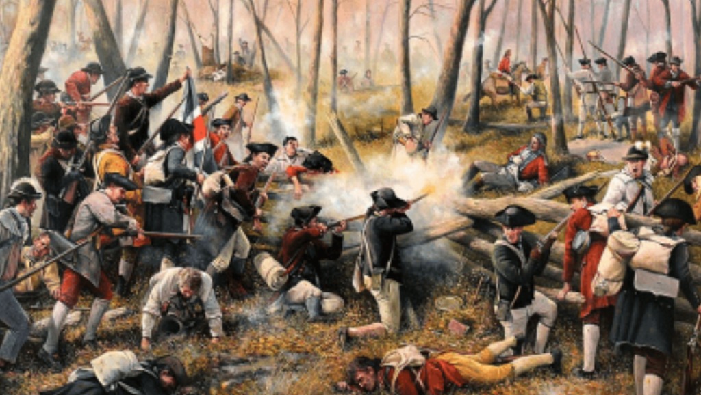
Forty-eight times between 1777 and 1910, an American state moved its capital. The count is unsettling because most people assume capitals were settled fixtures, chosen at statehood and inherited from the territorial period, but the truth is that for the first 130 years of American history, the question of where to put the seat of government was almost permanently open. States moved their capitals because of British raids, river floods, sectional politics, Civil War armies, and the occasional incident of drunken disorder at a tavern. Tennessee moved its capital six times in twenty years. Rhode Island rotated through five different capitals every year. Louisiana moved its capital between New Orleans and Baton Rouge four separate times before finally giving up.
The strict count of individual transitions is closer to sixty-five. Some moves were genuine relocations – Delaware’s flight to Dover in 1777, Indiana’s planned migration to Indianapolis in 1825, Oklahoma’s notorious 1910 capital-snatch from Guthrie. Others were brief embarrassments that the legislators concerned would rather not discuss, like Tennessee’s one-day relocation to Kingston in 1807 to satisfy a treaty obligation, or Louisiana’s eleven-month experiment in moving the capital to Donaldsonville. Several were Civil War evacuations, with Confederate governments fleeing Union armies up rivers and across plateaus. A handful were simply the result of someone better organized winning a vote.
The list below proceeds chronologically, beginning in October 1777 with Delaware’s response to a British raid, and ending in June 1910 with the Oklahoma state seal being smuggled out of a county courthouse hidden in a dirty laundry bundle. The 130 years between produced flooded statehouses, single-vote margins, arrested draymen, dueling steamboats, lawsuits taken to the Supreme Court, and one capitol containing the tomb of its own architect. No state capital has been relocated since 1910.
- The first state capital relocation in U.S. history happened in October 1777, when Delaware moved from New Castle to Dover after a British raid.
- Tennessee moved its capital six times in twenty years – including a one-day relocation to Kingston in 1807 to satisfy a treaty obligation, then immediately reversed.
- California Governor Leland Stanford rowed to his own inauguration in January 1862 because the Great Flood had left Sacramento underwater – the legislature then relocated to San Francisco for six months.
- Abraham Lincoln, then a 28-year-old state legislator, personally engineered the 1837 vote to move Illinois’s capital to Springfield.
- Rhode Island had five state capitals from 1776 to 1854, with the legislature rotating annually through Providence, Newport, East Greenwich, South Kingstown, and Bristol.
- The William Strickland-designed Tennessee State Capitol contains the architect’s tomb in its north portico wall, one of only two American statehouses in which the building’s architect is interred within the walls.
Delaware: New Castle to Dover (1777)
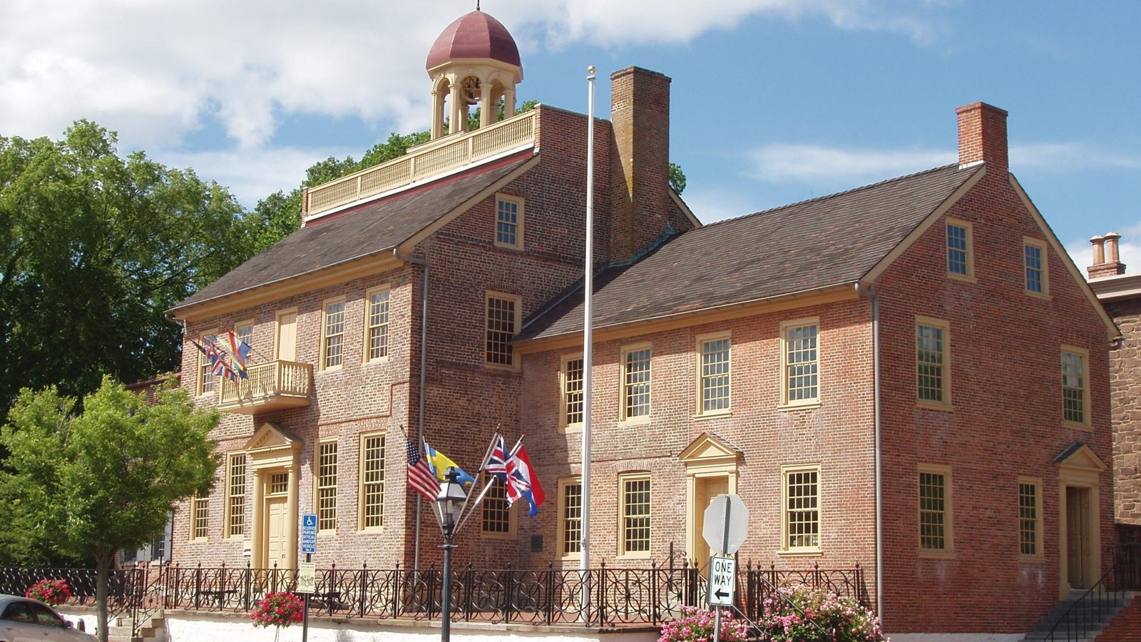
New Castle had everything a colonial capital was supposed to have – a courthouse, a riverfront, prosperous merchants, and a long history of self-governance dating back to its days as the Dutch outpost of Fort Casimir. It also had the misfortune of sitting directly on the Delaware River, which in 1777 was the most dangerous address in the country. British warships had been patrolling the bay since spring, and the threat of a sudden raid was constant enough that the Delaware General Assembly relocated inland that year, settling at the small inland town of Dover.
The decision was barely theoretical. While the legislature was making the move, the British actually invaded Delaware in August and September of 1777, marching through Newark and Cooch’s Bridge on their way to capture Philadelphia. Delaware’s president – the title used for governor in those years – was already in British chains, captured during a separate raid. Caesar Rodney, of midnight-ride fame, took over running the state from his home in Kent County. The new capital at Dover was William Penn’s planned town from 1683, laid out around a central green, and far enough from the river to be defensible.
Dover has been the capital ever since. The General Assembly never seriously revisited the question. Sometimes a wartime decision made in haste turns out to have been the right one all along.
Georgia’s Revolutionary War circuit (1778-1786)
Georgia’s capital during the Revolutionary War was wherever the British weren’t. Savannah fell to Lieutenant-Colonel Archibald Campbell on December 29, 1778, in a battle that lasted less than an hour and cost the British three dead. The state government fled 127 miles north to Augusta, but Augusta turned out to be no safer – in early 1779 only three counties’ worth of representatives could even reach it, no quorum was possible, and the executive council had to flee again when the British arrived in late January. They returned in February when the British abandoned the town. Then the British came back. Augusta changed hands three times during the war.
In January 1780 the legislature met in Augusta long enough to pass a single sensible resolution: if Augusta fell again, they would meet at Heard’s Fort, a small wooden stockade owned by Stephen Heard in Wilkes County. Heard’s Fort served as Georgia’s de facto capital through most of 1780. After that the records become deliberately vague – the government likely roamed Wilkes County and possibly briefly into South Carolina, staying ahead of the British. By July 1782, with the British finally withdrawing, the legislature met for two days at Ebenezer, a half-deserted Salzburger settlement on the Savannah River, before adjourning to Savannah itself.
For the next four years Georgia rotated its government between Savannah and Augusta. Nobody could agree where the capital should permanently sit.
New York’s Revolutionary flight (1777-1788)
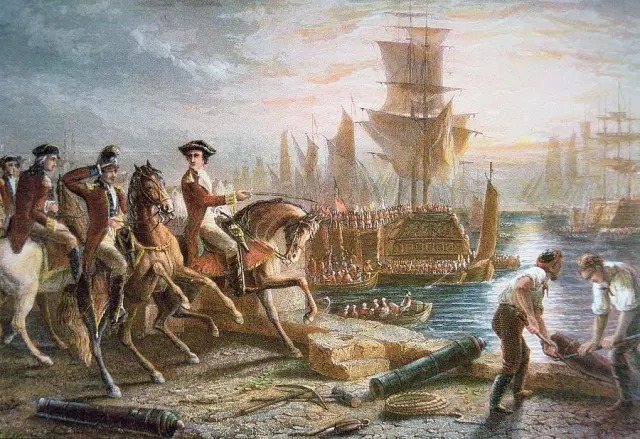
New York’s first state government was driven from its capital almost as soon as it had one. The British occupied New York City in September 1776 and would hold it for the next seven years, leaving the newly independent state of New York with no functional capital. The Provincial Congress retreated up the Hudson Valley, and in early 1777 the legislature began meeting at Kingston, a stone-built Dutch town on the river’s west bank.
Kingston lasted six months. On October 16, 1777, British forces under General John Vaughan sailed up the Hudson and burned the town to the ground – in retaliation, Vaughan said, for Kingston’s role as “a nursery for almost every villain in the country.” The legislature fled to nearby Hurley, which served as capital for several panicked weeks, then to Poughkeepsie, where it stayed for the rest of the war. Poughkeepsie hosted the convention that ratified the U.S. Constitution in 1788.
Once the British evacuated New York City after the war ended, the legislature returned there as if nothing had happened, treating the wartime cities as the temporary measures they were. New York City served as both state and (briefly) national capital from 1788 until 1790, hosting Washington’s first inauguration on the steps of Federal Hall. The state legislature kept meeting there until 1797. By then the population was pushing northward and the case for an inland, central, defensible capital had become unanswerable.
Virginia: Williamsburg to Richmond (1780)
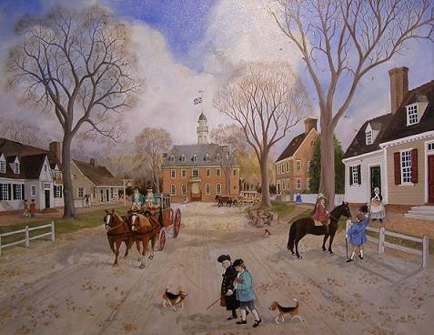
Thomas Jefferson hated Williamsburg. He had hated it since his student days at the College of William and Mary in the 1760s, considered its colonial swampy lowland air unhealthy, and as early as 1776 had introduced legislation in the General Assembly to move the capital. That bill was narrowly defeated. Three years later, with the war going badly in the South and British warships moving freely along the Tidewater coast, the political case for relocation finally caught up with Jefferson’s personal one.
On June 18, 1779, the General Assembly passed “An Act for the Removal of the Seat of Government,” declaring that Williamsburg was “exposed to the insults and injuries of the publick enemy” and naming Richmond – then a riverside town of about 600 residents – as the new capital. Jefferson signed it as governor. The physical move was completed on April 7, 1780, when public records were loaded onto a convoy of tobacco ships and sailed up the James River. The General Assembly convened in Richmond on May 1.
The relocation did not protect Virginia from invasion. In January 1781, Benedict Arnold – now a British general – led 1,600 troops up the James River, captured Richmond, set fire to government buildings, and forced the legislature to flee to Charlottesville and then Staunton. Jefferson barely escaped Monticello hours ahead of Banastre Tarleton’s cavalry. Williamsburg, deprived of its government and its glamour, lost roughly half its population within three years.
New Jersey: Joint Perth Amboy/Burlington to Trenton (1784)
For more than a century, New Jersey had two capitals, which made it the only colony with a structurally split government. The reason was historical accident: in 1676 the colony had been divided into East Jersey and West Jersey, two separate proprietary governments with separate courts, separate land offices, and separate capitals – Perth Amboy in the east, Burlington in the west. When the two halves were reunified in 1702 under a single Crown government, nobody wanted to give up their statehouse. The General Assembly simply alternated between them, meeting in Perth Amboy one session and Burlington the next, dragging records back and forth across the colony for eighty years.
The Revolution made the absurdity of this arrangement obvious. New Jersey had been the country’s most-fought-over state, with both Perth Amboy and Burlington occupied or threatened at various points. After independence, the legislature began holding sessions at a small but rapidly growing town along the Delaware River called Trenton. In 1784 the General Assembly formally designated Trenton as the state capital. The choice was a compromise – geographically between the two old capitals, and politically acceptable to both East and West Jersey factions.
Trenton briefly served as capital of the United States itself in late 1784, when Congress met there for two months at the French Arms Tavern. Trenton’s selection ended what had become a 108-year administrative joke. New Jersey had a single capital at last.
South Carolina: Charleston to Columbia (1786)
Charleston was, by some distance, the wealthiest city in the South in 1786. It had a deep harbor, a slave economy that produced rice and indigo at staggering profit, and a planter aristocracy that genuinely believed it had been put on earth to govern. The backcountry settlers in the upstate – Scots-Irish farmers, Presbyterians, small landholders, recent migrants pushing in from North Carolina – did not share this view. They had been politically excluded from the colonial government for decades, lived three to five days’ ride from the capital, and were tired of it.
After independence, the upcountry’s representation in the legislature grew rapidly with its population, and in 1786 those representatives forced the issue. The General Assembly voted to move the capital to a new city to be built from scratch at the geographic center of the state, near the Congaree River. They named the place Columbia, after the personification of America. It was the first state capital deliberately designed to balance regional power rather than to inherit existing infrastructure.
Charleston did not take the loss gracefully. For the next several decades, lowcountry politicians treated trips to Columbia as exile and complained constantly about the inland town’s lack of amenities. But the move was permanent. Columbia has been the capital ever since, and the political logic that produced it – inland, central, away from the coast and its concentrated wealth – became a template that nearly every other state would eventually follow.
North Carolina: New Bern to Fayetteville (1789)
New Bern was North Carolina’s colonial capital, founded by Swiss and German Palatine settlers in 1710 and named for the Swiss city of Bern. Its centerpiece was Tryon Palace, completed in 1770 by royal Governor William Tryon as a symbol of British authority – a building so extravagant that it triggered the Regulator movement, an armed uprising of backcountry settlers furious at being taxed to pay for it. Tryon Palace burned to the ground in 1798. New Bern’s role as the state’s capital had ended nine years before that.
When North Carolina began debating where its permanent capital should sit after the Revolution, the legislature settled on a compromise: hold sessions in Fayetteville while a dedicated capital city was being built somewhere central. Fayetteville got the assignment in 1789 essentially by being available and willing. It was the largest inland town, sat near the Cape Fear River, and had recently changed its name from Cross Creek to honor the Marquis de Lafayette. The state convention that ratified the U.S. Constitution met there in November 1789.
Fayetteville’s tenure as capital was always understood to be temporary, a placeholder while the General Assembly figured out what came next. Sessions continued there for five years. The decision the legislature was waiting on – to build a proper inland capital from scratch – was made in late 1788. It just took a few years to find the land, settle the location, and start construction. The new city would be called Raleigh.
North Carolina: Fayetteville to Raleigh (1794)
Raleigh did not exist before it was selected to be North Carolina’s capital. The state Senate’s 1788 session had appointed commissioners to find a site within ten miles of Isaac Hunter’s tavern in Wake County, a location chosen because Hunter’s was a known meeting place at the geographic crossroads of central North Carolina. The commissioners purchased a thousand acres from Hunter himself in 1792, surveyed a grid of streets, named it after Sir Walter Raleigh – the Elizabethan adventurer whose lost Roanoke colony had been the first English attempt at North America – and began constructing a statehouse.
The legislature held its first session in Raleigh in December 1794, in a building so fresh that workmen were still finishing it around them. The town had perhaps a few dozen permanent residents at that point. It existed because the state needed it to exist, which is a different origin story from any other capital so far on this list. South Carolina had done something similar with Columbia eight years earlier, but Columbia had at least been a small existing settlement before its promotion. Raleigh was, in 1792, a tobacco field.
The original 1796 statehouse burned in 1831 – a particularly common fate for early American capitols, which tended to be built of wood, lit by candles, and heated by open fires. The Greek Revival replacement was completed in 1840 and is still in use today. Raleigh has never lost its capital status.
Georgia: Augusta to Louisville (1796)
By 1796 Georgia had been rotating its capital between Savannah and Augusta for a decade and was tired of the arrangement. The state’s population was pushing west into the lands recently ceded by the Creek Nation, and the geographic case for a coastal capital had collapsed. The General Assembly chose to do what South Carolina and North Carolina had already done: build a new capital from scratch at a more central location.
The chosen site was a small town in Jefferson County originally called Galphintown, after the Indian trader George Galphin, but renamed Louisville to honor King Louis XVI of France, the recently guillotined patron of the American Revolution. The legislature appropriated funds for a brick statehouse and held its first session there on May 5, 1796. The building was modest by capital standards – two stories, plain Federal style, no grand portico – but it represented Georgia’s first attempt at having a single, settled, peacetime seat of government.
Louisville lasted only eleven years as the capital. The reasons were practical. The town sat in lowland near the Ogeechee River and developed an unfortunate reputation for malaria. Population continued to push westward into former Cherokee and Creek lands. By 1804 the legislature was already debating relocation. Louisville is still there – a small town of about 2,500 people – but its courthouse square is now the place where the state’s brief experiment with peace before the next move played itself out.
New York: NYC to Albany (1797)
After the war, New York reverted to using New York City as its capital because that was what New York had always done. The legislature met at Federal Hall, the same building that hosted the federal government from 1785 to 1790 and where George Washington was inaugurated. But by the 1790s the arrangement was straining. New York City was growing faster than any other American city – it would pass 60,000 residents by 1800 – and the noise, expense, and political distractions of meeting in the country’s commercial capital were a constant complaint among upstate legislators.
Albany made a more sober kind of sense. It was a Dutch-founded river town at the head of navigable Hudson, the gateway to the Mohawk Valley and the country’s expansion westward, and crucially it was about 150 miles from anywhere British had ever attacked. In 1797 the General Assembly designated Albany as the permanent capital. The first session there opened in January 1798 in the city’s Stadt Huys, a Dutch-era civic building that would serve as a temporary statehouse until a proper capitol could be built.
The choice of Albany was prescient. New York City would have been a poor capital for a state whose center of gravity was about to shift north and west with the Erie Canal, completed in 1825. Albany sat at the canal’s eastern terminus and became, almost by accident, the political hinge of one of the most economically important infrastructure projects of the nineteenth century.
Pennsylvania: Philadelphia to Lancaster (1799)
Philadelphia in the 1790s was simultaneously the capital of the United States, the capital of Pennsylvania, the largest and richest city in the country, and a recurring death trap. Yellow fever epidemics in 1793, 1794, 1797, and 1798 killed thousands, including a tenth of the city’s population in 1793 alone. The federal government temporarily relocated to Trenton during the 1799 outbreak. Pennsylvania’s state government had a separate but related complaint: Philadelphia was on the eastern edge of a state that now stretched all the way to the Ohio River, and its political dominance increasingly grated on western farmers and Scots-Irish settlers in the Susquehanna Valley.
In 1799 the General Assembly voted to relocate the state capital to Lancaster, an inland city about seventy miles west of Philadelphia. Lancaster had genuine credentials. It was the largest inland town in the United States at the time – population around 4,000 – and had served briefly as the capital of the Continental Congress for one day in September 1777, when delegates fleeing Philadelphia paused there before continuing on to York. The legislature moved into the Lancaster County Courthouse and began the process of governing Pennsylvania from a town it could fit inside several times over.
Lancaster lasted thirteen years as capital. The arrangement worked well enough but never settled the deeper question of where Pennsylvania’s permanent capital should sit. The state’s population was still pushing west, and Lancaster, despite its inland location, was not actually central to the state.
Vermont: Burlington to Montpelier (1805)
Vermont came into the Union in 1791 as the fourteenth state, having spent the previous fourteen years as an independent republic – a fact most Americans, including most Vermonters, have largely forgotten. Its first state capital was Burlington, on the eastern shore of Lake Champlain, chosen because it was already the largest town in the new state. But Burlington had a problem fundamental to its candidacy: it sat in the far northwest corner of a state shaped like a long vertical rectangle. For a Vermonter from the southeast, getting to the capital meant a journey of more than a hundred miles across the Green Mountains.
In 1805 the legislature moved the capital to Montpelier, a small town in the center of the state on the Winooski River. Montpelier had perhaps 1,200 residents at the time. It had no particular claims to importance other than its location, which was the entire point. The legislature met in a wooden statehouse that lasted until 1836, when it was replaced by a granite Greek Revival building, which itself burned in 1857 and was replaced by the current capitol in 1859.
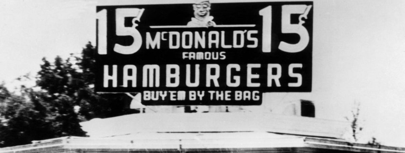
Montpelier remains the smallest state capital by population in the United States, with just over 8,000 residents. It is the only state capital without a McDonald’s. These two facts are unrelated and beloved in equal measure by Vermonters, who have settled into a comfortable identity as the state that does things its own way.
Georgia: Louisville to Milledgeville (1807)
Louisville had been Georgia’s capital for eleven years when the legislature decided it was time to move again. The reasons were the ones that had driven every previous Georgia capital decision since the Revolution: the population was pushing west, the geographic center of the state was shifting, and the existing capital was not where most Georgians actually lived. Louisville also had the persistent complication of malaria, which the lowland town along the Ogeechee River produced reliably every summer.
In 1804 the legislature appointed commissioners to find a new site, and in 1807 it settled on a tract of land in Baldwin County that had recently been Creek territory. The new capital was named Milledgeville after John Milledge, the sitting governor and the man who had personally donated the land for the University of Georgia in 1801. Milledgeville was a planned town from the start – laid out in a grid, with public squares, a designated lot for the statehouse, and another for a governor’s mansion. It was Georgia’s first capital that had been designed as a capital before any government arrived.
The Milledgeville statehouse, built between 1807 and 1815, was the first government building in the United States constructed in the Gothic Revival style – which made it a rare exception in an era when nearly every American capital wanted Greek or Roman columns to legitimize itself. Milledgeville served as the capital for over fifty years, the longest run of any Georgia capital before Atlanta.
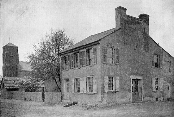
Tennessee: Knoxville to Kingston for one day (1807)
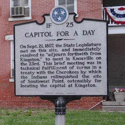
The state of Tennessee was the capital of itself for several hours on September 21, 1807, in a small town in Roane County called Kingston. The reason was a Cherokee treaty. Two years earlier, in October 1805, U.S. Indian agent Return Jonathan Meigs had negotiated the Treaty of Tellico, in which the Cherokee ceded all land north of the Duck River and across the Cumberland Plateau. Article 1 of the treaty included a Cherokee request that the small section of ceded land at Southwest Point – the future Kingston – be considered as a desirable location for the Tennessee state capital. The treaty was signed, ratified, and accepted.
The treaty did not specify how long Kingston had to serve as the capital. The Tennessee General Assembly noticed this. On September 21, 1807, the legislators traveled the roughly forty miles from Knoxville to Kingston, convened the Seventh General Assembly in a small wooden courthouse, conducted the minimum amount of legitimate state business they could justify – electing a Speaker for each house, choosing clerks, counting the votes for governor and Congress – and then voted nine to four to adjourn back to Knoxville the following morning.
The terms of the treaty were thus fulfilled, the land remained with the state, and Kingston was relieved of capital duty before its residents had really registered the honor. A monument in the center of Kingston commemorates the day. It is genuinely the strangest capital city story in American history.
New Hampshire: Portsmouth to Concord (1808)

Portsmouth had been the colonial and early state capital of New Hampshire essentially because it was the largest town and the only port. It had a Royal Governor’s residence, a prosperous merchant fleet, and the social pretensions of a city that thought of itself as a smaller and more refined Boston. None of this counted for very much by 1808, when the rest of New Hampshire – which is to say, nearly all of it – was tired of having its government located in a single coastal corner that was both physically remote from the interior and dangerously exposed to British warships, a lesson the War of 1812 was about to underline.
The legislature had been migrating the question for two decades. Sessions had been held at various towns – Exeter served as the wartime capital during the Revolution, and the General Court rotated through several inland sites in the 1780s and 1790s. In 1808 the legislature finally voted to designate Concord, a small town on the Merrimack River, as the permanent state capital. Concord was central, inland, and on a navigable waterway. It had perhaps 2,000 residents at the time.
The choice was unglamorous and entirely practical, which made it durable. Concord has been the capital ever since, and the New Hampshire State House – completed in 1819 and still in use – is the oldest state capitol in the country in which the legislature still meets in its original chambers.
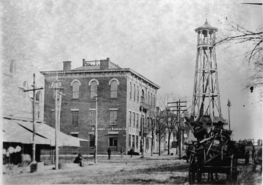
Ohio: Chillicothe to Zanesville and back (1810-1812)
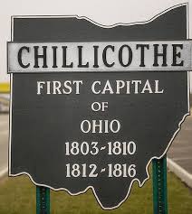
Ohio’s brief Zanesville detour was a piece of legislative horse-trading that fell apart almost as soon as it was completed. When Ohio entered the Union in 1803, Chillicothe was the natural choice for capital – it had been the capital of the Northwest Territory before statehood, sat on the Scioto River in a fertile valley, and had a stone statehouse already built. But Chillicothe was also in the southern third of the state, and as settlers pushed north along the Muskingum River, eastern Ohio politicians began agitating for a capital closer to them.
In 1810 the General Assembly cut a deal: the capital would relocate to Zanesville, an inland town named for frontier road-builder Ebenezer Zane, in exchange for legislative votes on an unrelated bill. The arrangement was understood by everyone to be a political bargain rather than a long-term plan. Zanesville built a new brick courthouse to host the legislature. The legislators arrived, governed for two years, and in 1812 packed up and went back to Chillicothe.
The reason for the return was simple: nobody had ever loved the Zanesville arrangement, including the Zanesville citizens who discovered that hosting a state government was less profitable than they had expected. Chillicothe served as capital for four more years while the General Assembly figured out where Ohio’s real permanent capital should sit. The answer was already being designed. It would not be Chillicothe.
Tennessee: Knoxville to Nashville (1812)
Tennessee’s capital sat on top of a sectional faultline from the moment of statehood in 1796. East Tennessee, centered on Knoxville, was older, more settled, and politically dominant. Middle Tennessee, centered on Nashville, was newer, growing faster, and increasingly impatient. The Cumberland Plateau between them was difficult to cross, and travel from Nashville to a session of the legislature in Knoxville could take a week of hard riding through Cherokee country.
The 1805 Treaty of Tellico changed the calculation by ceding the entire Cumberland Plateau to Tennessee, finally connecting east and middle Tennessee with reasonable roads. By 1812 the Nashville delegation had the votes to force a relocation. The General Assembly moved the capital across the plateau to Nashville, which had perhaps 1,500 residents at the time but had become the commercial hub of the Cumberland Valley. Andrew Jackson, who would soon make Nashville famous through his 1815 victory at the Battle of New Orleans, had built his plantation, the Hermitage, just outside the new capital.
The move was understood as a victory for middle Tennessee, which it was, and as a permanent solution, which it was not. Tennessee had four major cities and a habit of indecisive politics. The legislators of east Tennessee had not given up. Within five years they would force a return move, beginning a fifteen-year sequence of capital ping-pong that became the most chaotic state government relocation history in the country.
Pennsylvania: Lancaster to Harrisburg (1812)
Lancaster’s thirteen-year run as Pennsylvania’s capital ended for the same reason it had begun: the state’s population was pushing west, and the capital was no longer where most Pennsylvanians lived. By 1810 the state stretched from Philadelphia to the Ohio River, and Lancaster – which had seemed reasonably central in 1799 – now sat in the eastern third of the state. Western farmers in the Allegheny region had no patience for travelling east of the Susquehanna to attend to their government.
In 1810 the General Assembly named Harrisburg as the new capital, and on October 13, 1812, the legislature held its first session there. Harrisburg sat directly on the Susquehanna River at a crossing point known since the 1730s as Harris’s Ferry, named for the Scots-Irish trader John Harris Sr., whose son had laid out the town in 1785. The city had perhaps 2,000 residents and an unfinished statehouse.
Harrisburg has been Pennsylvania’s capital ever since. The original 1822 statehouse burned in 1897, and the current Capitol, completed in 1906, is one of the most ornate state capitols in the country – a Beaux-Arts confection with a dome modeled on St. Peter’s Basilica that Theodore Roosevelt called the handsomest building he ever saw. It cost three times its budget, which is the kind of detail that explains why Harrisburg eventually settled into the role nobody had originally wanted it to fill.
Ohio: Chillicothe to Columbus (1816)
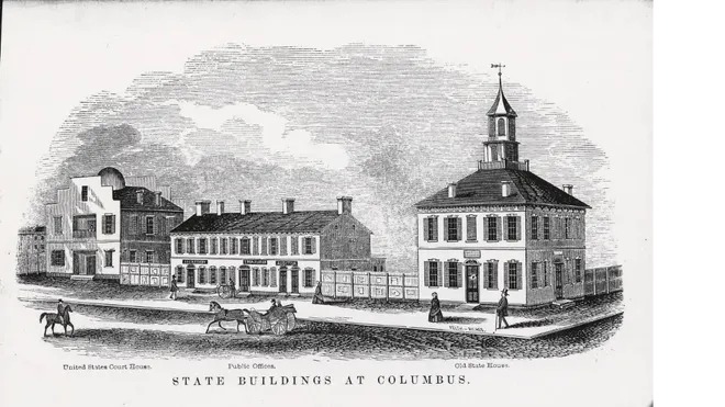
Columbus did not exist before Ohio decided to put its capital there. In February 1812 – while the legislature was still meeting in Chillicothe and the question of where to locate a permanent capital had been bouncing around for nearly a decade – four landowners on the high banks across the Scioto River from the small town of Franklinton made the General Assembly an offer: donate two ten-acre parcels of forest, and pay up to $50,000 toward statehouse construction, if the legislature would put the capital there. The General Assembly accepted within days.
The new town was named Columbus after Christopher Columbus, surveyed and platted into a street grid in mid-1812, and offered for public sale in lots starting in June. The site had been chosen partly for its location near the geographic center of the state, partly for the financial inducement, and partly because the alternative site – a town called Franklin – had been disqualified by what one source delicately calls “an incident of drunken disorder at a tavern near the proposed statehouse.” Ohio politicians of 1812 were prepared to overlook many things, but apparently not that.
The General Assembly moved into the new Columbus statehouse in December 1816. The town had perhaps 700 residents by then. The current Greek Revival capitol, begun in 1839 and completed in 1861, replaced that original brick building and is today one of the oldest working statehouses in the country. Columbus has been Ohio’s capital for over two centuries.
Tennessee: Nashville to Knoxville (1817)
Five years after middle Tennessee won its capital fight, east Tennessee won the rematch. The 1817 General Assembly voted to relocate the capital back to Knoxville, reversing the 1812 move. The reasons given were procedural – Knoxville had a working statehouse, Nashville’s facilities were inadequate, the state’s records were stored in Knoxville anyway. The actual reason was political. East Tennessee politicians had spent five years arguing the move had been a mistake, and they finally had the votes.
Knoxville in 1817 was a town of perhaps 600 people, smaller than Nashville and considerably less well-positioned for the future. It sat near the Cumberland Plateau in a region whose population growth had stalled while middle and west Tennessee boomed. The legislature met at the existing Knox County courthouse – the same building that had hosted the original 1796 state convention – and conducted business on the assumption that Knoxville would now serve as the permanent capital.
The assumption lasted exactly one year. The 1818 General Assembly almost immediately began debating another relocation, this time to a compromise site between east and middle Tennessee. The pattern was becoming embarrassing even by the standards of frontier-era state politics. Tennessee had moved its capital three times since 1807 and was about to move it a fourth time. No other state had ever had this much trouble settling on a seat of government, and no other state has matched it since.
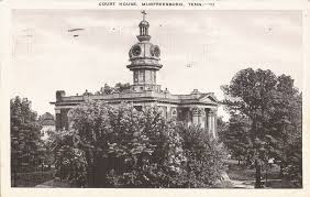
Tennessee: Knoxville to Murfreesboro (1818)
Murfreesboro was the compromise candidate. After more than a decade of east-versus-middle Tennessee capital warfare, the General Assembly in 1818 settled on a town that satisfied nobody fully, which is generally how compromises are constructed. Murfreesboro sat at the geographic center of the state, in newly opened Rutherford County, about thirty-five miles southeast of Nashville. Its population in 1818 was approximately 950 people. It had been incorporated as a city only the year before.
The town was named for Colonel Hardy Murfree, a Revolutionary War officer from North Carolina who had never lived there – the General Assembly had originally named the place Cannonsburgh, after Newton Cannon, but had renamed it a month later at the request of Captain William Lytle, who happened to be Murfree’s friend and apparently had stronger views about commemoration. The legislature met in the local Rutherford County Courthouse. The arrangement worked passably until 1822, when the courthouse burned down and the General Assembly was forced to relocate to the local Presbyterian Church on East Vine Street.
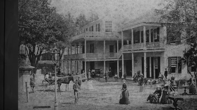
For eight years Murfreesboro hosted the state government on a biennial basis, with sessions every other year. Andrew Jackson, James K. Polk, Sam Houston, and Davy Crockett all spent time conducting state business there – a remarkable concentration of future national figures in a town smaller than a modern office park. Murfreesboro’s tenure as capital ended in 1826. The legislature was tired of meeting in a Presbyterian church, and Nashville had finished campaigning to get the capital back.
Alabama: Huntsville to Cahawba (1820)

The site of Alabama’s first permanent capital was a federal land grant from President James Monroe. When statehood arrived in 1819, the temporary capital was Huntsville, in the far north of the state, chosen because it had a usable building and a population of about 2,000. But Alabama needed a permanent seat of government, and Governor William Wyatt Bibb – the state’s first chief executive – had a very specific vision for what that should look like. Bibb wanted a planned capital city built from scratch at the confluence of the Alabama and Cahaba rivers, where steamboats could reach it from Mobile.
Bibb persuaded Monroe to grant the Cahawba site to the new state. He persuaded the Alabama General Assembly to appoint commissioners to lay out a town. By 1820 Cahawba had been platted into a grid, a brick statehouse had been constructed, and the legislature was meeting there. Land that had sold for $1.25 an acre a year earlier was now selling for $60 to $70 an acre.
Cahawba had two problems that nobody had thought through carefully. It sat at the meeting of two rivers, which meant it flooded reliably. The marshes around it bred mosquitoes that spread malaria and yellow fever, though no one yet understood the connection. Governor Bibb died in 1820 from injuries falling off his horse, leaving Cahawba’s chief patron gone before the town’s flaws could be defended.
Illinois: Kaskaskia to Vandalia (1820)
Kaskaskia was an old French colonial town on a low-lying tract along the Mississippi River, established by Jesuit missionaries in 1703 and serving as the capital of the Illinois Territory long before statehood. When Illinois entered the Union in 1818, Kaskaskia simply continued as the state capital because it was the only place anyone had thought to put one. Its tenure was always meant to be brief. The state constitution itself stipulated that a permanent capital would be chosen within twenty years.
Kaskaskia’s natural disqualifications became apparent quickly. The town flooded constantly. Its population was small and shrinking as new settlers pushed eastward into central Illinois. By 1819 the General Assembly had selected a site in Fayette County and named the new town Vandalia. The choice was geographic – Vandalia sat near the National Road, the federal highway being constructed across the country – and demographic, since the population center of Illinois was migrating north.
The legislature moved to Vandalia in December 1820 and met in a hastily-built two-story frame statehouse that burned to the ground in 1823. A replacement brick statehouse was thrown up so cheaply it began crumbling within a decade. By 1836 a fourth Vandalia statehouse – the one still standing today – had been completed in a desperate attempt to keep the capital from moving again. None of it would matter. The 1820 act had a built-in twenty-year sunset clause, and population was already pushing further north.
Mississippi: Natchez to Jackson (1821)
Mississippi’s first state capital was Natchez, the wealthy slave-trading port on a high bluff above the Mississippi River. Natchez had been the territorial capital, the largest city, and the political center of the state when statehood was granted in 1817. None of this counted for very much by 1821, because Mississippi’s geographic shape meant that a riverside capital on the western edge of the state was inconvenient for everybody who didn’t live within a day’s ride of the Mississippi.
In November 1821 the General Assembly appointed three commissioners – Thomas Hinds, William Lattimore, and Peter Van Dorn – to find a more central site. They surveyed the area along the Pearl River and recommended a Choctaw town called Chisha Foka, meaning “among the post oaks,” which had become a small trading post owned by a French-Canadian named Louis LeFleur. The settlement was known as LeFleur’s Bluff. The Treaty of Doak’s Stand, signed the previous year, had legally opened Choctaw lands to white settlement.
The General Assembly authorized the site as the permanent state capital on November 28, 1821, and renamed it Jackson, after General Andrew Jackson – the hero of New Orleans, soon to be president, and recently the negotiator of the Doak’s Stand treaty himself. One Whig politician complained that the location was “a serious violation of principle” because it wasn’t quite at the absolute center of the state. He was overruled. Jackson has been the capital ever since.
Indiana: Corydon to Indianapolis (1825)
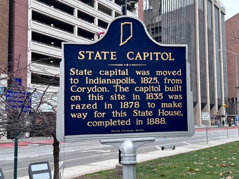
Indianapolis was conceived in 1820 specifically to be Indiana’s capital. The first state capital was Corydon, a town of about 500 people in southern Indiana that had served as the territorial capital and continued in the role at statehood in 1816. Corydon’s claim to permanence was tenuous from the start. The state’s population was rapidly pushing north into central Indiana, into lands recently ceded by the Miami and Potawatomi nations.
In 1820 a state commission was sent to find a permanent capital site at the geographic center of Indiana. They settled on a forested tract at the west fork of the White River, near the mouth of Fall Creek. The new capital was named Indianapolis – “Indiana” plus the Greek “polis” – and was deliberately laid out to resemble Washington, D.C., with broad avenues radiating from a central circle and a grid system of numbered streets. The town in 1820 had essentially no permanent residents.
The actual move took place over two weeks in late 1824 and early 1825. State Treasurer Samuel Merrill led a wagon convoy of state records and furniture 132 miles north from Corydon, through bad weather and worse roads, with state workers falling sick along the way. The Indiana General Assembly held its first session in Indianapolis on January 10, 1825. The town had perhaps a few hundred residents. It would become, in time, the largest American city not located on a major waterway.
Tennessee: Murfreesboro to Nashville (1826)
By 1826 the General Assembly had been wandering Tennessee for nearly twenty years and was beginning to look ridiculous. Murfreesboro’s courthouse had burned in 1822, forcing the legislature to meet in a Presbyterian church. Nashville had grown to roughly 5,000 residents and was now indisputably the commercial center of Tennessee. Andrew Jackson was about to win the presidency. The argument for keeping the state government in a small town with no statehouse was running out.
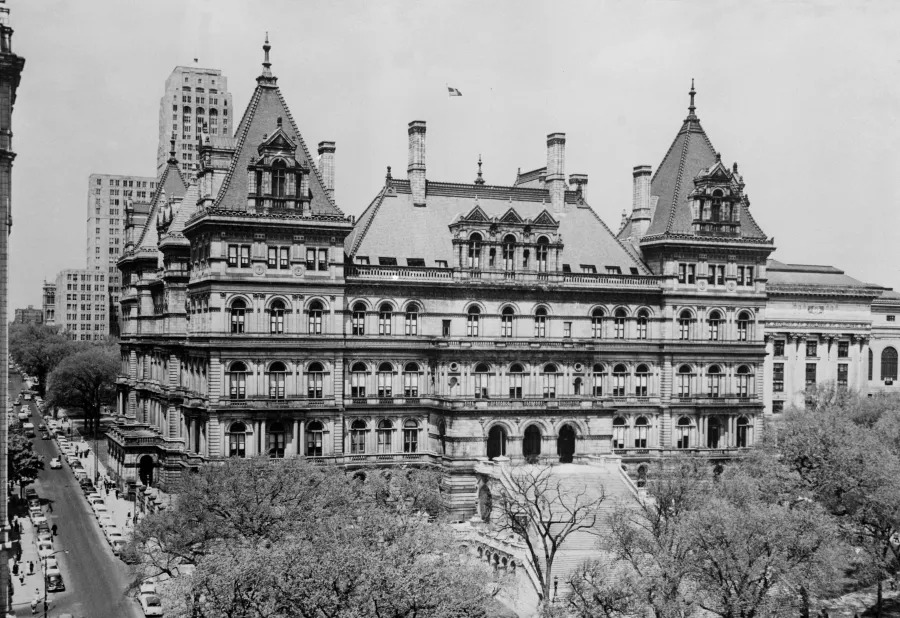
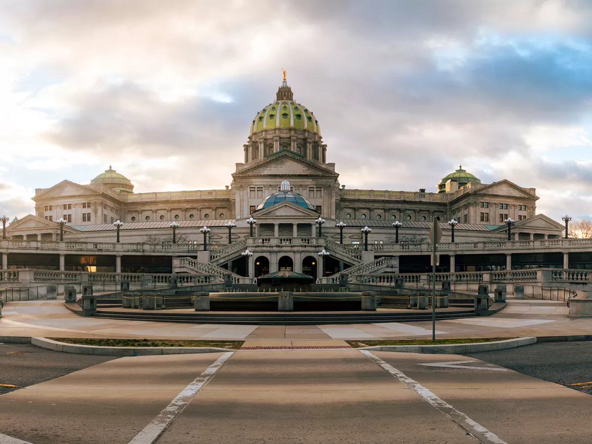
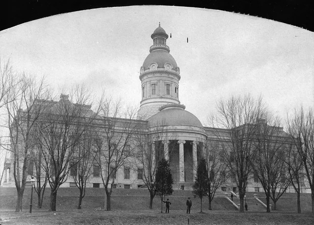
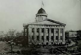
In October 1826 the legislature voted to relocate the capital permanently to Nashville. The decision was structurally similar to the 1812 move – middle Tennessee’s commercial weight overwhelming east Tennessee’s political grievances – but this time it stuck. The 1834 Tennessee Constitution required the General Assembly to formally designate a single capital, and in 1843 it finally did, ratifying Nashville officially. Construction of the current Tennessee State Capitol, designed by William Strickland, began in 1845 and took fourteen years.
Strickland died of pneumonia during construction in 1854 and is buried in the wall of the capitol’s north portico, his tomb sealed behind a marble panel inscribed with his name. He had asked to be entombed there, and the legislature obliged. The Tennessee State Capitol is one of only two American statehouses in which the building’s architect is interred within its walls. The other is the New York State Capitol in Albany.
Missouri: St. Charles to Jefferson City (1826)
Missouri’s first state capital was a temporary measure from the start. When Missouri entered the Union in 1821 – after the Missouri Compromise had taken eighteen months to work out – the state had no purpose-built capital and no clear plan for where to put one. The General Assembly settled on St. Charles, a former French colonial trading post along the Missouri River about twenty miles upriver from St. Louis, as a placeholder while a commission identified a proper permanent site.
The commission chose a wooded bluff along the south bank of the Missouri River and named the site Jefferson City after Thomas Jefferson – who was, somewhat awkwardly, still alive at the time, and who would die on July 4, 1826, exactly fifty years to the day after the signing of the Declaration he had drafted. Surveying began in 1822. A simple two-story brick statehouse was constructed by 1826, and the legislature held its first session in Jefferson City that October.
The town in 1826 had about thirty residents. It existed because the state needed a capital, not because anyone had previously thought to settle there. By 1830 the population had climbed to roughly 600. Jefferson City has remained the capital ever since, weathering the burning of its capitol in 1837, the burning of its replacement in 1911, and the construction of the current capitol, which was struck by lightning in 1916 before it was even finished.
Alabama: Cahawba to Tuscaloosa (1826)
The flooding at Cahawba was real, but it was not what moved the capital. The town did flood – 1822 saw rising water in the streets, and the lowland location at the confluence of two rivers guaranteed yearly trouble – but the floods were exaggerated by Cahawba’s political opponents into a public health crisis that justified relocation. The actual driving force was the death of Governor William Wyatt Bibb in 1820. Cahawba had been Bibb’s personal project. With him gone, the rival Warrior-Tombigbee faction, which had wanted Tuscaloosa as the capital from the beginning, mobilized to finish the job.
On December 13, 1825, the Alabama General Assembly voted by a single-vote margin to move the capital to Tuscaloosa. The relocation took effect February 1, 1826. Tuscaloosa sat on the Black Warrior River about a hundred miles north, in a region growing rapidly with the cotton boom. Within weeks of the move, Cahawba’s population dropped from over 2,000 to roughly 300. Most of the influential families packed their houses onto barges and floated them to Tuscaloosa or Mobile.
The state capitol building at Cahawba was abandoned. Its copper-plated dome was eventually removed and installed atop a Methodist church in nearby Lowndesboro, where it remains. Cahawba itself became a brief antebellum cotton town, was used as a Confederate prisoner-of-war camp during the Civil War, and was eventually abandoned. It is now a state archaeological park where deer wander through the foundations of what was once a state capital.
Louisiana: New Orleans to Donaldsonville (1830)
Louisiana was unique among American states in finding its largest city, busiest port, and most powerful economic center genuinely intolerable as a capital. New Orleans in 1830 had over 46,000 residents and a ferocious culture of yellow fever, political corruption, dueling, and Creole-Anglo factional warfare. The state legislature, dominated by Anglo-American planters from upriver parishes, had been complaining about meeting in New Orleans for years. The city’s social pleasures distracted legislators, its costs were exorbitant, and its summer epidemics frequently shortened legislative sessions by killing or scattering the participants.
In 1830 the General Assembly voted to relocate the capital to Donaldsonville, a small French-speaking town about seventy miles upriver on the west bank of the Mississippi. Donaldsonville had been founded in 1806 and named after William Donaldson, who had laid out the town. Its population was perhaps 600. It had no statehouse and no infrastructure for hosting state government, and no particular reason to have been chosen other than being not New Orleans.
The legislature met in Donaldsonville for the 1831 session and immediately regretted it. The town’s accommodations were inadequate, its yellow fever was no better than the city they had fled, and the rural setting that had seemed appealing in theory turned out to be merely inconvenient in practice. Within a year, the same legislators who had voted to leave New Orleans were voting to go back. Donaldsonville’s tenure as capital lasted approximately eleven months.
Louisiana: Donaldsonville to New Orleans (1831)
The return to New Orleans in 1831 was a quiet admission that the Donaldsonville experiment had failed. The General Assembly had voted to leave New Orleans for what it considered principled reasons – the city’s corrupting influence, its unhealthy summers, the inconvenience of meeting in a metropolis – and had discovered within a single legislative session that all of those problems were preferable to the actual experience of governing from a small French-speaking river town with no functioning statehouse.
The legislature reconvened in New Orleans in 1831 and resumed business as if Donaldsonville had been a brief unfortunate experiment that no one wished to discuss. New Orleans was, in fact, what its critics said it was: corrupt, expensive, pestilential, and thoroughly distracting. But it was also where the state’s records, its merchants, its newspapers, and its political machine actually lived.
The deeper problem was not solved by the return. New Orleans was an inappropriate state capital for reasons that had not changed. It sat on the southeastern edge of Louisiana, was dominated by French Creole culture in a state increasingly governed by Anglo-American planters from upriver, and had a yellow fever season that would kill multiple legislators over the next two decades. Within fifteen years the General Assembly would try again, this time choosing a smaller upriver town with better claims to centrality. The 1830-1831 round trip was a rehearsal. The real move would come in 1849.
Maine: Portland to Augusta (1832)
Maine had been a state for exactly twelve years when its capital relocated. When Maine separated from Massachusetts in 1820 under the Missouri Compromise, Portland was the obvious choice for capital – it was the largest city, the busiest port, and home to Maine’s commercial elite. Everyone understood the arrangement to be temporary. Portland sat in the southwestern corner of a state shaped like a vast, sparsely populated rectangle, and Maine’s interior settlers had no patience for travelling to the coast to attend sessions of a government that was supposed to represent them.
The legislature opened the question in 1822 and spent five years debating which inland town should host the new capital. The principal candidates were Augusta, Brunswick, Hallowell, Waterville, Belfast, and Wiscasset. Augusta won by offering a free thirty-four-acre site on Weston Hill, overlooking the Kennebec River, and pledging to help pay for construction. Governor Enoch Lincoln signed the bill on February 24, 1827. The cornerstone of the new statehouse was laid on July 4, 1829, in an elaborate Masonic ceremony, and the legislature held its first Augusta session on January 4, 1832.
The statehouse itself was designed by Charles Bulfinch, the architect of the U.S. Capitol’s central rotunda, who modeled Maine’s capitol on the Massachusetts statehouse he had also designed. Granite for the walls was hauled from Hallowell quarries by oxen. Portland spent the next eight decades trying to win the capital back, sending repeated proposals and proposing capital-relocation amendments. Each one failed.
Illinois: Vandalia to Springfield (1839)
The campaign to move the Illinois capital to Springfield was orchestrated by a young state legislator from Sangamon County named Abraham Lincoln. He was twenty-eight years old, in his second term, six feet four inches tall, and spectacularly unsuited to the political arts of bargain and threat – except that he turned out to be excellent at them. The 1820 act that had made Vandalia the capital contained a sunset clause expiring in 1839, and as the deadline approached, towns across central Illinois lobbied for the prize.
Lincoln led a delegation of nine Sangamon County legislators – all of them notably tall, with a combined height reportedly approaching fifty-four feet – who became known as the Long Nine. Their nickname came from a heavy naval gun. Their strategy involved trading votes on internal-improvement appropriations for votes on capital relocation, and Lincoln drafted an amendment requiring any candidate town to contribute $50,000 and two acres of land, which immediately eliminated smaller competitors. The bill passed on the fourth ballot on February 28, 1837. Springfield received seventy-three votes, Vandalia sixteen.
The physical move took two more years. Springfield’s new statehouse was still under construction. The legislature finally convened there in December 1839, in the building now known as the Old State Capitol, which would later host Lincoln’s “House Divided” speech in 1858 and serve as the place where his body lay in state in 1865. Springfield has been Illinois’s capital ever since.
Alabama: Tuscaloosa to Montgomery (1846)
Tuscaloosa had served as Alabama’s capital for exactly twenty years when the state’s center of gravity shifted out from under it. When the legislature had voted to move from Cahawba to Tuscaloosa in 1825, Tuscaloosa sat in what was then the demographically dominant western half of the state, in the cotton country along the Black Warrior River. By the mid-1840s the dominant region was central Alabama. Population had pushed east into the rich Black Belt soils around Montgomery and Selma, and the old western capital was again sitting outside the state’s actual political center.
Montgomery had risen rapidly. Founded in 1819 at the confluence of two rivers, it had become the commercial hub of the Black Belt cotton economy, with steamboat connections to Mobile and a growing railroad network. In 1846 the Alabama General Assembly voted to relocate the capital to Montgomery effective the following year. The move was understood to be permanent, and this time it was. Montgomery built a brand-new Greek Revival statehouse, which opened in 1847 and burned down in 1849, and was replaced by the current Alabama State Capitol in 1851.
Fifteen years later, the same building hosted the formation of the Confederate States of America. Jefferson Davis was inaugurated as Confederate president on its front steps on February 18, 1861. Montgomery was briefly the Confederate capital before that designation moved to Richmond in May. The bronze star marking where Davis stood is still embedded in the portico.
Michigan: Detroit to Lansing (1847)
In August 1812, the territorial governor of Michigan handed Detroit over to British forces without firing a shot. William Hull, fearing massacre at the hands of Tecumseh’s warriors, surrendered the city – making it the only American city ever to be surrendered to a foreign power. American forces recaptured it the following year, and Hull was court-martialed and sentenced to death, then spared because of his Revolutionary War service. The episode was thirty-five years past by the time Michigan’s 1835 constitution required the state capital to be moved away from Detroit by 1847. It still felt recent enough to matter.
The 1835 framers had written the deadline directly into the document. Detroit was the temporary capital, the constitution said, and it would remain so “until the year 1847, when it shall be permanently located by the legislature.” When the time came, the contenders were Ann Arbor, Jackson, Marshall, Grand Rapids, DeWitt, and a township in Ingham County containing fewer than twenty residents and almost no infrastructure. The Ingham County tract was called Lansing.
Lansing won partly because it was geographically central, partly because it was distant from the British-controlled Canadian border, and partly because the state was nearly broke and Lansing had offered free land and free buildings. The legislature moved on March 17, 1847, into a two-story wood-framed statehouse with green shutters, on a tract that had been forest a few months earlier. The first Lansing legislative session opened January 4, 1848.
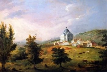
Louisiana: New Orleans to Baton Rouge (1849)

The third attempt to move Louisiana’s capital out of New Orleans was the one that finally worked. After the 1830-1831 Donaldsonville debacle, the legislature spent eighteen years complaining about New Orleans without doing anything about it. The pattern was familiar: yellow fever epidemics killed legislators, the city’s social pleasures drained productive sessions, and Anglo-American planters from upriver continued to chafe at meeting in a French-Creole metropolis. By the late 1840s the political coalition for relocation had finally rebuilt itself.
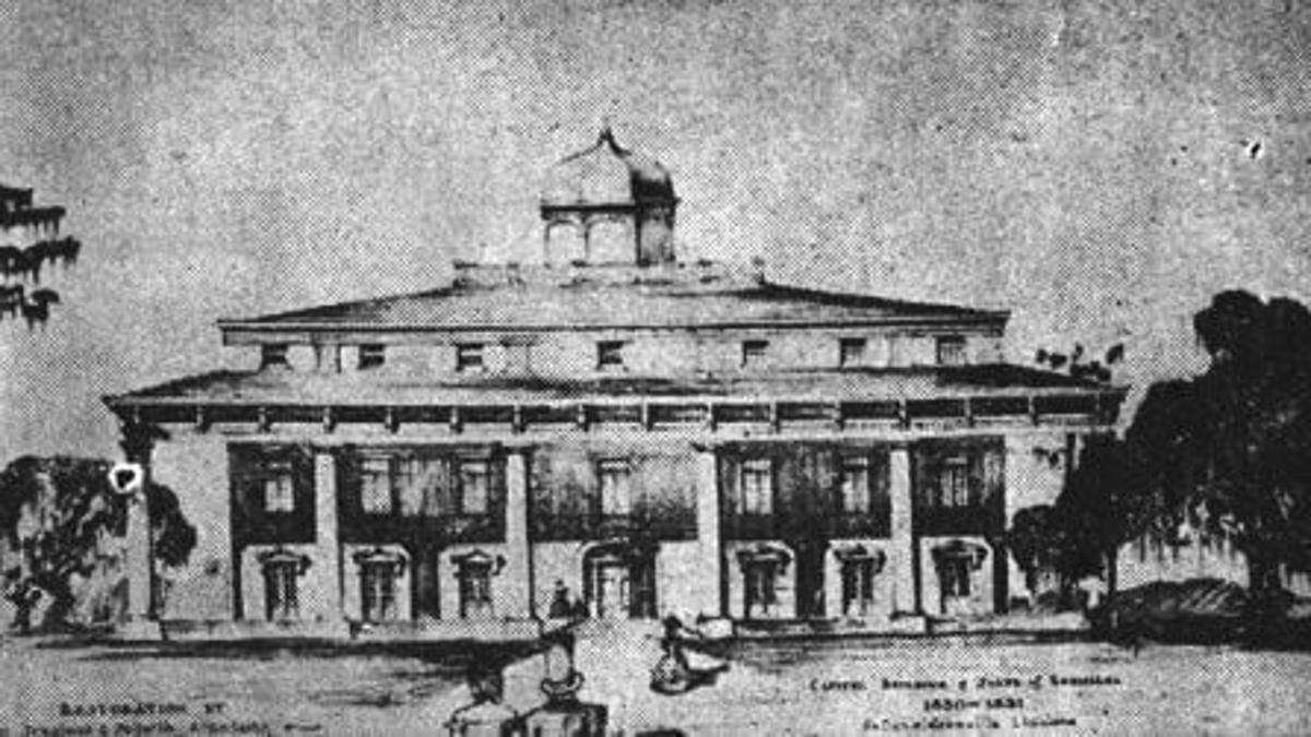
In 1846 the legislature designated Baton Rouge as the new capital, and in 1847 it appropriated funds for a statehouse to be built there. Baton Rouge sat about eighty miles upriver from New Orleans on the east bank of the Mississippi. It was small – perhaps 3,000 residents – and Anglo-American in character, with strong commercial ties to the upriver parishes. The architect James Dakin was hired to design a statehouse, and what he produced in response was unlike any other state capitol in America: a Gothic Revival castle, complete with crenellated towers, pointed arches, and a turreted facade that Mark Twain would later call “this little sham castle.”
The new Louisiana State Capitol opened in 1849, and the legislature held its first session in Baton Rouge that December. Twain detested it. He wrote that Sir Walter Scott had been “in great measure responsible for the war” because his romantic medievalism had infected the South with sham gentility. The capitol still stands today.
California’s chaotic capital search (1852-1854)
California’s first four years of statehood produced the most disorganized capital relocation in American history. When California entered the Union in September 1850, the legislature was already meeting in San Jose, which had been chosen the year before mostly because the state’s first constitutional convention had met in nearby Monterey. San Jose’s facilities were inadequate, its accommodations expensive, and the legislators almost universally hated it.
In 1851 the legislature accepted an offer from a Mexican-American War veteran named Mariano Vallejo, who pledged to build a new capital city named for himself, complete with statehouse, hotels, library, and schools. Vallejo was an unfinished promise. When the legislature arrived in January 1852, the buildings were not ready. Within weeks they relocated to Sacramento, which had grown rapidly with the Gold Rush. Sacramento served for the rest of that session. In 1853 the legislature returned briefly to Vallejo, found it still inadequate, and moved to Benicia, where it spent a year in a brick statehouse along the Carquinez Strait.
The Benicia building still stands and is one of the oldest legislative buildings in the West. The legislature found Benicia just as unsatisfactory as the previous four locations. In February 1854 it moved permanently back to Sacramento, where the offer of land and buildings had been more generous and the population larger. Sacramento has been the capital ever since. The 1852-1854 period had produced five capital cities in three years.
Iowa: Iowa City to Des Moines (1857)
The campaign to move Iowa’s capital from Iowa City to Des Moines involved, by the open admission of one of its principal organizers, “all lawful and legal means . . . including Chesapeake and Sardinian appliances, and any quantity of whiskey.” The organizer was General James A. Williamson, and the appliances in question were oysters, which were apparently effective on Iowa state legislators. The deeper case for the move was demographic: Iowa’s population had exploded from 192,000 in 1850 to over 674,000 by 1860, and the new settlers were pushing west into the Des Moines River Valley.
In 1855 the legislature voted to relocate the capital to a tiny town near the confluence of the Des Moines and Raccoon rivers. The town had been Fort Des Moines until February 1857, when residents officially dropped “Fort” from the name to look more dignified. The compromise that produced the move was elegant: Des Moines would get the capital, but Iowa City would get the State University of Iowa as consolation. Both arrangements were written into the 1857 state constitution.
The actual relocation took place in November 1857 in deep winter. State workers loaded records, furniture, and four large iron safes onto wagons and started the 130-mile overland trip across the unbridged Iowa prairie. A blizzard caught the convoy, and the treasurer’s safe was abandoned in the snow for several days until the storm passed. It was eventually hauled the rest of the way by bobsled across frozen ground.
California: Sacramento to San Francisco and back (1862)
Leland Stanford rowed to his own inauguration. On January 10, 1862, California’s newly elected governor traveled by boat from his mansion to the state capitol because Sacramento was under ten feet of water. The Great Flood of 1862 had been building since November, when snow gave way to forty-three consecutive days of rain fed by what meteorologists now call atmospheric rivers. By early January, the entire Central Valley had become an inland sea three hundred miles long and twenty miles wide. Sacramento sat at the center of it. The city’s levees, designed to keep water out, instead trapped it inside until the water level inside Sacramento was higher than the river beyond.
The legislature attempted to convene. It was unworkable. On January 22, the entire state government relocated to San Francisco, where it remained for six months, meeting at the Merchants’ Exchange Building. By the time the legislature returned that summer, the state had nearly gone bankrupt – one in eight California buildings destroyed, a quarter of taxable property gone. Stanford himself rowed back to his mansion after the inauguration and entered through a second-story window.
Sacramento’s response was to physically raise the entire city. Over the next twenty years, downtown buildings were jacked up eight to ten feet, and the streets beneath them filled with dirt. The original first floors became basements. Some of them remain accessible today, beneath the modern sidewalks of Old Sacramento.
Louisiana’s Civil War flight (1862-1865)

The Confederate state government of Louisiana spent the Civil War running away from Union forces. It began on April 25, 1862, when Admiral David Farragut’s fleet captured New Orleans without firing a major shot – the largest city in the Confederacy fell faster than anyone had thought possible. Two days before the surrender, Governor Thomas Overton Moore and the legislature evacuated upriver to Baton Rouge. Baton Rouge fell on May 9. The state government fled west to Opelousas, a French-speaking town about seventy miles inland in St. Landry Parish.
Opelousas served as the Confederate Louisiana capital for nine months. Governor Moore lived in a plantation house at 231 North Liberty Street that had been built in 1850. The legislature passed laws there, including a state conscription act that drafted Louisiana men into the Confederate army. In January 1863, with Union forces advancing through Bayou Teche country, the government fled again – this time about two hundred miles north to Shreveport, in the far northwestern corner of the state.
Shreveport was the Confederate capital of Louisiana for the remaining two years of the war. It was also the headquarters of the Trans-Mississippi Department under General Edmund Kirby Smith and the exile capital of the Missouri Confederate government. The Union High Command listed it alongside Richmond, Atlanta, and Mobile as one of four targets of strategic value remaining in 1864. It survived the war intact, partly because the 1864 Red River Campaign aimed at capturing it failed.
Arkansas: Little Rock to Washington (1863)
Governor Henry Massie Rector evacuated Little Rock in a panic. In May 1862, after the Confederate defeat at Pea Ridge in northwest Arkansas, Rector ordered state officials to pack their records onto a steamboat and flee up the Arkansas River, bound for Hot Springs. Rector had been suggesting Arkansas might withdraw from the Confederacy entirely, which had not endeared him to Richmond. The evacuation was supervised by John Wesley Woodward of Clarksville, a state employee who had been deaf since birth and was, according to his contemporaries, “affectionately and universally” known as Dummy Woodward. Woodward worked through the night arranging the wooden crates that held the state’s records.
The Union forces that had triggered the panic withdrew east before reaching Little Rock, and the government returned. The real evacuation came on September 10, 1863, when Major General Frederick Steele’s Union forces took Little Rock after the Battle of Bayou Fourche. Confederate Governor Harris Flanagin moved the state government 110 miles southwest to Washington, in Hempstead County. The Hempstead County Courthouse, completed in 1836, became the Confederate capitol of Arkansas. Woodward, now better organized, got the records to Washington intact.
A separate Unionist provisional government was installed in occupied Little Rock under Isaac Murphy in January 1864. For the rest of the war, Arkansas had two governments and two capitals. Washington remained the Confederate capital until the war’s end in 1865. The courthouse still stands and is now part of Historic Washington State Park.
Georgia’s Civil War flight: Milledgeville to Macon and back (1864-1865)
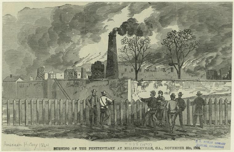
Sherman was coming. By November 1864, Major General William Tecumseh Sherman’s Army of the Tennessee was burning its way from Atlanta toward the Atlantic, and Milledgeville sat directly on its projected path. Georgia’s Confederate Governor Joseph E. Brown had spent years feuding with the Confederate government in Richmond over states’ rights, conscription, and the Confederate command’s strategic neglect of Georgia. None of that helped him now. On November 17, 1864, Brown evacuated Milledgeville for Macon, eighty miles to the southwest, taking the state’s records and the legislature with him.
Sherman occupied Milledgeville on November 23. His soldiers ransacked the statehouse, threw legislative records out of windows, held a mock legislative session in which they voted Georgia back into the Union, and burned the magazine and the penitentiary on their way out. The state archives that Brown had managed to remove were spared. The legislature reconvened in Macon in early 1865, meeting in the Macon City Hall building, which is still standing today. The session was brief and dominated by recriminations about the war’s progress.
By the spring of 1865 Sherman had reached the Carolinas, the Confederacy was collapsing, and the Macon capital had outlived its purpose. The legislature returned to Milledgeville before the war ended, finding the statehouse damaged but standing. Brown surrendered on May 9, 1865, twelve days after Lincoln’s death and one month after Lee’s surrender at Appomattox. Milledgeville’s days as the capital were already numbered.
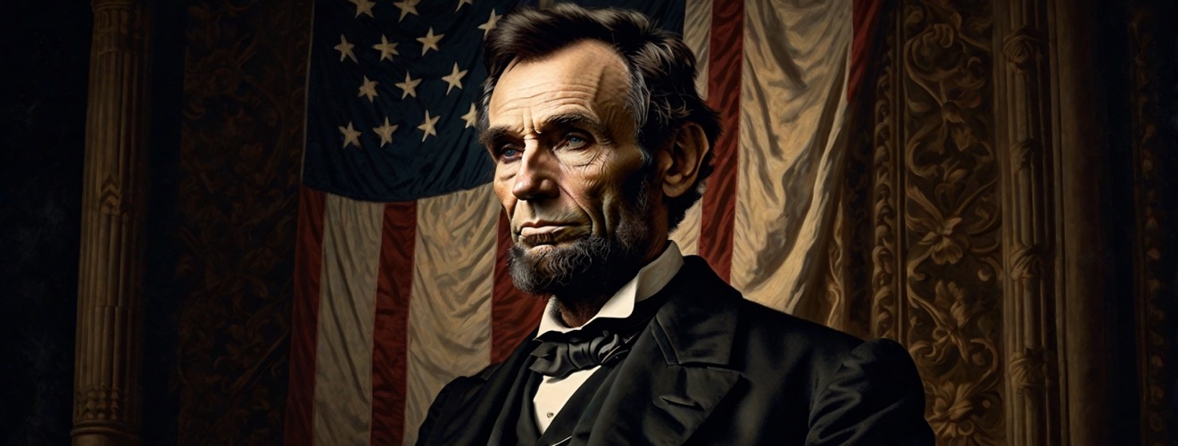
Nebraska: Omaha to Lincoln (1867)
Nebraska’s capital relocation happened simultaneously with statehood and reflected one of the more vicious sectional fights in the state’s history. The Nebraska Territory had been created in 1854 with Omaha as its capital – chosen because it sat directly across the Missouri River from Council Bluffs, Iowa, and was the obvious gateway for settlers moving west. Northern Nebraska was the demographic and political center of the territory. South of the Platte River, however, lay an increasingly populous region whose settlers resented Omaha’s dominance, and they began agitating to move the capital south almost immediately.
When Nebraska achieved statehood in March 1867, the legislature took the opportunity to settle the question. South-of-the-Platte legislators had the votes. They chose a small village called Lancaster, in Lancaster County, about sixty miles southwest of Omaha. The town had perhaps thirty residents, a salt-mining operation, and almost nothing else. It was renamed Lincoln in honor of the recently-assassinated president, partly because that name had bipartisan appeal and partly because pro-Union Nebraskans wanted to commemorate him.
The choice was deeply unpopular in Omaha, which lost a bitter fight to retain the capital. The legislature met for the first time in Lincoln in December 1868, in a hastily-built statehouse that was already crumbling within ten years and had to be replaced. Lincoln has been the capital ever since, growing into a substantial city around the planned grid that Nebraska’s commissioners had laid out in 1867 around an undeveloped salt flat.
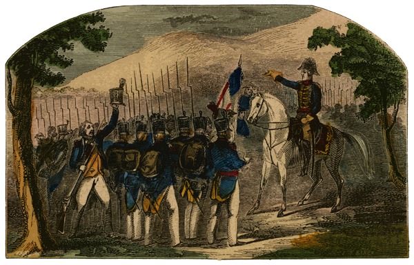
Georgia: Milledgeville to Atlanta (1868)
Atlanta in 1868 was three years removed from being burned to the ground. Sherman had ordered the city torched in November 1864 after his troops had finished destroying its rail yards and military infrastructure. By the time the war ended, Atlanta was largely rubble. What rebuilt it – astonishingly fast – was the same thing that had made it militarily strategic: railroad junctions. Within two years of the war’s end, Atlanta was again a hub of railway commerce, and its population was approaching twenty thousand.
Georgia’s Reconstruction-era constitution of 1868 made the capital relocation official. The convention that drafted it was dominated by Republicans, including thirty-seven African American delegates, and represented the first state government in Georgia’s history not controlled by the antebellum planter elite. Milledgeville was deeply associated with that elite. Atlanta was associated with commerce, railroads, and the future. The constitution designated Atlanta as the new capital effective immediately. On June 30, 1868, Georgia’s state government was loaded into sixteen railcars and shipped to Atlanta in what may be the only state capital relocation in American history conducted entirely by train.
The first sessions were held in the Kimball Opera House, which served as the temporary statehouse for the next two decades. The current Georgia State Capitol opened in 1889, with a dome covered in gold leaf from Dahlonega in northern Georgia, where the country’s first major gold rush had occurred in 1828.
Connecticut: Joint Hartford/New Haven to Hartford alone (1875)

For 174 years, Connecticut had two capitals. The arrangement was a relic of the colony’s seventeenth-century origins: Hartford had been the capital of the Connecticut Colony from 1636, and New Haven had been the capital of the separate New Haven Colony from 1638. When the two colonies merged in 1665, neither town was willing to give up its statehouse, and so the General Assembly simply alternated between them, holding spring sessions in Hartford and fall sessions in New Haven. The arrangement survived the Revolution, statehood in 1788, and the entire first half of the nineteenth century.
By the 1860s the dual-capital system had become functionally indefensible. State records had to be physically transported between the two cities twice a year. Officials needed two offices. The cost was substantial and the inconvenience constant. Hartford had also become significantly larger, more economically central, and home to the state’s growing insurance industry, which would shortly make it one of the wealthiest small cities in America.
The Connecticut General Assembly voted to consolidate the capital permanently in Hartford in 1873. The change took effect in 1875 with the opening of the new Hartford statehouse, designed by Richard Upjohn in High Victorian Gothic style and built at a cost of $2.5 million – extravagant by the standards of the day. New Haven kept its old statehouse as a courthouse and museum. The two-capital experiment, the longest in American history, was finally over.
Louisiana: New Orleans to Baton Rouge, permanent (1882)
The fourth and final move of Louisiana’s capital between New Orleans and Baton Rouge was the one that finally stuck. Reconstruction had complicated the arrangement: the 1864 Union-installed government had moved the capital back to New Orleans, where it remained through the postwar years even though the original 1849 designation had been Baton Rouge. The Gothic statehouse in Baton Rouge had been damaged by fires during Union occupation and stood gutted for nearly two decades.
The 1879 Louisiana Constitution settled it. It declared that the capital would return to Baton Rouge and appropriated funds to restore the gutted Gothic Revival statehouse. James Dakin’s 1849 castle was rebuilt by architect William Freret, who added a fourth floor and replaced the original cast-iron staircase with a spectacular spiral. The legislature held its first restored Baton Rouge session in 1882. Mark Twain, visiting the rebuilt building shortly afterward, repeated his earlier complaint that the structure represented everything wrong with Southern romanticism, calling it “this little sham castle” and again blaming Sir Walter Scott.
Twain notwithstanding, the building has stood ever since. In 1932, Governor Huey Long pushed through funding for a new thirty-four-story Art Deco state capitol, which opened that year and is now the tallest state capitol in the country at 450 feet. Long was assassinated inside it three years later. Baton Rouge has not lost the capital since 1882.
West Virginia: Wheeling/Charleston tug-of-war (1870-1885)
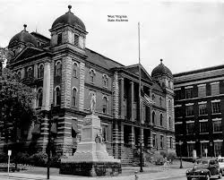
West Virginia spent its first twenty-two years as a state moving its capital up and down the Ohio River by steamboat. The state had been born during the Civil War, on June 20, 1863, in the loyalist northwest counties of Virginia that had refused to secede with the rest of the state. Wheeling, in the northern panhandle, was the obvious initial capital – it had hosted the constitutional convention and was the largest city in the new state, with about 19,000 residents. Charleston, in the central Kanawha River valley, had perhaps 3,000.
In 1870 the state legislature moved the capital south to Charleston, partly to balance regional interests and partly because former Confederates in the Kanawha Valley had recently regained the right to vote. State records traveled by the steamer Mountain Boy down the Ohio and up the Kanawha. Five years later the legislature reversed itself, voting in 1875 to return to Wheeling. The Charleston citizens sued, draymen carrying the records were arrested, and the state government boarded the steamer Emma Graham anyway, leaving the records behind under court injunction. They were transferred to a second steamer, the Chesapeake, at Parkersburg.
A statewide referendum in 1877 finally settled the question. Wheeling – largely Republican and resented by the Democratic legislature – was kept off the ballot entirely. Charleston, Clarksburg, and Martinsburg competed. Charleston supporters traveled with a circus during the campaign. Charleston won. The capital moved back south on May 1, 1885, by steamboat, and has stayed there since.
Rhode Island: Five capitals to one (1854 and 1900)

Rhode Island had five capital cities for seventy-eight years. The arrangement began in 1776, when the newly-independent state decided that legislative sessions should rotate through all five of its county seats – Providence, Newport, East Greenwich, South Kingstown, and Bristol – so no single town could dominate the others. Each county built a courthouse that doubled as a statehouse. Sessions opened every year in Newport in May, then moved through the other four locations on a complicated annual circuit. The arrangement was, by the standards of state government, completely insane.
In 1854 the rotation was reduced to two cities. A constitutional amendment cut Bristol, East Greenwich, and South Kingstown from the schedule, leaving only Providence and Newport, which alternated spring and fall sessions for the next forty-six years. Providence had grown rapidly with industrialization and was becoming the dominant city. Newport, which had been ruined as a port by the British occupation during the Revolution, had recovered as a summer resort but stagnated as a year-round commercial center.
In 1900 a second amendment ended the rotation entirely. Providence became the sole capital. Construction had begun on a new state capitol building in 1895, designed by McKim, Mead & White, with what would become the world’s fourth-largest self-supporting marble dome. It opened in 1901. Rhode Island had spent 124 years figuring out it only needed one capital. By the standards of a state geographically smaller than most American counties, this seems unhurried.
Oklahoma: Guthrie to Oklahoma City (1910)
Oklahoma’s last capital relocation involved a Governor stealing the state seal under cover of darkness and hiding it in a dirty laundry bundle. The 1906 Enabling Act that had created Oklahoma had specified Guthrie as the temporary capital until 1913, when the question would be put to a public vote. Governor Charles Haskell, a Democrat, did not wait. The Oklahoma City Chamber of Commerce had been agitating for an earlier referendum, and Haskell scheduled a special election for June 11, 1910. Oklahoma City – already six times Guthrie’s population – won in a landslide. Haskell, hearing the result in Tulsa, immediately telephoned his private secretary W.B. Anthony and ordered him to retrieve the state seal.
Anthony drove to Guthrie in a car rented by the OKC Chamber of Commerce, arriving at 3 a.m. The Logan County courthouse was guarded by deputy sheriffs enforcing a court injunction against removing the seal. Anthony never went near the building. Instead, he sent three subordinates – Secretary of State Bill Cross, Earl Keys, and Paul Nesbit – to “fetch some laundry” from the governor’s office. They emerged minutes later with the seal hidden inside a dirty shirt, drove to Oklahoma City, and met Haskell at the Lee-Huckins Hotel at 7 a.m.
Haskell hung a “Governor’s Office” sign on a hotel door. The lawsuits went to the U.S. Supreme Court, which ruled the state could relocate its capital however it pleased. It was the last state capital move in American history.
Sources
- Wikipedia – List of Capitals in the United States
- Tennessee Encyclopedia – Capital Cities
- Encyclopedia of Alabama – State Capitals
- Illinois Historic Preservation Division – Old State Capitol
- West Virginia Public Broadcasting, Ohio County Public Library, West Virginia Legislature historical archive
- Oklahoma Historical Society, Tulsa World, Oklahoma Gazette – 1910 capital relocation materials
- Newport Historical Society, New England Historical Society, Rhode Island state government archives
- Library of Congress, U.S. National Archives, state historical societies (multiple)