Every Volcano Humans Have Watched Being Born
In October 2026 the Smithsonian’s Global Volcanism Program listed 11,089 eruptions since the last ice age, and in nearly all that anybody saw, the volcano was already standing. Mountains, as a rule, are there first. Watching one actually arrive is a different and much rarer experience, and usually nobody gets the chance.
Off Mayotte in 2018 and 2019 a volcano grew on the sea floor until it stood 820 m tall, built from about 5 km3 of lava, and nobody saw any of it. It turned up in May 2019 on an oceanographic survey a year after the earthquakes began, and its discoverers called it the largest active submarine eruption ever documented. It is not on this list, because nobody watched it being born, and that is the whole test.
The births that are here were seen as they happened: by Seneca’s generation of Romans, by old islanders who talked to a Jesuit, by a hacienda administrator in Michoacan, by a Mexican farmer and his wife, by an Icelandic fishing crew, and in the satellite era by instruments in orbit. The rule is strict about the birth – a new cone, dome, crater or island where none stood, even above an older volcano, but not a fresh vent on an old mountain – and generous about the witness, so long as someone set down what was seen. They run in order of birth. Thirteen of the islands have since disappeared, which says something about how the sea treats new arrivals.
Forty-six new volcanoes have been watched being born in recorded history, from Hiera in Santorini’s caldera in about 197 BCE to an island off Ioto, Japan, in 2023. Each is a new cone, dome, maar crater or island that rose where none stood before and was seen while it formed; 28 began as islands.
Hiera
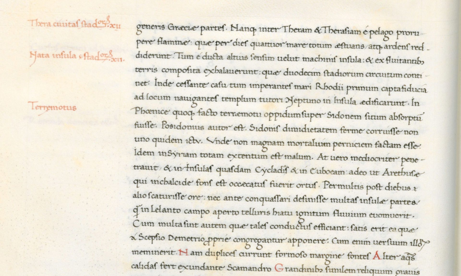
For four days, Strabo wrote, the sea between Thera and Therasia “boiled and blazed,” and the fires pushed up an island of burning masses that rose “as though by levers.” It measured twelve stadia around, about 2.2 kilometres. When it cooled, the Rhodians, then the masters of the Aegean, were the first to step onto it, and they built a temple there to Poseidon Asphalios, the god who keeps ships safe and the ground steady.
No witness from 197 BCE left a name, and no document from that year survives. The story reaches us through Posidonius, a philosopher born around 135 BCE who spent most of his life on Rhodes, home port of the sailors in the story. Strabo and Seneca both drew on him, and Seneca’s version adds the sequence: foam and smoke by day, fire flashing at night, boulders and pumice, and finally “the top of a burned mountain” rising from the waves. The historian Justin says the island appeared to the astonishment of sailors on the same day an earthquake shook Rhodes. Ancient chronologies scatter the year between 201 and 196 BCE.
It counts as watched because the account is that of people in boats: a staged eruption, a first landing, a shrine raised by the islanders who saw it. Hiera was probably built into Palaea Kameni by later lavas. A chapel of St Nicholas, patron of sailors, stands there now, and one historian suspects it simply took over from Poseidon. The job description had not changed.
Thia
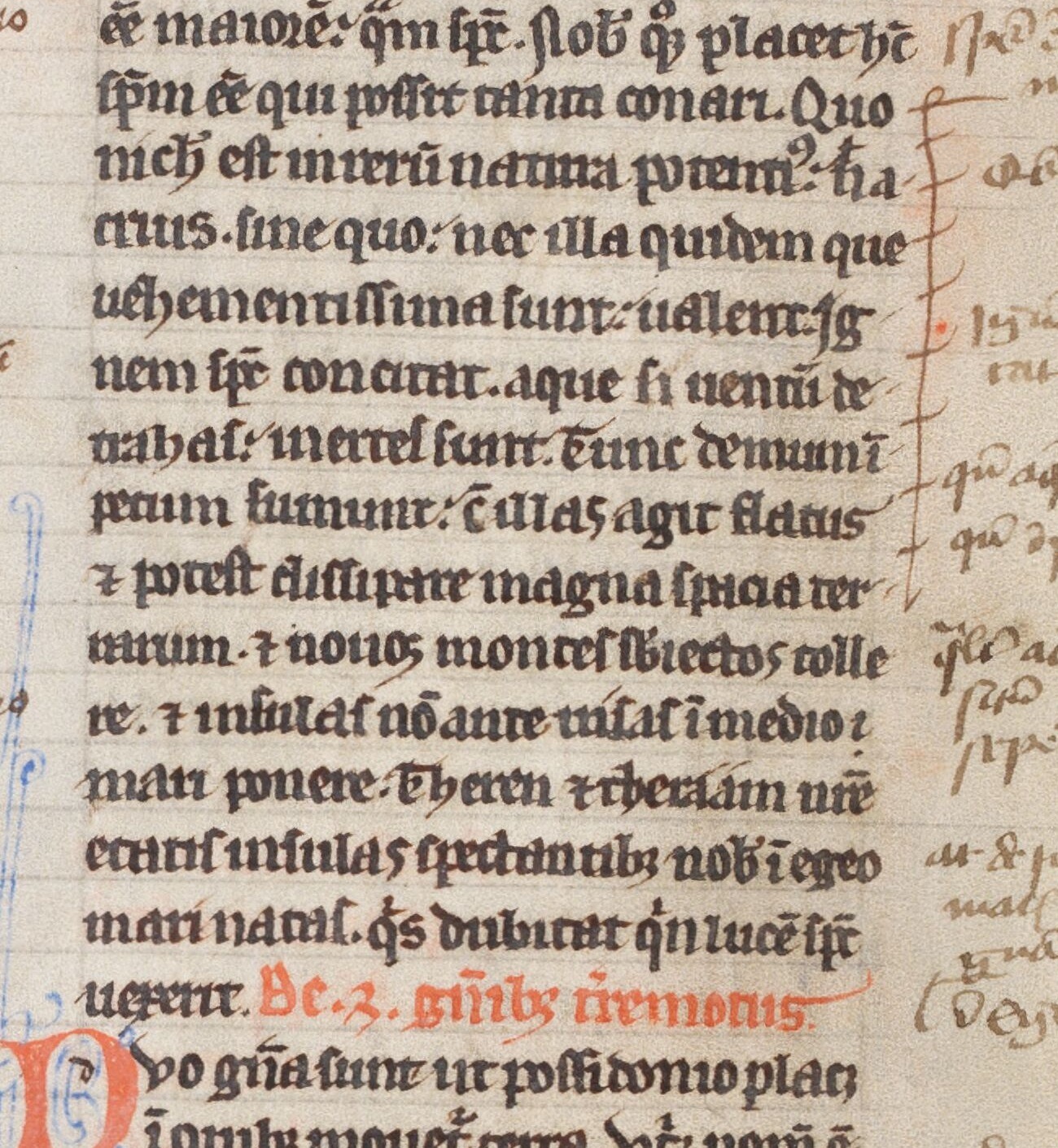
Seneca wrote a line that ought to settle the matter: an island “which in our own time was born before our very eyes in the Aegean Sea.” It has one small difficulty. Seneca spent the years 41 to 49 in exile on Corsica, so whatever eyes were on the Aegean in 46 CE, his were elsewhere. His Latin, spectantibus nobis, is best read as “in our generation,” and nothing in it says he stood on a shore.
The rest of the record is solidly Roman. Seneca dated the island by the second consulship of Valerius Asiaticus. Pliny the Elder named it Thia and put it two stades from Hiera, on the same sunken edifice. Cassius Dio gave it one sentence – “a small islet, hitherto unknown, made its appearance close to the island of Thera” – and placed that sentence in the chapter where Asiaticus himself is tried before Claudius and destroyed. Aurelius Victor says the island rose on the night of a lunar eclipse, and there was a total one on 31 December 46, the date the Smithsonian’s catalogue happens to use.
Dio’s chronology points to 47, so the honest date is 46 or 47 CE. What makes Thia count is that its two earliest writers, Seneca and Pliny, were alive when it happened and placed it in their own time, and no source suggests it was found later. Modern volcanologists still date the eruption from these texts. The island, unlike the consul, survived the chapter.
Monte Nuovo
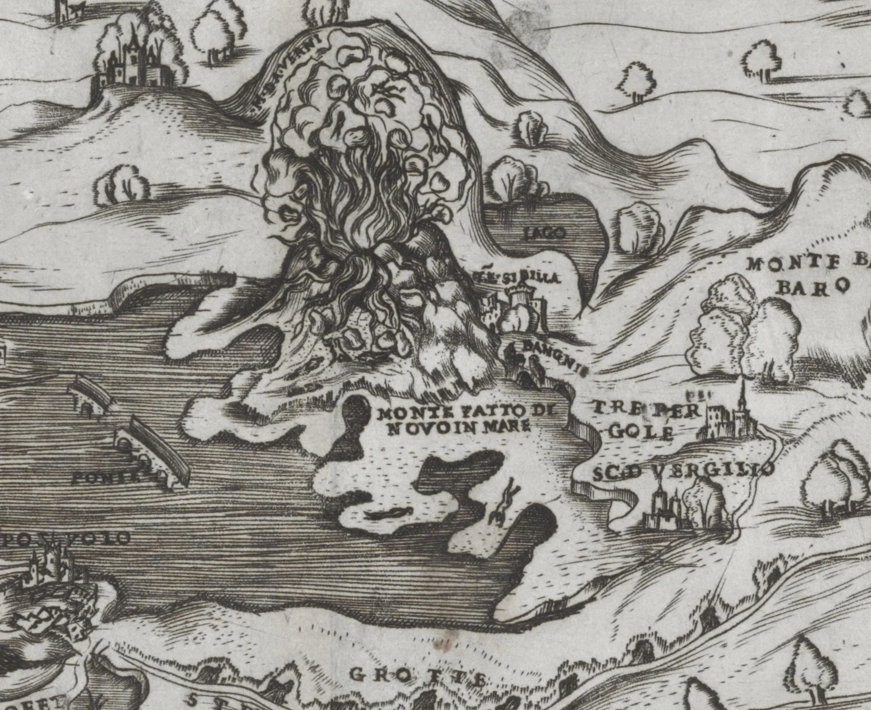
In the two days before the mountain appeared, the sea at Pozzuoli drew back about two hundred paces, and the townspeople did the practical thing and gathered up the stranded fish. Then, on the evening of 29 September 1538, the ground beside the spa village of Tripergole split open. Within a week a cone stood where the village had been, and most of it, the volcanologist Behncke reckons, went up in the first 24 hours.
Few births have had better correspondents. Marco Antonio delli Falconi and Francesco del Nero described it in letters that year, Pietro Giacomo da Toledo in a pamphlet printed in 1539, and Simone Porzio in an account for the viceroy. Del Nero was “standing in my garden” when the fire broke out. Toledo climbed the new hill on the third day and looked into a crater where the stones were “boiling up, just as a caldron of water boils on the fire.” On Sunday 6 October a sudden explosion killed 24 sightseers who had followed his example.
Tripergole, with its hot springs, its hospital for bathers and its three inns, was simply gone, and Lake Lucrino was much reduced. The mountain got the obvious name; Toledo’s own title already calls it the nuovo monte. It is now a wooded cone, 123 metres high by Behncke’s measure, with a nature reserve on its slopes, and USGS called its birth the only historical eruption in Campi Flegrei. Being new, it turns out, is a lifetime appointment.
Mikra Kameni
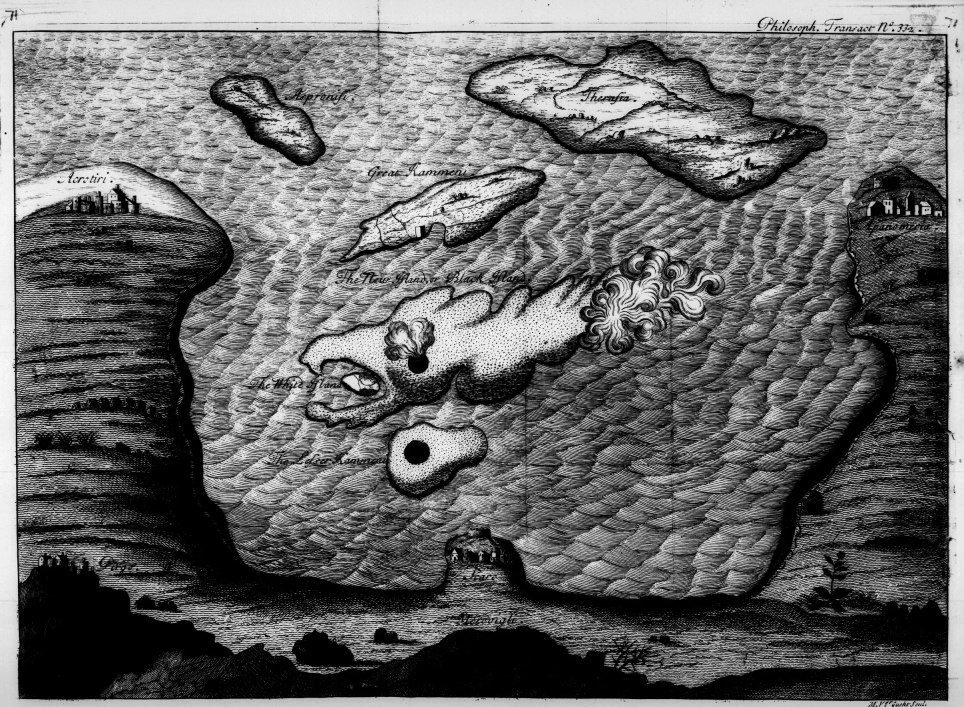
The evidence for Mikra Kameni is a room full of old men. In 1657 the Jesuit Francois Richard, who lived on Santorini, wrote that “a good number of old men” there had told him they saw a neighbouring island form itself by fire in the middle of the sea in 1573. That, they said, was why it was called Micri Cammeni, the little burnt island.
It is fair to ask how much weight that can bear. The answer is: some. Richard wrote about 84 years after the date the old men gave, which makes anyone who watched it as a child at least in his mid-eighties by then – the edge of plausible, not beyond it. Athanasius Kircher repeated the story in 1665, and Tournefort quoted Richard in his Levant travels. In 1650 islanders were already using their memory of the earlier eruption to predict a new one. And a single 2025 study points to a Greek travelogue by Iakovos Miloitis of Patmos, written out in 1588, which describes fire, smoke and stones rising from the sea in 1572, a new island born from them, vineyards ruined and boatmen tying their ropes to it.
The dates wander between 1570 and 1573. The island itself was real enough: about 400 metres across and 70 high, with a crater 20 metres deep. The lavas of 1925-26 fused it into Nea Kameni, and it went the way Hiera probably did, an independent island that ended up as somebody else’s foundations.
Kolumbo
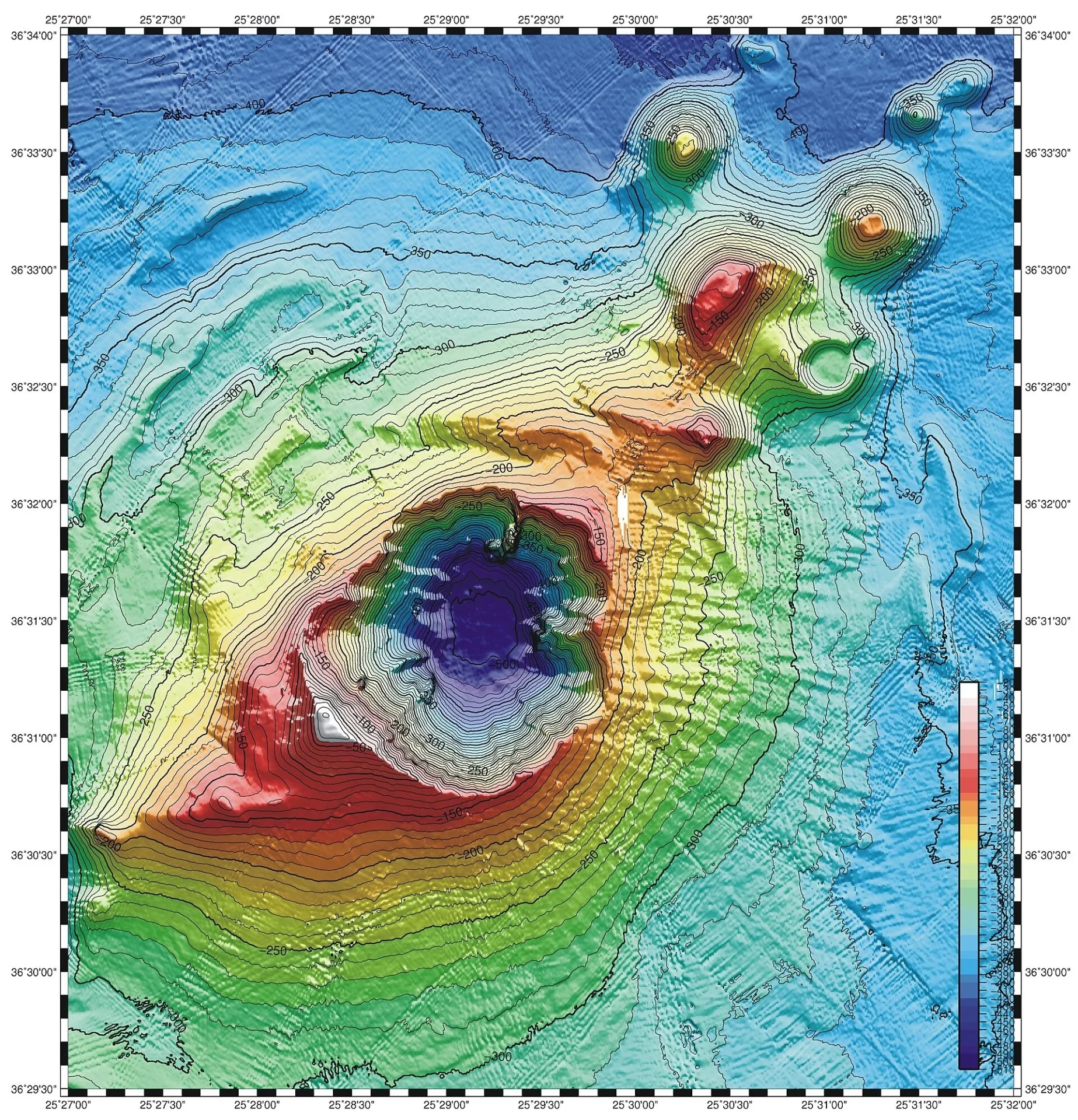
The volcano off Cape Kolumbo is not young. Its cone was built over at least five eruptive cycles, the earliest more than a million years ago, and it sits in a chain of 24 submarine cones off Santorini. What was new in September 1650 was that it broke the surface where Santorini could see it. Villagers on the caldera rim watched “a small round white islet” offshore, smoking every other hour.
On 29 September came the paroxysm. Detonations were heard 400 km away, ash fell on western Turkey, and a tsunami ran 20 metres up the shore of Ios and stripped about 2 km2 of Santorini’s east coast. Then the gas came ashore. Counts of the dead run from about 20 to at least 70 depending on the source, and on 2 October nine men who took a boat toward the vent were later found swollen and burnt. Priests and travellers set it down: the Jesuit Francois Richard put the fires that came out of the bottom of the sea in 1650 into the title of his 1657 book, and the Venetian Zorzi Morosini wrote a letter about it on 14 October.
Whether the white islet was ever solid ground is still argued; a summary printed in 1708 insisted the eruption built only a bank under water. Whatever it was, it was gone within four months. The summit now lies 18 metres down, and the volcano carries the name of the cape that had the best view.
Nea Kameni
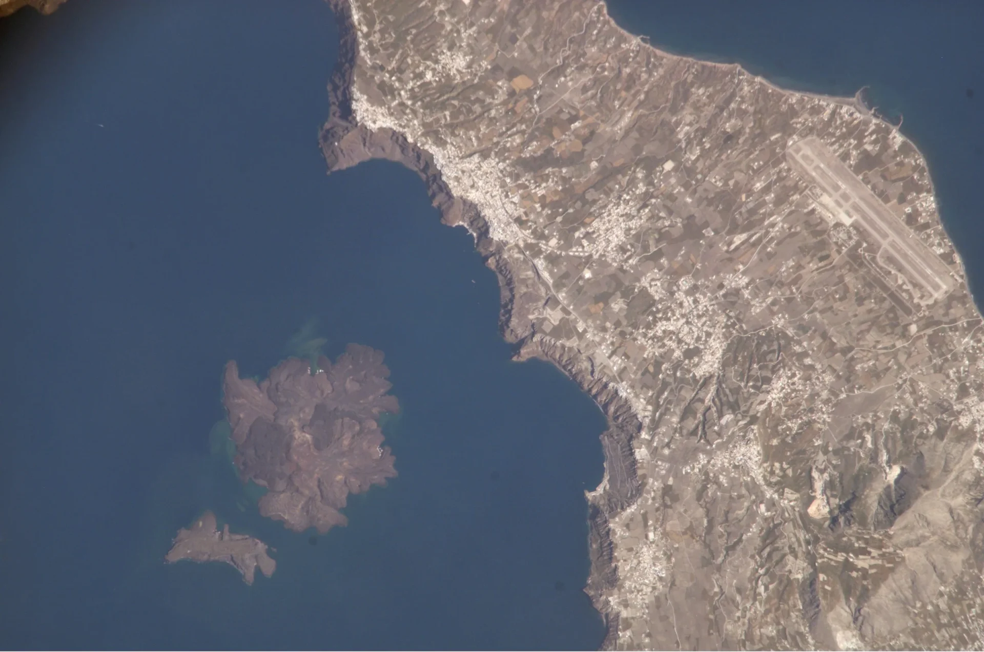
At sunrise on 23 May 1707 the people of Santorini saw what looked like a floating rock between the two Burnt Islands, concluded it was a shipwreck, and sent out boats “in hopes of Booty.” The seamen found an island instead and rowed home frightened. The next day a party of clergy and laymen, who were not inclined to take sailors at their word, landed on the new ground while it “sensibly increased under their Feet,” and came back with very large oysters it had lifted off the sea floor.
It was born twice. The first mass, pale and crusted with shells, was called the White Island; in mid-July a ridge of black stones rose about 60 paces away, from a spot where islanders swore no bottom had ever been found, and the black island grew into the white one. The Jesuit Father Goree, who said he was the only person on Santorini keeping a journal of every day, recorded the rest: claps like cannon, a whistle like an organ pipe, and smoke that turned unripe grapes in one night to raisins. Ottoman tax collectors, there to gather the yearly tribute, begged the Christians to make their young children cry Kyrie eleison, children not yet having offended God.
The activity ran to 1711, and later lavas, from 1866 to 1950, welded the island into what one historian calls a single, complex volcanic dome. The booty never materialised.
Laoheishan and Huoshaoshan (Wudalianchi)
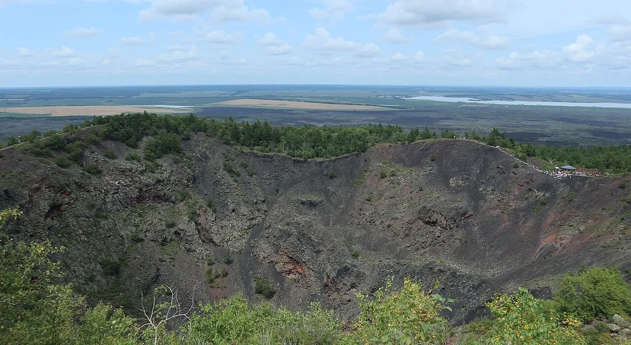
Officers and soldiers of the Qing garrison went out to watch this eruption 43 times, 61 person-visits in all, and filed their reports in Manchu to the Heilongjiang General, who sent the important ones to the Kangxi Emperor. One memorial, from the acting general Makari on 20 February 1720, is headed as being about “fire coming out of the ground to form a mountain,” and it reports flying stones as large as an ox.
The first outburst on the officials’ list converts to 14 January 1720, after a run of earthquakes from the previous October. Laoheishan erupted until 18 March 1721, and a second cone, Huoshaoshan, rose from 26 April to 28 May 1721, slightly taller than a house when the inspectors first described it. On 6 March 1720 the advancing lava stopped the Udelin river and melted its ice, and water backed up behind the flows. Lava-dammed lakes give the field its name, Wudalianchi, the Five Connected Pools.
The papers had adventures of their own. Russian forces carried the Heilongjiang archive off from Qiqihar in 1900, it returned to China in 1956, and the volcano reports were brought to light in 1998. They overturned the old printed version, written decades after the event, which had the fire last a few days; the officials had watched for more than a year. Chen and Wu, who worked through the papers, call it the only organized observation of an eruption in Chinese history.
Don Joao de Castro island (1720)

In his log the pilot Jean Morel wrote that the island appeared at midnight on 31 December 1720. A harbour pilot from Sao Miguel told the French Academy it rose on the night of 7 to 8 December, and the Smithsonian gives 8 December with a question mark. The accounts do agree that it rose from the sea between Terceira and Sao Miguel, and that it was on fire.
People went to look. The governor of Terceira sent Captain Jean Robcon of the English corvette Richarte Isabel to reconnoitre, and the flames kept him off. The Sao Miguel pilot got close enough to sound beside it; a stone he dropped made the water boil and leap, and the sea bed was hot enough to melt the tallow on his lead twice. On 2 January 1721 the council of Ponta Delgada held an extraordinary meeting to report it to the king. The Portuguese called it the Island of Good Jesus.
By March 1722 it had sunk to the waterline, and in July a ship master saw only “a great breaker, about a league long” where it had stood. Searches in 1874 and 1927 found nothing, and the island was long doubted. In 1941 a Portuguese survey ship sounding a spot marked “Breakers” found a submerged volcano with 14 metres of water over its rocks, and that bank is now taken to be the island’s stump. It took the ship’s name, Joao de Castro, after a 16th-century navigator. The witnesses got nothing.
Montanas del Fuego (Timanfaya)

The parish priest of Yaiza, Andres Lorenzo Curbelo, recorded that on the night of 1 September 1730 the ground suddenly opened near Timanfaya, two leagues from his village, and that a mountain rose that same night with flames that burned for nineteen days. The parishioners of southern Lanzarote had a ringside seat they would have happily declined.
What followed was the largest historical eruption in the Canary Islands, according to the Smithsonian: activity until 16 April 1736, 26 villages destroyed and about a quarter of the island buried. Curbelo’s diary breaks off abruptly on 28 December 1731, by which time most of his flock was leaving. His manuscript is lost. Leopold von Buch found it in Santa Cruz de Tenerife and printed an extract in Berlin in 1825, so readers since have met the priest only through translation, which improved him: his “enormous mountain” was the modest cone now called Caldera de los Cuervos, and von Buch’s red and blue lightning is, one Canarian historian argues, an addition no native of the island would have written. Independent records back the start, including a report to the Archivo de Simancas dating the outbreak to the night of the first of September 1730.
The cluster known as the Montanas del Fuego rose in a later phase. In 1970 Cesar Manrique built the El Diablo restaurant on the Islote de Hilario, over a five-metre well where the ground reaches around 250 degrees. The volcano now does the cooking.
Jorullo
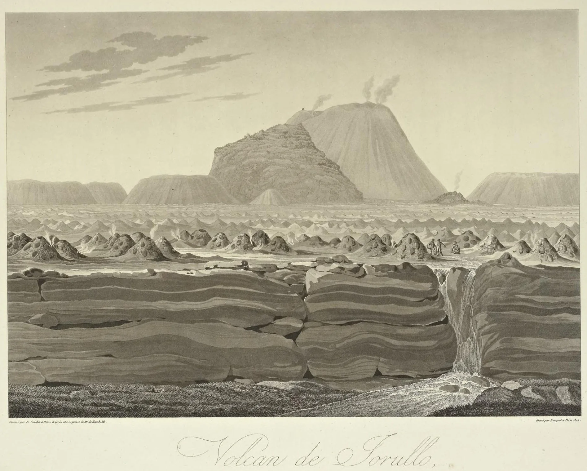
At 3 a.m. on 29 September 1759, St Michael’s Day, after three or four violent tremors, a column of black smoke burst out of the Cuitinga ravine a quarter of a league from the houses of the Jorullo hacienda. The estate’s administrator, Manuel Roman Sayago, kept a diary from that day and signed himself el mas inmediato testigo de vista, the nearest eyewitness.
He had been warned. Rumblings began in late June; by early September the quakes were violent and the workers had fled to the hills on a rumour that Jorullo would end on St Michael’s Day. The diary records stones as big as an ox, the smaller ones looking “by day a flock of crows, and by night a handful of stars.” On 15 October Sayago led more than 150 workers in procession, carrying the chapel’s image of Our Lady of Guadalupe ahead of the ash. On 7 November a chaplain tried to exorcise the volcano, was driven off by a fresh roar, and finished the exorcism from half a league further back.
The volcano rose, Sayago noted, not on top of a hill but in the flattest, deepest part of the ravine. The hacienda was a total loss, put at 150,000 pesos, yet his diary of 13 November says no one had perished. The cone reached about 250 metres, by the Smithsonian’s figure, and kept erupting until 1774. The field’s next newborn came 184 years later, and it too arrived on farmland.
Izalco

For two centuries ships off El Salvador had a volcano to steer by. Izalco erupted so often that sailors called it the Lighthouse of the Pacific. The light came on, by the standard account, on 23 February 1770, when after months of subterranean noise and earthquakes the ground opened about half a mile from the buildings of a cattle hacienda at the foot of Santa Ana volcano.
That account is thinner than the volcano. It cites no document written in 1770. The date and the scene come from the American diplomat E. G. Squier, writing in 1852: the family fled, but the vaqueros kept riding over every day and reported the smoke and flame growing as ash and stones piled up into a cone. The geologists Dollfus and Montserrat, on the spot in 1866, were told an official report of the first eruption sat in the archive of Izalco village, though they never read it. And in 1840 the curate of Sonsonate told the traveller Stephens a different story: as a boy he had gone to look at a small new hole puffing out dust and pebbles, and he gave the year as 1798.
A violent eruption of 1798 is on record, so the curate may have seen a revival rather than a birth. On Squier’s telling, people working the ranch were there when the ground opened. The cone eventually stood about 650 metres above its original vent and fell quiet in 1966. The ranch is underneath it.
Nyey
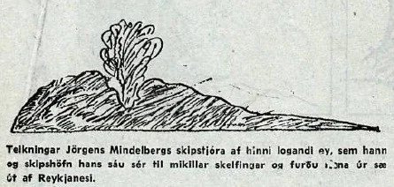
On 26 June 1783 a royal decree in Copenhagen named a new island off Iceland Nyey, the New Island, and ordered the Danish flag raised on it beside a stone 3 ells high carved with the royal insignia. Nobody in Copenhagen had seen it. One man who had was Captain Mindelberg of the Danish ship Boesand, who sighted it burning in the sea at the start of May 1783, about 8.5 sea miles south-west of the Geirfuglasker skerries.
Mindelberg put his report in a memorandum dated 8 July 1783, with a sketch, and wrote that he had sailed close enough to see its shape before turning back for fear his crew would faint in the sulphur smoke. The island was at least 0.9 km across. Thorarinsson, writing in 1965, gathered the memorandum, the decree and later Danish and Icelandic papers into the account historians use, which is the main reason the island is remembered at all. The Smithsonian has the eruption beginning on or before 1 May; it was already burning when Mindelberg came by, so he saw a birth already under way rather than its first breath, which is close enough to count.
It was a crowded year for Icelandic volcanoes: on 8 June the Laki eruption began on the mainland. By the autumn of 1783 the island could not be found, and what remains is a reef. The carved stone never left Denmark. There was, in the end, nowhere to put it.
Bogoslof (Castle Rock)

Ivan Kriukov and some hunters were sheltering on the north point of Umnak Island in May 1796 when something black rose a little above the sea under a column of smoke, about 10 miles away. That night its fire lit up their island. Stones were thrown toward them, the ground shook, and they “every moment expected to perish.” At sunrise, as the quaking stopped, they “plainly saw an island of the form of a pointed black cap.”
Kriukov did not write it down. Twenty years later, by then the Russian-American Company’s manager at Unalaska, he told the story to Otto von Kotzebue, whose ship Rurik was exploring the North Pacific, and Kotzebue printed it in London in 1821 as the account of a man who “was himself an eye-witness.” A report attributed to Alexander Baranov dates the start to 1 May 1796; Kriukov’s version gives 8 May in the Russian calendar of the day; the Alaska Volcano Observatory settles for 18 May, give or take ten days. The hunters were close enough to fear for their lives, which makes Kriukov’s memory worth more than most documents.
The Russians called the island Bogoslof, the theologian, for the feast of St John; the Aleuts called it Agasaagux, newborn. It has been rebuilt so often since, including in 2016-17, that the Smithsonian calls it a Jack-in-the-Box volcano. Castle Rock, the steep pinnacle on its south-west side, is what remains of the 1796 island, and the sea lions have had it ever since.
Tao, Nuevo del Fuego and Tinguaton (Lanzarote, 1824)
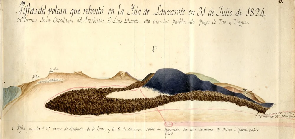
Lanzarote had been quiet for 88 years when, at seven on the morning of 31 July 1824, a strong earthquake shook the villages near the capital and something burst from a rock beside the road to Tiagua. The Gaceta de Madrid reported “a whirlpool similar to a pump or a water hose” rising from the rock, followed by a column of smoke coming out of it “with great force.”
That was Tao, the first of three vents on a single fissure: a small cone 700 metres long and no more than 20 high, which had stopped by two the next morning. Weeks of gas, tremors and odd gushes of brackish water followed. Nuevo del Fuego opened on 29 September and sent the main lava flow 6.3 km to the coast. Tinguaton followed on 16 October and ended with a week of jets of hot salt water, which two volcanologists call unique in the historical eruptions of the Canary Islands. The news reached Marseille by ship while the eruption was still going on, and Baltasar Perdomo, parish priest of San Bartolome, left a written account of all three vents.
After the catastrophe of the 1730s this was a modest affair – a much smaller lava flow, in the Smithsonian’s words – and all three cones survive. Nuevo del Fuego goes by the nickname El Chinero, because its cinders were dug out to build the road through what became Timanfaya National Park in 1974. Part of the volcano is now the road.
Ferdinandea (Graham Island)
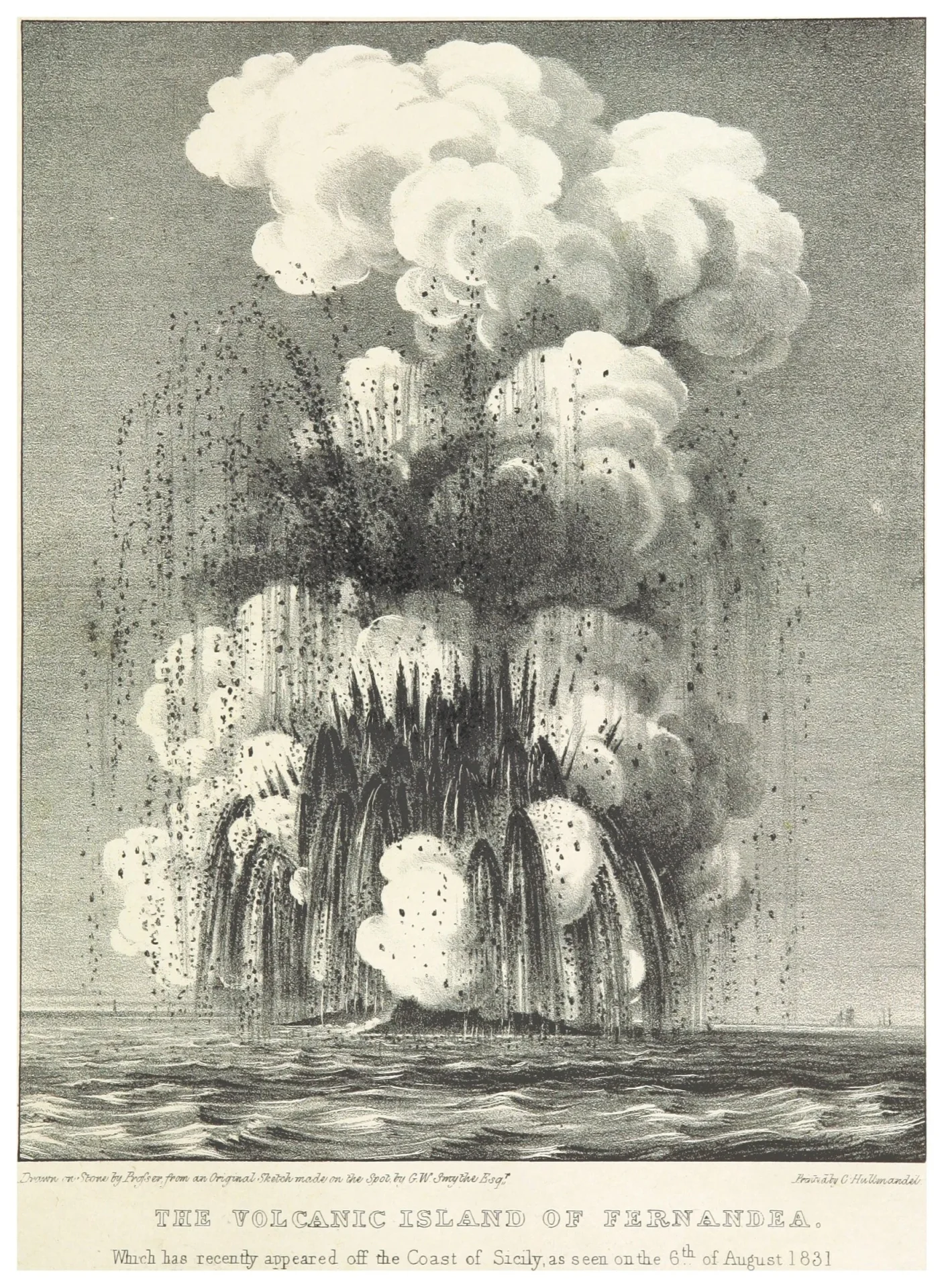
At five in the morning on 19 July 1831, Commander C. H. Swinburne of HMS Rapid, having steered 30 miles toward a column of white smoke and watched flashes of fire all night, saw “a small hillock, of a dark colour, a few feet above the sea.” He rowed round it and found a crater about 20 feet high at its highest point, with a lake of muddy water inside.
The island’s birth is documented mostly by British naval officers, though a Neapolitan schooner had seen smoke on the water on 12 July, after weeks of tremors. In early August Captain Humphrey Senhouse of HMS St. Vincent went ashore, planted the Union Jack under “the imminent danger of a fresh eruption every moment,” and named the place Graham Island after the First Lord of the Admiralty. The Kingdom of the Two Sicilies called it Ferdinandea and the French called it Julia, and before long the island had seven names, which Charles Lyell regarded as a multiplication of synonyms scarcely outdone in the annals of zoology and botany.
It never got big. Wodehouse’s survey that August found it 107 feet high, about 33 metres. The eruption was over by mid-August, and the sea went to work on the loose cinders; by the end of the year there was little left to argue over. The summit lay about 9 metres below the surface in surveys of 2012-14. For a territory three powers wanted, it removed itself from the dispute with real tact.
Cerro Negro
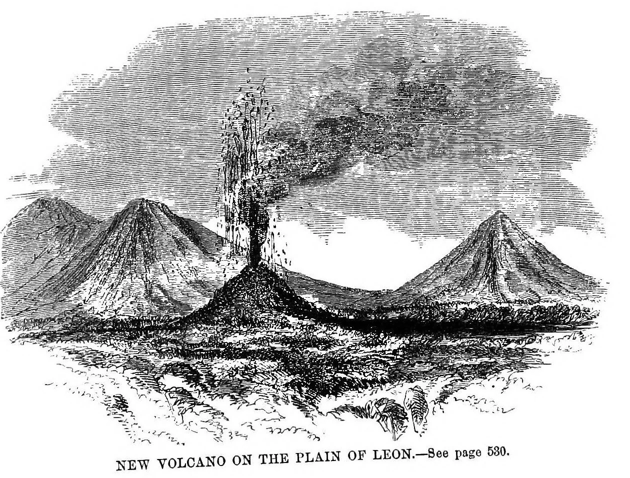
E. G. Squier, the American charge d’affaires in Central America, was in Leon when a volcano was born nearby, and he wrote that he had been “a personal witness of the origin of a new volcano.” Rumbling like thunder was heard in the city on 11 and 12 April 1850, and early on 13 April an orifice opened on the plain near the base of the long-extinguished Las Pilas.
Nine days later Squier and the U.S. consul, Dr J. W. Livingston, climbed the new cone. Near the top the stones were hot enough to blister the doctor’s hands, and then it erupted: the sky went black with stones and lightning flashed among them. Both men ran, reaching the bottom as rocks fell where they had stood. Squier admitted that nobody lived within miles and he knew little of the first hours, but he described the cone perhaps 150 or 200 feet high, like “an immense kettle, upturned, with a hole knocked in the bottom.”
Vaqueros asked the Bishop of Leon to baptize the newcomer and keep it in moderation. Squier intended to stand as godfather to the Volcano de los Nortes Americanos, but it quieted before the rite was performed. That did not last. The Smithsonian calls Cerro Negro Nicaragua’s youngest volcano and lists 23 later eruptions, including one in 1999. In 2004 a hostel owner in Leon began sending visitors down its black cinder slope on boards, which is one way to keep a volcano in moderation.
Didicas (1856 island)
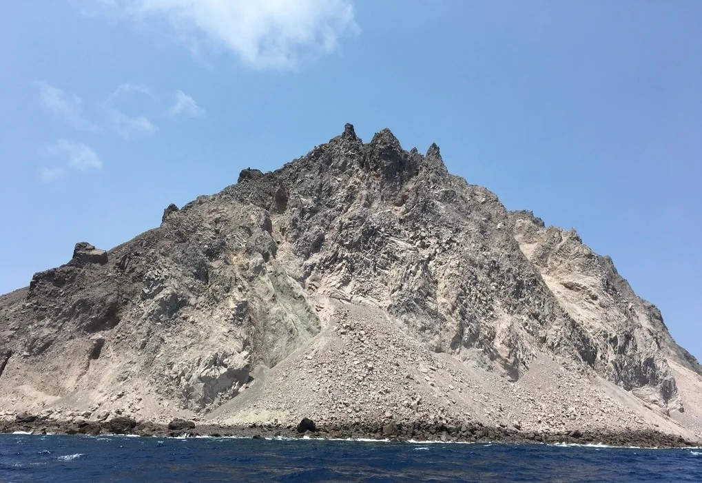
Early one morning in about September or October 1856, islanders on Camiguin in the Babuyan Islands saw smoke rising between the two Didica rocks, a pair of pointed islets long marked on Spanish charts. That day the volcano broke the surface, and the upper halves of both old rocks collapsed into it.
Nobody on Camiguin wrote it down. The German zoologist Carl Semper, staying on the island in autumn 1860, took the story from a Spanish-speaking islander and copied it into his diary, about four years after the event, and he printed it in 1869 in Die Philippinen und ihre Bewohner. He did better than listen. From Camiguin’s east coast in September 1860 he measured the angle to the new summit and worked out that it stood at least 700 feet high. He could not land: the sea was rough, and the islanders refused to go near the thing. The night before the first smoke, they told him, there had been only a violent thunderstorm and no earthquake.
The Spanish Navy’s sailing directions of 1879 cited Semper and wrote the new volcano into the official record. It did not last. It eroded beneath the sea, and an eruption in 1900 left three rock masses where it had been. In 1952 the same vent tried again, and a US Air Force plane from Clark Field watched a new crater break the surface; that later dome is the island now on the map. Semper’s volcano turned out to be the rough draft.
Georgios, Aphroessa and Reka (Santorini, 1866)

In late January 1866 the watchman who spent the winter in the village of Vulkano on Nea Kameni noticed stones rolling down the old cone and cracks in his house. A reef of glowing lava rose out of Vulkano bay on 3 or 4 February, depending on whose notes are trusted, and spread, the district physician Decigalla wrote, like a soap bubble.
This was Georgios, named for King George I, who reportedly protested that a constitutional king could not be “the godfather of a volcano.” Aphroessa broke the sea on 13 February about 50 metres off Nea Kameni, in front of the Greek government’s scientific commission, and took the name of the steamer that had brought them; Julius Schmidt, director of the Athens Observatory, worked out the moment at about 10:35 a.m. On 20 February Georgios answered with its first great explosion while the commission sat on the old cone. Hot stones burned their clothes, a block holed their steamer, and the captain of a merchant ship moored nearby was killed. Fouque, the French Academy’s man, watched almost daily from March and lit scraps of paper from flames burning on the open sea.
Reka, the third, was named for a helpful Austrian corvette. By the end of May Fouque counted eleven new islets, and the eruption ran on until October 1870. All three have since grown into Nea Kameni, more than doubling the area of an island that was itself born in 1707. They are, in effect, the volcano’s grandchildren.
Vulcan
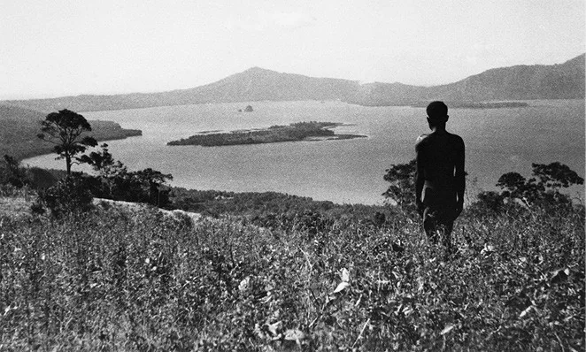
The missionary usually named as the witness was not there. The Rev. George Brown was across the water on the Duke of York Islands when word came on 30 January 1878 that the volcano at Matupit was erupting, and he landed on the new island in Blanche Bay about two weeks after it rose, noting that he was the first white man to set foot on it. Among the people who saw it rise were the Matupit trader Hicks and a Tolai man named ToMaran, who was canoeing across the bay to buy food when, “with a noise like a great cannon,” the sea exploded not far from him.
ToMaran’s account was dictated decades later and printed in Pacific Islands Monthly in 1951; Hicks’s version reached print second-hand in 1879. The English explorer Wilfred Powell, whose ketch lay nearby, said an island “of about two miles in extent, and seventy feet high” rose in one night, with a crater in the centre full of boiling water. The bay ran so hot that its fish died, and visitors had to keep moving to stop their feet burning. Hicks planted coconuts on it anyway, to claim the land.
Brown called it Hicks Island. The Germans charted it as Vulkan, after the Roman god of fire, and that name stuck. In 1937 an eruption from a vent nearby joined it to the shore under a blanket of pumice and killed more than 500 people. Hicks’s claim, coconuts and all, is under there somewhere.
Islas Quemadas
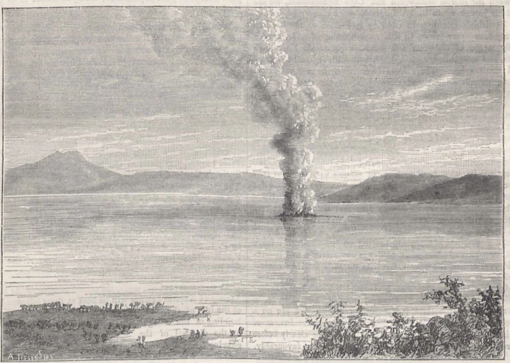
Lake Ilopango gave the warning before the volcano did. After a swarm of 600 to 800 tremors at the end of December 1879 the lake rose, and by 9 January 1880 its outflow down the Jiboa River was strong enough to flood the valley, destroy the town of Atuscatla and kill many cattle. Then the water dropped 9.2 m between 12 and 20 January, at up to nearly 10 cm an hour.
On 20 January a column of ash and glowing rock rose from the middle of the lake, and by 23 January a cluster of new islands stood above the water: the Islas Quemadas, the burnt islands. The French consul in San Salvador, M. J. Laferriere, described a crater about 20 m above the lake, ringed by water “in a state of ebullition” that kept boats at a distance, and Nature printed his report on 10 June 1880 with an illustration from a photograph. The dome reached about 50 m above the lake before explosions in March 1880 blew most of it away. What survives is a handful of low islets marking the summit of a mostly drowned dome, the only islands on this list born in a lake.
The locals had half expected trouble. Spaniards held that a rising lake meant earthquakes, and for a century trenches had been dug to drain it. “The present phenomena seem to justify this tradition,” Nature observed, about as close as a scientific journal comes to I told you so.
Shin-Iwo-jima (Fukutoku-Okanoba)
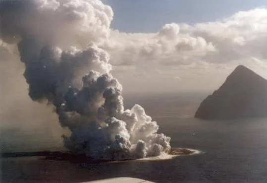
At 8 p.m. on 28 November 1904 the settlers on Iwojima saw “a feather of smoke” out at sea and took it for the smoke of a man-of-war. About an hour later it came up dark and in far greater quantities. Cannon-like noises had been booming across the water since 14 November, and on 5 December the settlers “first caught sight of an islet lying amidst the smoke.”
They decided to look. On 5 January 1905 the settlers met and called for volunteers, ten men answered, bad weather kept their boat and canoe ashore until the end of the month, and on 1 February they landed and surveyed the thing: about 3 miles round and 480 feet high, loose ash over hardened rock, with a steaming pond on its north side. Their report went to the island office and from there to the geologist T. Wakimizu, who published extracts in English in 1908. It is a birth recorded by amateurs, and recorded well.
Wakimizu went out himself on 16 June 1905 and at first saw nothing. Then his captain spotted what seemed a wave breaking on a reef, and through a telescope the island “looked like the back of a whale half hidden by the waves.” It had been worn down to a rock 8 to 10 feet high. Shin-Iwo-jima means New Sulphur Island, and the same submarine vent has built and lost islands since, in 1914, 1986 and 2021. It is a volcano with a short attention span.
Rininahue Maar
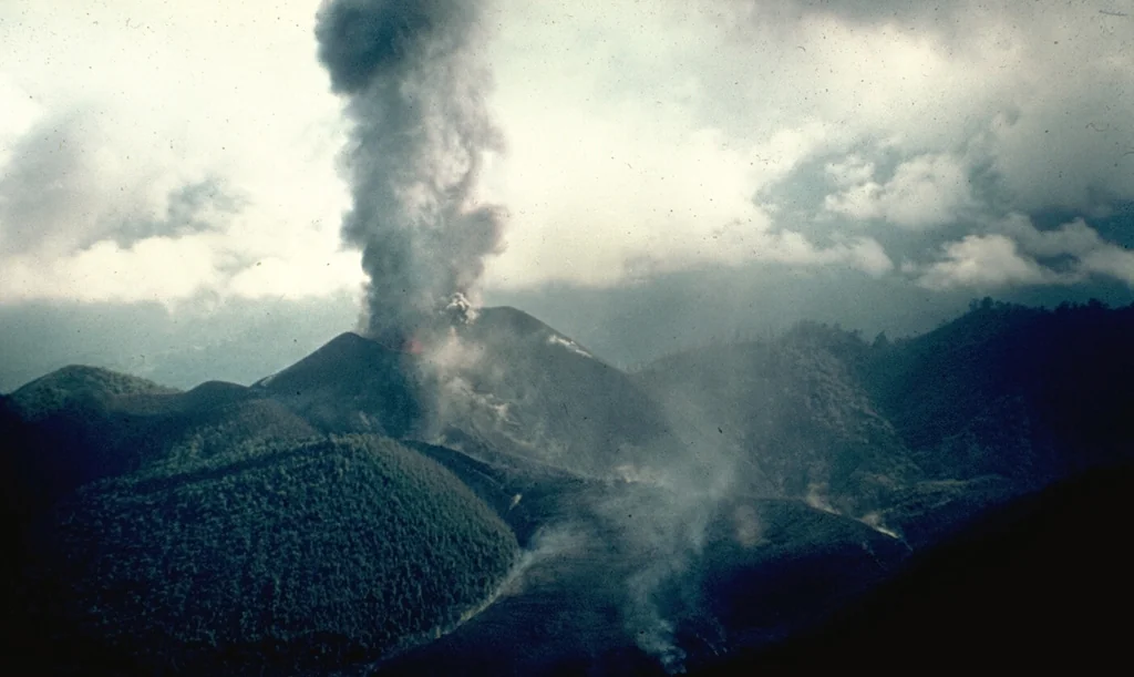
The first thing the new crater did was dam a river. Ash and debris from the eruption blocked the Nilahue and turned the upper valley into a lake 5 km long, which, by the geologist Moreno’s account, burst on 9 June and swept the valley 30 km down to Lago Ranco.
The eruption began in April 1907 on a plain east of Lago Ranco, in what Moreno later showed was an ancient crater depression – which is why the newborn is a maar, a crater blasted down into the ground, rather than a mountain. Wire reports first blamed Puyehue. Three weeks in, on 29 April, Professor Hans Steffen wrote from Santiago to a German geographical journal that Puyehue was at rest and that a new volcano was forming near Lago Ranco, named in the reports after the local place, Rininahue. He cited an eyewitness, a Capuchin father printed as Burhard, who put the crater 22 km east of the lake, and a second witness who said it began on the evening of 4 April. The Smithsonian gives 9 April, which Moreno lists as the day the gas and explosions began; the 4th, in his chronology, was the day of the earthquakes.
Ash darkened the district for 3 days and fell on Valdivia. The eruption finished with lava filling a crater 1200 m across, and a small cone on its rim fumed until 1914. Moreno drew the moral from this very valley: there is no such thing as an extinct volcano.
Ile des Cendres
On Friday 2 March 1923 the second officer of the Japanese steamer Wakasa Maru, bound from Japan to Bombay, saw a cloud of smoke to port and called the captain to the bridge. Thinking a ship was on fire, the captain turned to help and found explosions throwing water and ash out of the open sea. He photographed it with a hand camera. The passengers, The Straits Times reported, were delighted.
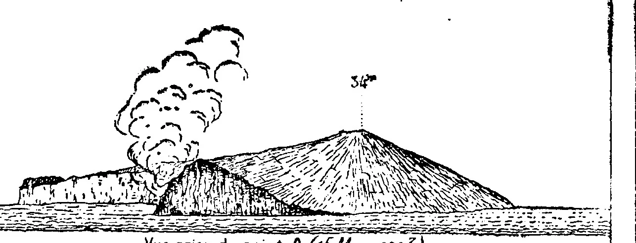
There was no island yet. HMS Carlisle radioed that the eruption had built one, and at 5.53 pm on 9 March the P&O liner Morea sighted it, about half a mile long and very narrow. A French hydrographic mission watched it erupting in mid-March, and on 5 April Captain Etienne Patte of the Geological Service of Indochina went ashore. He described a horseshoe of ash and scoria about 500 yards long and 80 to 100 ft high, for the Bulletin Volcanologique of 1924. Its name means the Island of Ashes, which was accurate.
Islanders on Poulo Cecir, 29 km north, had felt a violent earthquake in the night of 15-16 February, on the eve of the lunar New Year, but never saw the volcano at all and heard of it only from the French. They had little time to catch up. Patte found its horns already gone in April, and by the end of July, Lacroix reported, it had been entirely swept away by the sea. It is the only eruption the Smithsonian has dated anywhere in Vietnam.
Anak Krakatau
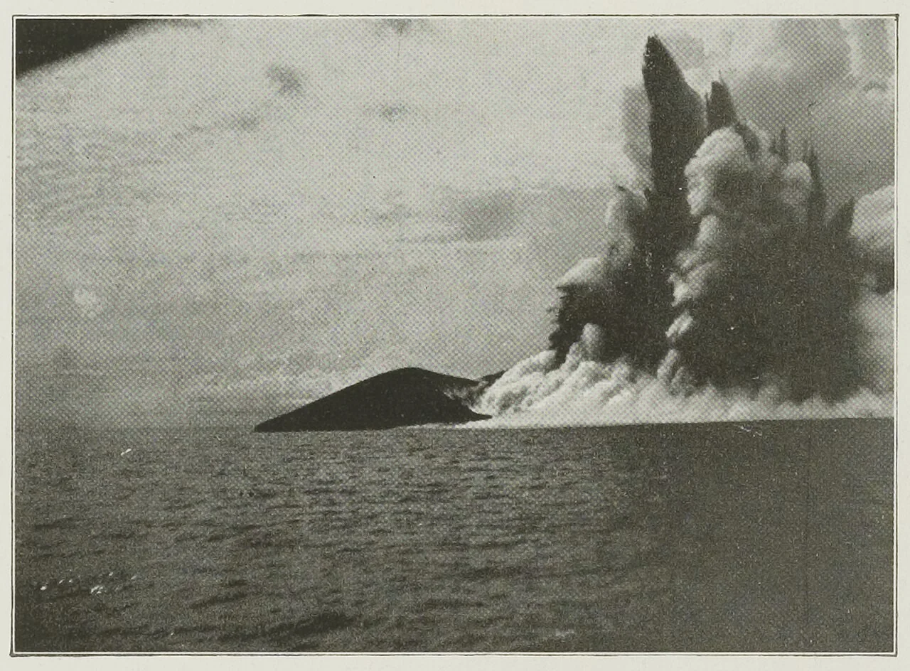
Forty-four years after Krakatau blew itself apart, fishermen from Bantam noticed the sea above the drowned caldera bubbling, boiling hot and steaming. The Smithsonian dates the submarine eruption to 29 December 1927. Charles Edgar Stehn, director of the Netherlands Indies Volcanological Survey, sailed out in the first days of January 1928 and reported the old volcano erupting under the sea every half minute to a minute, throwing up columns of steam 80 to 200 m high.
At four o’clock on the afternoon of 26 January 1928 the government steamer Wega radioed that an island had formed at the spot. It was 175 m long and 3 m high, and the surf had it by February. A second attempt appeared in January 1929; on 20 February the survey’s topographer, W. Petroeschevsky, became the first person known to climb it, and it too was gone by July. The island that stayed began on 12 August 1930. By then it had a name, Anak Krakatau, the Child of Krakatau, though nobody has established who first used it. By 1933 a botanist was writing in Nature about coconuts germinating on it.
The child grew into its inheritance. On 22 December 2018 a collapse of its flank cut the cone from 320 m to 120 m and set off a tsunami that killed 430 people by one official count, at least 437 by another. It began rebuilding almost at once, which, given its parentage, surprised nobody.
Showa Iojima
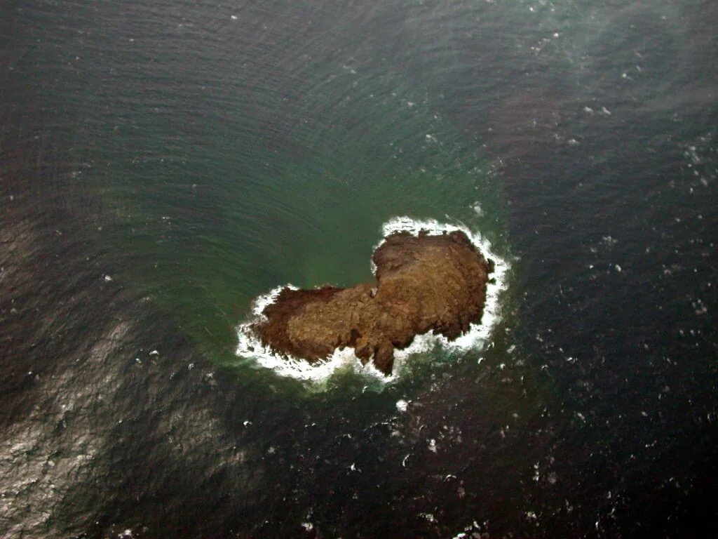
The islanders of Iojima got the news from their hot spring. On the morning of 16 September 1934 the spring on the village shore rose to 45-48 C, and cracks a metre wide opened in the rock around it. Something was happening in the sea 2 km to the east, in about 300 m of water, deep enough to muffle an eruption.
What came up first was pumice: floating “islands” several metres across, crusted like bread, red-hot inside, steaming until their gas ran out and they sank. Smoke climbed to 1,000 m. A real island broke the surface on 7-8 December 1934, grew into a cone 20 to 30 m high, vanished in the last days of the year, and came back for good on 5 January 1935. Tanakadate Hidezo, whose series of reports is the backbone of the record, logged its rhythm that month: every 1 to 3 minutes a rumble, a cannon-like report, black smoke rising through the white, and lava blocks flying.
On 8 March 1935 islanders landed on it and found it still erupting every 5 minutes. By volume it was a big one, which the Geological Survey of Japan calls the largest eruption of the Showa era. The island survives, 26 m high, as Showa-Iojima or Iojima-Shinto, the Iojima New Island. Satsuma-Iojima and Takeshima sank by at least 0.7 to 1 m while it was being built, which is the kind of thing neighbours notice.
Paricutin
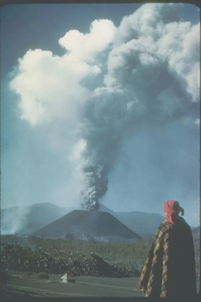
Dionisio Pulido was about to burn a pile of branches on his farm near the village of Paricutin on 20 February 1943, his wife Paula nearby, when the ground in a hollow “swelled and raised itself 2 or 2 1/2 meters high” and grey smoke rose with a loud hiss and a smell of sulfur. He rode his mare into the village. When the men sent to look reported that the earth had opened, the parish priest took down a book on Vesuvius so they would know what they had seen.
The paperwork was prompt. By 10 the next morning the municipal council had met, telegraphed President Avila Camacho for help and unanimously named the new mountain Volcan de Paricutin. The US Geological Survey later interviewed Pulido and other eyewitnesses; his labourer Demetrio Toral, a deaf mute, had just completed a furrow when the outbreak came almost in the exact furrow he had drawn. Six days in, the cone was 167 m high.
The eruption lasted about nine years, to 1952. The lava buried San Juan Parangaricutiro, a town of about 4,000 people, and by mid-July 1944 “Of the church only the 75-foot towers projected above the torn lava surface.” In 1945 Robert Ripley believed he was about to buy the volcano, until the Mexican government stopped the sale. TIME, reporting the deal, noted that Pulido’s title to the volcano was “somewhat hazy,” which, for a mountain that came up through his own field, was putting it kindly.
Waiowa
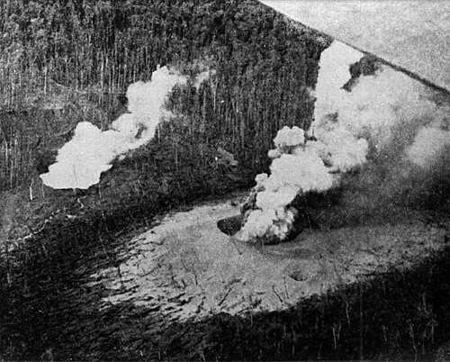
In October 1943, with a war going on around them, villagers on Collingwood Bay in Papua saw four columns of smoke rising from the hills south of Tufi, in a place where, as Johnson’s history of the eruption puts it, no volcano was known to exist. Rumour said the Japanese had built an aerodrome up there, because aircraft kept circling the spot. The pilots were Allied, and simply curious.
The witness who matters is Lieutenant D. R. Marsh of ANGAU, the Australian New Guinea Administrative Unit, who went up to the crater, watched eruptions blow the growing cone almost flat, and wrote a 1944 report on the volcanic disturbances inland of Collingwood Bay that sits in the National Archives of Australia. Johnson built his 2013 account from Marsh’s report and from people on the coast, while conceding that no volcanologist studied the eruption at the time. On 27 December 1943 a 5,000-metre ash cloud went up over the Goropu hills, and at Wanigela, one letter-writer reported, people screamed and ran in all directions. The Smithsonian dates the first small explosions to 18 September.
Big explosions in February and July 1944 flattened 80 km2 of forest and pitted the tree trunks, Marsh wrote, “as though with a heavy machine gun,” a comparison that in 1944 needed no explaining. No one was reported killed, and ANGAU fed the villagers who had fled to the coast. The volcano fell quiet after August 1944, and its crater holds a small lake in the forest.
Myojin-sho
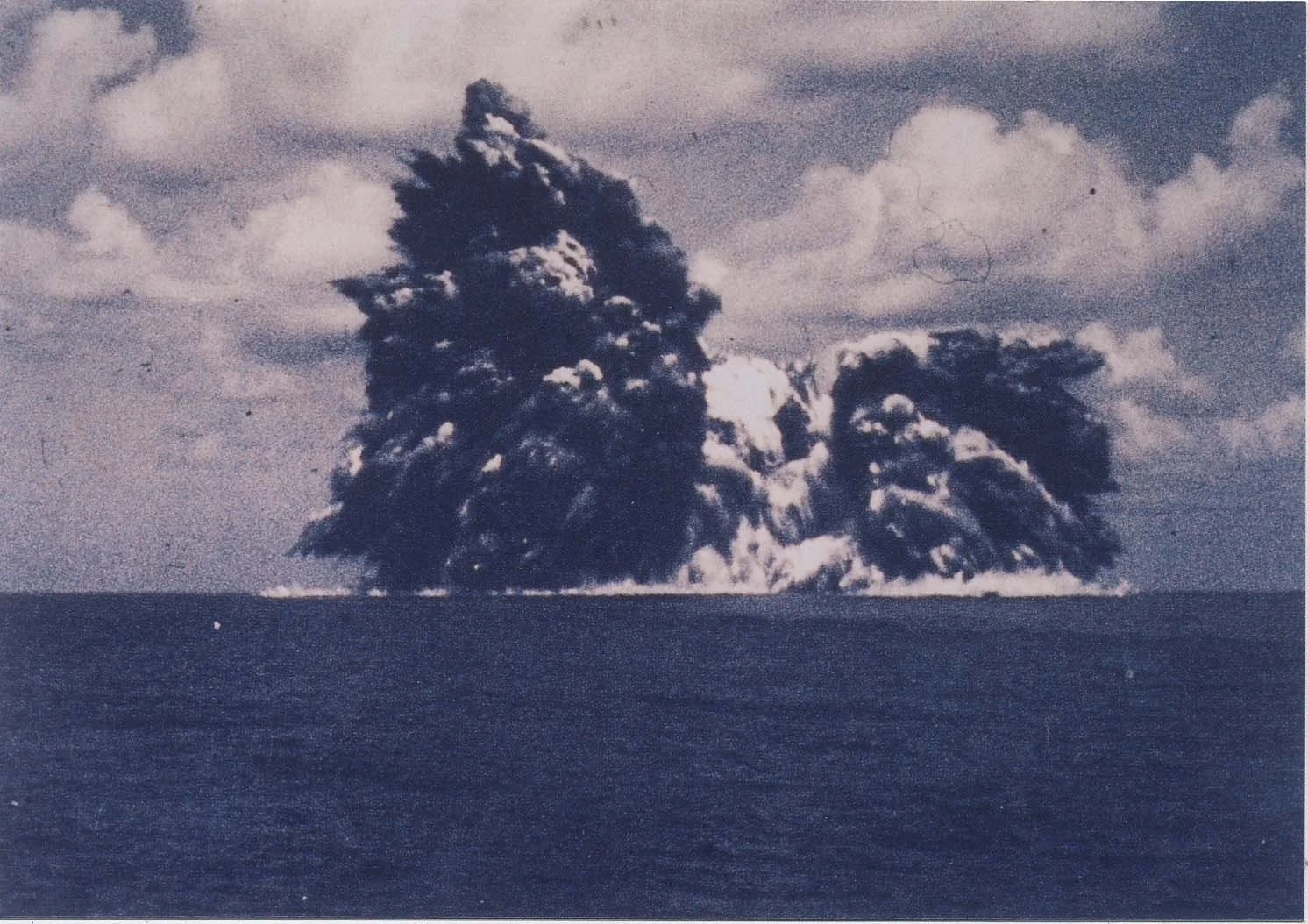
This volcano is named after the fishing boat that found it the second time. The first time was in early 1946, when a British warship, recorded in Japanese files as the Uranus, reported a new island 200 m long and 150 m wide. In April the Arimasan Maru saw several islands; by October there was one, 100 m high; in December it sank below the sea and left a reef of breaking waves.
The vent woke again in September 1952, and just after 7 a.m. on 17 September the No. 11 Myojin Maru, passing by chance, came upon the eruption. The next day the new island was named Myojin-sho, Myojin Reef, after her. Scientists from the Japan Meteorological Agency flew out in planes chartered by newspapers. On 24 September the survey ship Kaiyo Maru No. 5 was destroyed with all 31 aboard, among them 9 scientists killed by the volcano they had come to study, and US Navy hydrophone stations in California recorded the blasts.
Among the dead was Ryoichi Mita of the Hydrographic Department, whose research is most of what is known about the island of 1946. The man who wrote down the birth died watching the sequel. Afterwards the department built an unmanned, radio-controlled survey boat called Manbou, the Sunfish, for exactly this kind of water, and sent Manbou II to survey Myojin-sho in 1998-99. The top of the cone was found 50 m down, which was as close as anyone sensible wanted to get.
Barcena
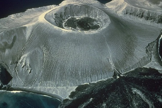
On the morning of 1 August 1952 Isla San Benedicto, an uninhabited island in the Revillagigedo group off Mexico, “literally burst from obscurity,” in the geologist Richards’s phrase. Robert Petrie, photographing from offshore, caught the opening surges racing across the sea minutes after the eruption began, with ash and lapilli raining down on a fishing boat. Richards later called the result “the first new volcano in the east Pacific Ocean whose birth was observed by human eyes.”
It grew with indecent speed. The Smithsonian puts the cone at about 300 m, and it was nearly fully formed by 12 August. A tuna boat reported it to the outside world, and TIME, on 29 September, noted that it had no special name. The first scientist to investigate, Robert S. Dietz of the Navy Electronics Laboratory, flew down that September in an Air Force B-29. In time the new mountain became Volcan Barcena. Lava domes followed, and from December a basal fissure poured lava into the sea until February 1953.
Ash and pumice buried the island 3 to 10 feet deep, killed its vegetation and many nesting seabirds, and appears to have exterminated the San Benedicto rock wren, a bird found nowhere else. A few were seen in December 1952; none was found in 1953, and it is assumed extinct. By November 1953 young plants were sprouting from surviving seeds, and the land crab had come through. Barcena is a rare volcano with a species on its conscience.
Tuluman Islands
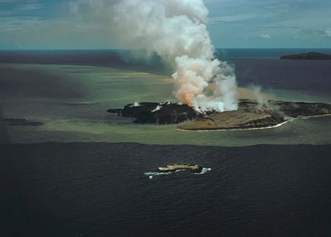
Tuluman means “hot” in the Manus language, which is the sort of name a volcano earns quickly. J. G. Best of the Bureau of Mineral Resources proposed it in 1954 for the new volcano rising from the sea about a mile south of Lou Island in the Admiralty Islands.
Who saw the first outbreak, on 27 June 1953, is not recorded by name. But Best wrote that Mr J. Landman, the Assistant District Officer on Baluan Island about 4 miles from the vents, “witnessed the activity from its inception,” and Captain Wilding of the motor vessel Bulolo watched explosions at the vent while it was still under the sea. The eruption came in bouts. The third, from 10 July 1954, built two small cones above the waves, Landman signalled Best in Rabaul, and Best flew over and then walked on the new cones that month. Landman timed the fall of one glowing bomb at 15 seconds.
At times blocks of gas-filled lava floated up from the sea floor and exploded when they reached the surface. A crater pool of bright green water stood at 74 to 76 C, and Best’s stainless-steel watch was “excessively tarnished” after a couple of hours on the island. The eruption went on until January 1957 and ended with rhyolite lava that cooled into black obsidian. The new islands have since merged into one, Tuluman Island.
Carran (Nilahue) Maar

Late in the afternoon of 27 July 1955, straight after an earthquake felt in Valdivia and Osorno, the ground at Laguna Negra in southern Chile blew an ash cloud 7,000 m high that darkened everything within 20 km. Laguna Negra was an old prehistoric crater holding a swampy lagoon, so this was not quite empty ground. What was new was the crater the eruption left: a double maar 1.5 km long, blasted into the floor of the old one a few kilometres from Rininahue’s crater of 1907.
The warning was plain in hindsight – small quakes through 1954, underground noise from 20 July, hot ground and gas around the lagoon on 25 July. The record lives in the newspapers as much as the science. Chilean police reported 34 people missing and 200 cut off; the 34, feared killed by gas, were later spotted from the air on the banks of the Nilahue, wholly isolated. Some 400 families were evacuated from Lago Ranco, and Valdivia reported 4,000 head of cattle dead. Wire services reported two deaths, though not every report agreed. Mapuche communities danced for hours to calm Pillan, the spirit of volcanoes, while the bishops ordered prayers.
The last explosion came on 12 November 1955. When a vent nearby erupted in 1979, the geologist Moreno wrote, the local people panicked because of the still-latent memory of the violent and destructive eruption of 1955. The new crater holds a warm lagoon now, which is the most peaceful thing it has done.
Mugogo
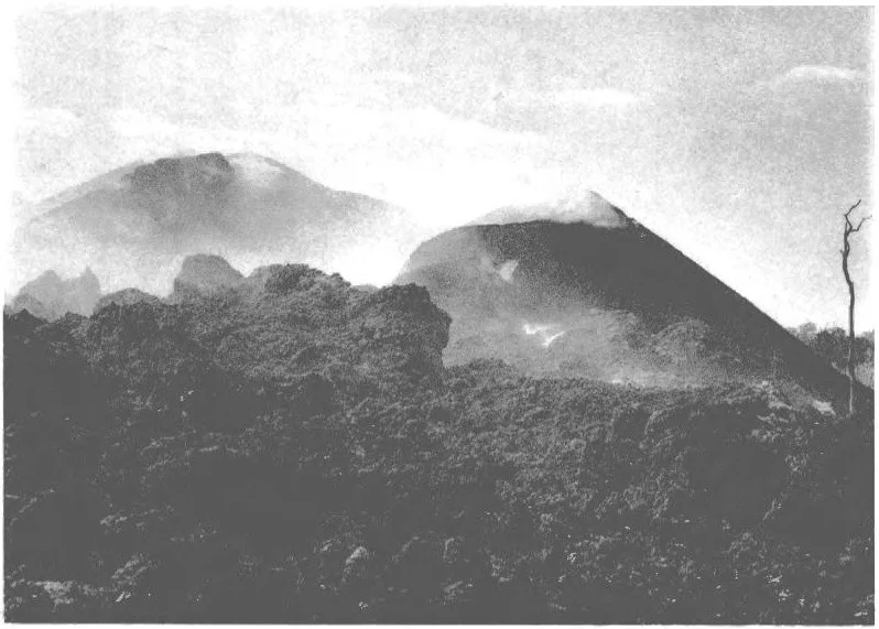
The geologist keeping watch for an eruption was on top of the wrong volcano. On the night of 1 August 1957 Marcel Verhaeghe, standing in for the staff volcanologist, was on the summit of Nyamuragira in the Belgian Congo, “ready to seize an eruption at its start,” when a new cone opened in the forest about 11 km north of Visoke. At 20:00 observers at the park station of Rumangabo saw what they described as an immense sheaf of fire. The news reached him by porter the next afternoon.
He reached the new cone at about 13:00 on 3 August, after hacking through bamboo with machetes and steering, he wrote, only by the explosions. He climbed a tree 300 m from the vent and kept a timed notebook until the last explosion at 16:52. The eruption had lasted about two days. It left a bean-shaped heap of scoria slightly under 40 m high, with three craters in a line and a lava flow more than a kilometre long. C. Donis of the Congo’s national parks flew over it and noticed a distinct smell of burnt flesh.
Verhaeghe could take no temperatures, his pyrometer having been made unusable in an encounter with elephants. Within a week the gas vents were ringed with crystals of white, salmon, pink and even sea-green, which proved to be almost pure salt. The volcano took the name of a nearby locality and has erupted once, which is all it needed to do.
Capelinhos
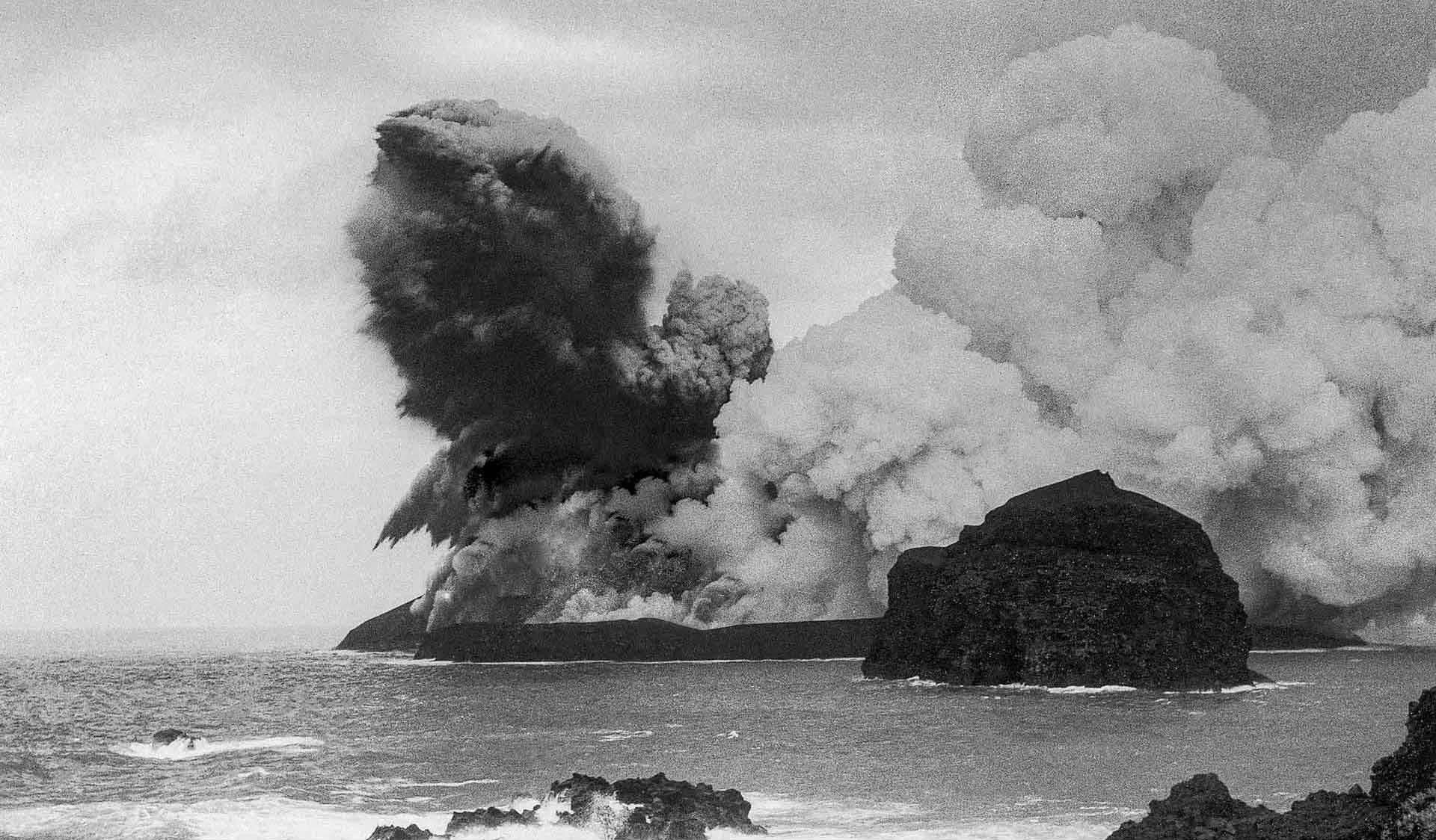
On 27 September 1957, after about 200 felt earthquakes, the sea began to boil at 08:00 off the western tip of Faial. The vent was about 80 m down. The tuff cone it had built by 29 October was largely dismantled by the waves within days, and a second vent about 100 m to the east, opened on 7 November, made the island that survived. It soon joined Faial.
The lighthouse keeper, Tomas Pacheco, stayed at his post at Capelinhos and made many valuable observations, and the lighthouse is now counted as the first volcanological observatory in Portugal. It was abandoned and then buried, 1.55 m of ash falling on it in a single night in February 1958. Scientists and reporters came from around the world, Haroun Tazieff among them. The whaling station at Porto Comprido was given up on the first day, and about 1,500 people were evacuated in October.
The eruption ran 13 months, to 24 October 1958, and added about 2.4 km2 to Faial, only a fourth of which remains. It also changed American law. Public Law 85-892, approved on 2 September 1958 and co-sponsored by Senator John F. Kennedy, authorised 1,500 special visas for Portuguese nationals displaced by “natural calamity in the Azores Islands,” and a later House resolution traced more than 175,000 Azorean arrivals in the United States between 1960 and 1980 to the wave it began. The volcano gave Faial new land and, by one estimate, cost it 40% of its working population.
Surtsey
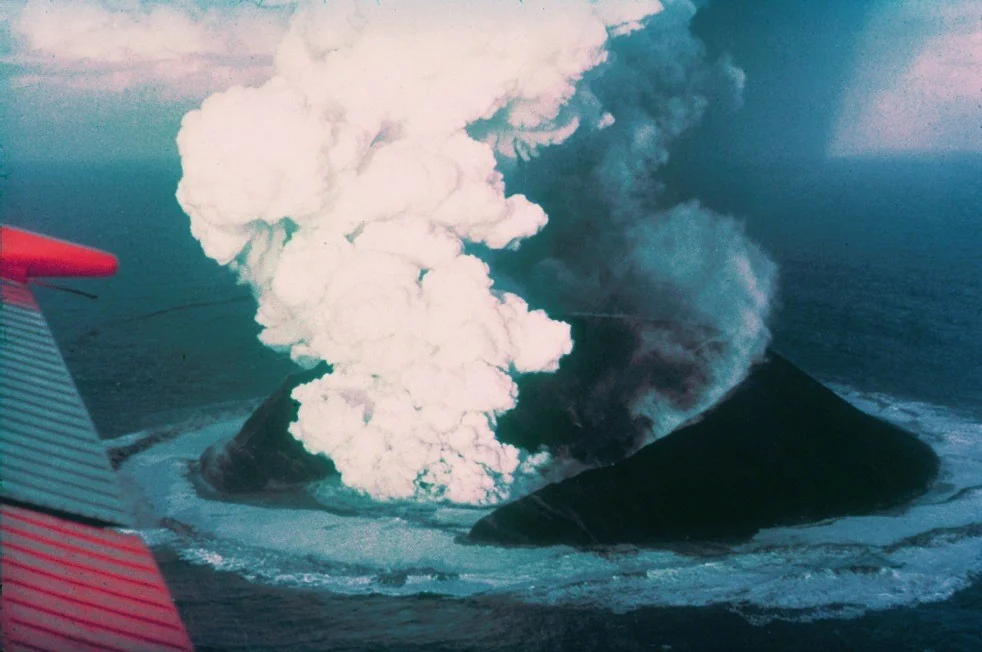
Early on the morning of 14 November 1963 the crew of the fishing boat Isleifur II, laying lines off the Westman Islands, smelled sulphur and saw smoke they took at first for a ship in distress. It was a volcano, and it had been at work on the sea floor for some time: seismographs 131 km away had been recording its tremor since the afternoon of 12 November. By the next day there was an island.
The Icelanders named it for Surtur, the fire giant of the Eddas. It kept erupting until 5 June 1967, which Iceland’s Environment Agency counts as the longest continuous eruption since Iceland was settled, and its chronicler was the geologist Sigurdur Thorarinsson, who brought the word tephra into volcanology from Aristotle and described the island for National Geographic as “Island born of fire.” On 1 December 1963, during a four-hour pause, seagulls touched down on it – probably the first living things on the new land. Marine diatoms were found on the lava in August 1964, and the first flowering plant, the sea rocket, in 1965.
Loose ash should have washed away. Surtsey survived because lava flowed over and protected its southern half and its tephra hardened into tuff, which the sea erodes slowly. Even so, more than half its area has gone since 1967, and it has sunk by about 1 m. It is disappearing, but on its own schedule.
Syrtlingur
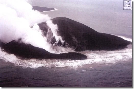
Surtsey’s lava had barely stopped flowing when its neighbour started. Effusive activity in Surtsey’s western crater ended on 17 May 1965, tremor began the same day, and on 22 May explosions broke the sea 600 m east-north-east of the island. By 28 May there was a new island, which was named Syrtlingur.
The Surtsey system had already tried this once. A fissure called Surtla erupted on the sea floor from 28 December 1963 to 6 January 1964 and built a ridge that never reached the surface, so Syrtlingur was the first of only two satellite vents to make an island. It grew to just over 70 m high and 0.15 km2, which for an island made entirely of ash is a respectable size and no guarantee of anything. Thorarinsson, who was documenting the whole eruption, photographed its column that spring, and Iceland’s seismologists logged it as the temporary island of Syrtlingur, a description that proved exact.
Its explosions went on until mid-October 1965, and by 24 October it had disappeared completely. Its short career still had consequences: kittiwakes and black guillemots that had begun prospecting for nest sites on Surtsey were probably put off by the activity at Syrtlingur and Jolnir next door, and real nesting waited until 1970. By 2000 the top of the former island lay 32 m under water, a submarine hill inside the Surtsey Nature Reserve, protected from visitors it was never going to get.
Jolnir
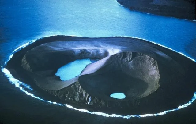
Jolnir arrived for Christmas. Explosions broke the sea about 1 km south-west of Surtsey on 26 December 1965, and the island came up on 28 December. The Icelandic Surtsey site puts it more simply: born at Christmas 1965. Whether its name actually refers to Christmas is less certain than the date makes it look, and no source settles it.
It was a restless child. Photographs taken in 1966 by Richie Williams of the US Geological Survey show an island that, the Smithsonian notes, went through repeated episodes of growth and destruction, rising above the sea and being knocked down by the waves more than once. At its biggest it reached about 70 m high and 0.28 km2, and no lava ever flowed from it to hold it together. It stopped erupting on 10 August 1966. On 19 August lava began to flow again from Surtsey’s eastern crater, inactive since early 1964, which makes Jolnir the last explosive act of the entire Surtsey eruption.
On 22 August 1966 water was already filling two of its craters, less than two weeks after the eruption ended, and by the end of October the island had been washed away. In 2000 its top lay 41 m below the surface, still inside the Surtsey Nature Reserve. It lasted about twice as long as Syrtlingur, which in this neighbourhood counts as longevity.
Eldfell
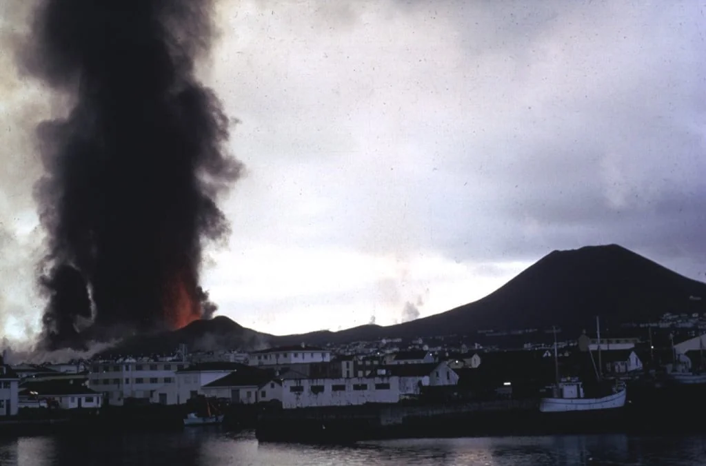
At about 2 a.m. on 23 January 1973 a fissure opened on the eastern side of Heimaey, about a kilometre from the centre of town, and quickly ran across the island from shore to shore. The town’s 5,300 people were lucky in one respect: bad weather the evening before had kept the whole fishing fleet in harbour. Within 6 hours nearly all of them had been taken off.
A cinder cone rose more than 100 yards in two days and eventually, by the museum’s figure, 220 m. Lava and ash destroyed almost 400 homes and businesses, a third of the buildings on the island, and a lava flow crept toward the harbour mouth on which Heimaey’s living depended. From 7 February crews sprayed seawater on it – more than 19 miles of pipe and 43 pumps, in what USGS called the greatest effort ever attempted to control lava flows during the course of an eruption. The harbour survived, and the lava tongue that nearly closed it now serves as a breakwater.
The name was settled by something like a public vote. The newspaper Morgunbladid asked readers for suggestions, 30 came in, among them Church Mountain and Rumble Mountain, and on 24 April 1973 the Place-Name Institute announced Fire Mountain – Eldfell. One house, at Gerdisbraut 10, was later dug out of the ash to become the heart of the Eldheimar museum. Its family had left in the middle of the night, taking only a bottle for the baby.
Nishinoshima 1973 new island

A fishing boat, the Daini-Ebisumaru, reported smoke near Nishinoshima at about 11:00 on 30 May 1973, and the next day a Maritime Safety Agency aircraft fixed the eruption point about 400 m east of the island. Nishinoshima was then a rock about 650 m long and 25 m high, some 930 km south of Tokyo, and JMA counts this as its first eruption in recorded history.
For months the eruption stayed under the sea. On 11 September a new island appeared, and by 14 September it was a black cinder cone 120 m across with a round crater, throwing out blocks. On the morning of 9 October there were three new islands in a row, with explosions every 1-2 minutes hurling black columns of water 250-300 m high. On 21 December 1973 the Maritime Safety Agency named the new land Nishinoshima Shinto, the new island of Nishinoshima, and on 10 June 1974 it joined the old one. The new island had annexed its parent.
In November 2013 the sea did it again. New land appeared about 500 m south-east of the island at a spot the Japan Coast Guard said coincides with where the 1973 eruption began, and the lava that followed buried most of what was there before. By JMA’s figures for December 2018, the rock that measured 650 m by 200 m before 1973 had become an island of 2.89 km2 and 160 m high, with more lava to come. Few births on this list kept growing up.
Ukinrek Maars
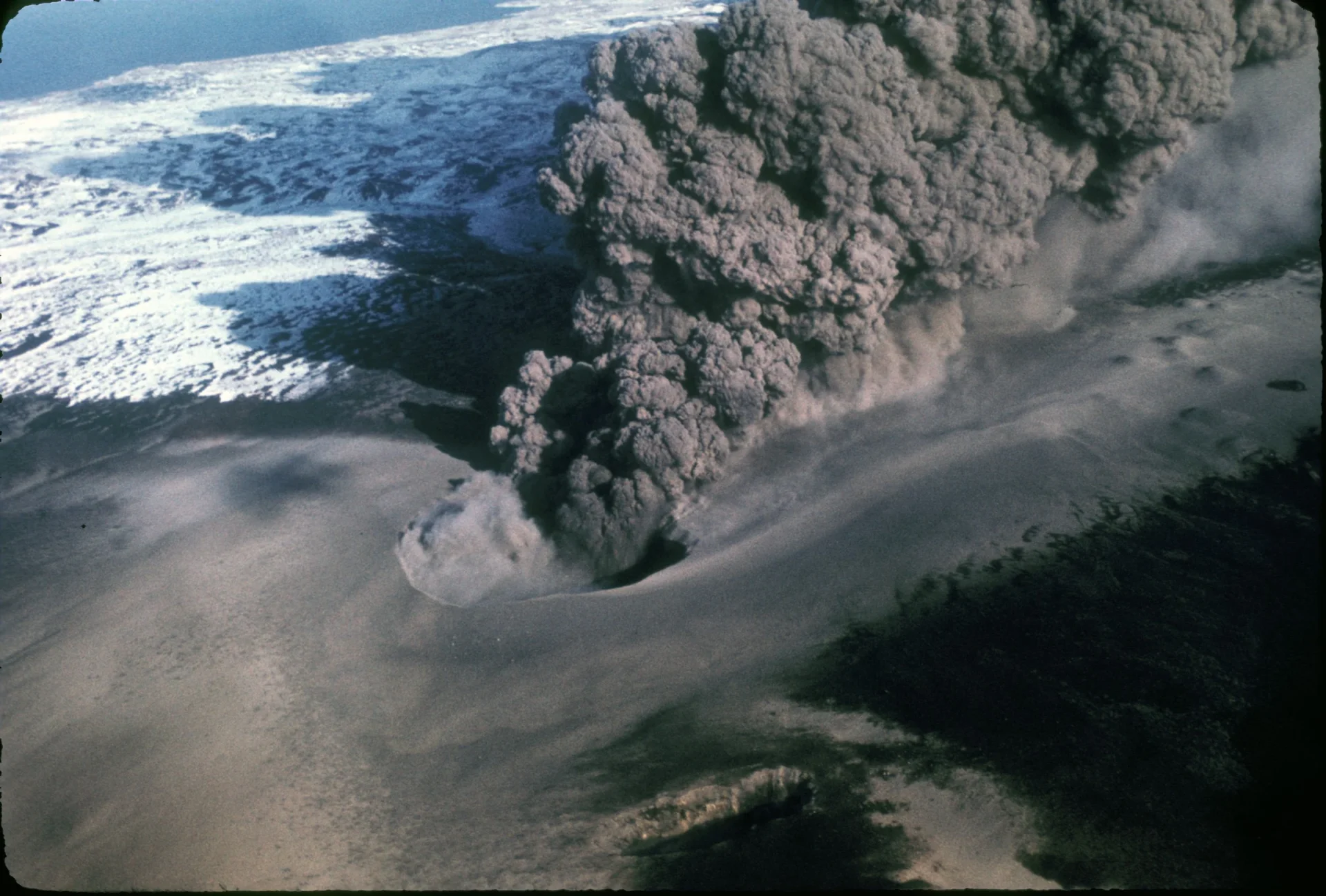
Two bush pilots from King Salmon, flying separately, saw it at 17:00 on 30 March 1977: a plume of steam and ash rising 1500 m from a new hole in the ground south of Becharof Lake, on the Alaska Peninsula, which later reached about 6500 m. People in Egegik, 65 km away, had seen the first explosions at about 4 that morning.
On 2 April an airline pilot reported a 3000 m ash plume, and that evening an FAA pilot found a second vent about 600 m east of the first, which had by then partly filled with water and gone quiet. Alaska Department of Fish and Game staff photographed a yellowish-orange pool of lava at the bottom of the new crater. Fine ash fell over some 20,000-25,000 square km, and a sulphurous haze settled over the city of Kodiak, 250 km to the east. Even the ending had a witness: early on 9 April a fisherman saw violent explosions from 30 km away, and that was the last of them.
The result was two maars, craters blasted below ground level, where groundwater met rising magma. The West Maar is up to 170 m across; the East Maar is up to 300 m wide and 70 m deep, with a lava dome 49 m high on its floor. GVP says they formed in an area without previous volcanic activity, though older domes stand 3 km away. The name, from the Yup’ik, means two holes, which is a fair summary.
Ardoukoba
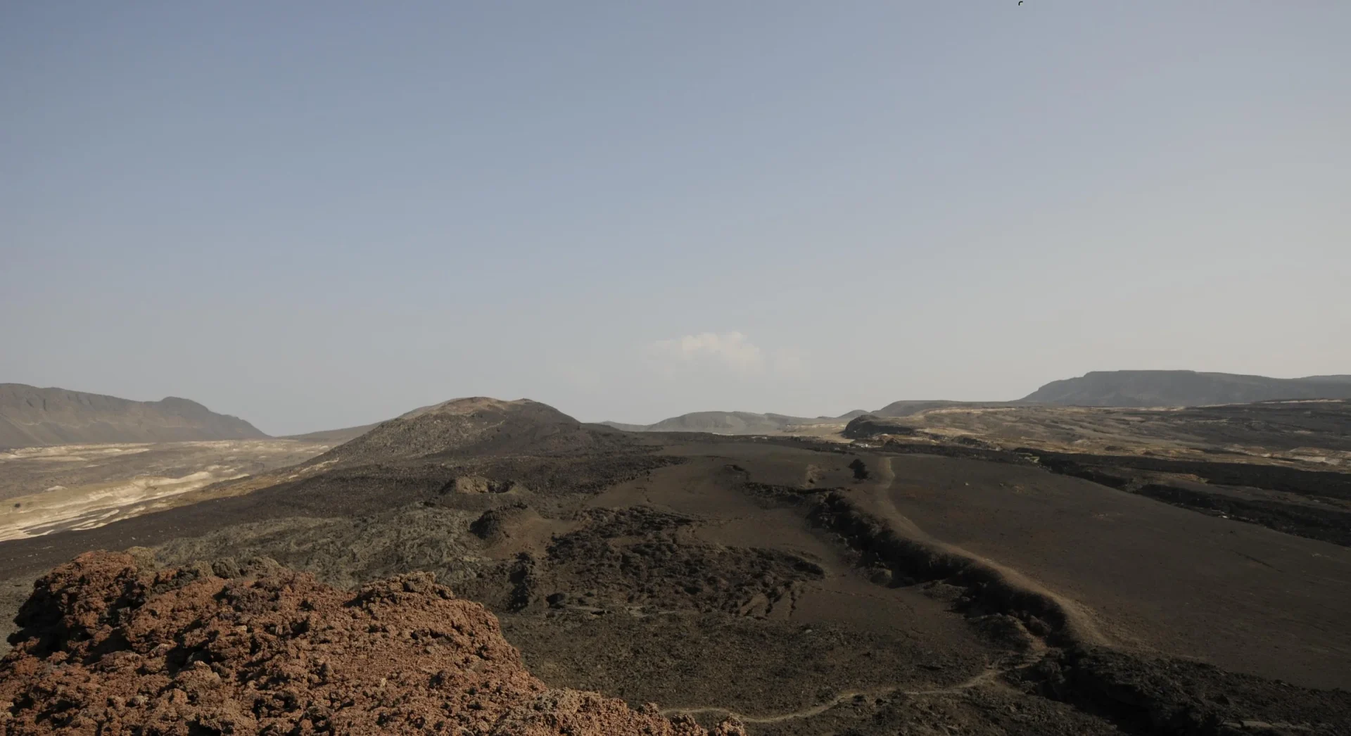
Early on 8 November 1978 the crew of a French observation aircraft saw lava fountaining from a newly opened fissure in the Asal Rift of Djibouti, south-east of Lake Assal. The ground had given notice: a magnitude 5.2 earthquake the evening before, after roughly 800 smaller quakes in 24 hours.
The eruption lasted a week, to 14 November. Gas came first, then fountains along a fissure 500 m long that built three spatter cones; then the activity shifted half a kilometre south-east and raised the main cone, Gira-le-Koma, about 30 m high, with a small lava lake that dropped rapidly on 13 November. It poured out at least 12 million m3 of basalt over a little more than 3 km2. About 25 new fissures opened parallel to the rift, and faults on the rift floor slipped by 0.15 to 0.5 m. Ardoukoba is a new cone in an old rift rather than a mountain from bare ground, but the Smithsonian gives it an entry of its own, and the rift had no historic eruptions before this one.
The scientific prize was the crack itself. Allard, Tazieff and Dajlevic wrote in Nature that the short eruption allowed “accurate measurement of seafloor spreading in Afar for the first time.” Estimates of how far the rift opened run from about 1 m to 2.4-2.8 m. No casualties or damage were reported, the usual outcome when the Earth splits somewhere almost nobody lives.
Anak Ranakah
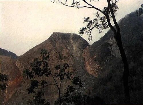
At ten at night on 28 December 1987 explosions began from a crater at the foot of Gunung Ranakah on western Flores, in an area with no known historical eruptions, and officials reported “fire” at the crater. The crater was old. What came out of it was not: a new lava dome that the Smithsonian calls Anak Ranakah, the Child of Ranakah.
Observers from the Volcanological Survey of Indonesia reached the nearby town of Ruteng on 30 December and soon had a seismometer running at Robo village. By 6 January about 20,000 people had been evacuated from within 5 km of the vent. On 11 January 1988 the observers confirmed that a new lava plug had risen 50-75 m in the crater, and by the end of the month the dome stood about 100 m above the rim, growing at about 500,000 m3 a day. On 12 January rockfalls off its face sent a glowing avalanche, a nuee ardente, about 5 km down the Wai Reno valley, singeing trees before it stopped 700 m short of the highway.
Ash fell 1 mm deep in Ruteng and 3 mm in Robo. On 30 March 1988 the crew of a British Airways flight from Singapore to Sydney reported a large black cloud, which satellite images showed to be thunderstorms. By late February the dome held about 11.5 million m3, and its growth had apparently ended by November 1989. The name fits: a new dome born at the foot of an old one.
Sholan Island
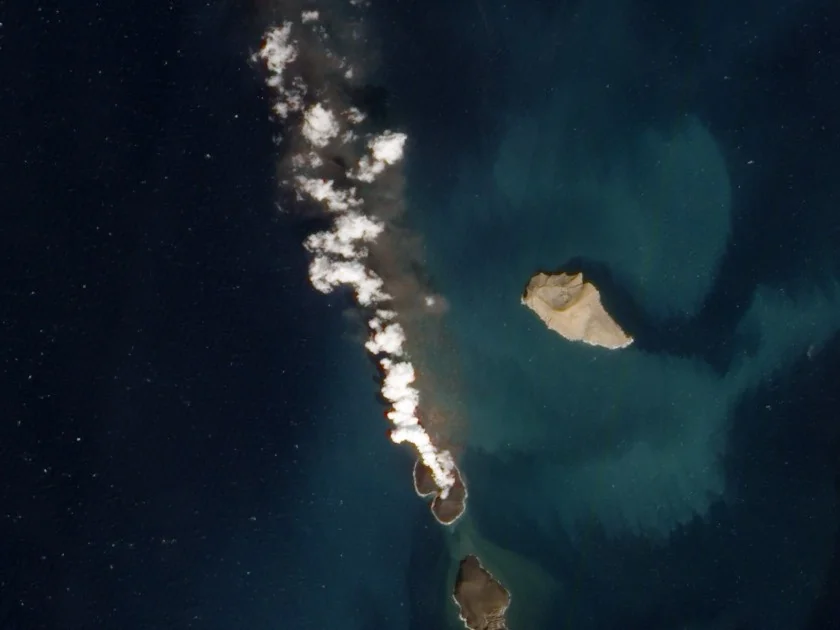
Yemeni fishermen from the port of Salif saw it on 18 December 2011: lava fountains 20 to 30 m high in the open Red Sea among the Zubair islands, about 60 km off the coast. The eruption had probably begun under water on 13 December, when two small earthquakes registered on Yemen’s seismological network, and on 23 December a WorldView-2 satellite image showed a new island.
The fishermen’s description, as Smithsonian Science relayed it, had the volcano “popping up red lava that reached 20 to 30 meters high.” NASA’s Earth Observatory, comparing its December image with one from October 2007, noted with admirable restraint “an apparent island where there had previously been an unbroken water surface.” The island was named after Jamal Sholan of Yemen’s Seismological and Volcanological Observatory, the first Yemeni scientist to visit it, who went out 5 days after the eruption ended. After 25 days of activity it measured at most 0.77 km long, with 0.25 km2 above water, and in August 2012 it stood about 94 m high.
Expectations were low. Smithsonian volcanologists said in January 2012 that islands like this often wash away in about a year, and the waves did take about 30 percent of Sholan quickly. Yet it persisted, Plank and colleagues found, for over 7 years before it was gone, around 2019. Xu and colleagues observed that only a few such eruptions have been witnessed since Surtsey emerged in the 1960s. This one, at least, had fishermen in the front row.
Jadid Island
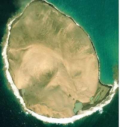
No human eyewitness to this birth has ever been found. The Zubair islands have no observers of their own, so the second new island of the sequence announced itself on 28 September 2013 to a satellite: a single-pixel thermal alert, then a sulphur dioxide plume, then a Landsat-7 image the next day of discoloured seawater and a thick plume between the Saddle and Saba islands, 8 km south-east of Sholan. By 23 October images showed a cone 0.8 km across.
This is the satellite age’s version of a farmer in a field, and under the rules of this list a satellite watching a birth counts as watching it. The researchers reconstructed the whole eruption from radar and optical images; KAUST’s Jonsson pointed out that the islands belong to Yemen and are basically out of reach for fieldwork. After about 54 days the island was about 0.9 km across with about 0.68 km2 above water, more than twice the size of Sholan, and by March 2014 it stood about 186 m high. The team named it Jadid, Arabic for new.
Xu and colleagues predicted that the two new islands would remain above the surface despite the fast erosion, and Jadid is the one that kept the promise. Plank and colleagues listed it as still existing at their census of March 2025, and from April 2019 a sand bank of its own eroded material formed a land bridge to Saba. The island no human saw has started reaching for the neighbours.
Hunga Tonga-Hunga Ha’apai 2014-15 island

Fishermen spotted the eruption on 19 December 2014, in the sea between the islands of Hunga Tonga and Hunga Ha’apai, and people in Nuku’alofa, about 65 km to the south, watched its plumes on the horizon into late January. A photographer on Tongatapu, Shane Egan, said it had been “puffing away like a steam train since Christmas Eve” and called it Tonga’s own white Christmas.
When the eruption ended in January 2015 the new land was about 2 km long and 120 m high, and it had welded itself to Hunga Ha’apai. On 6 March GP Orbassano and two other Tonga residents landed on one of its beaches and found a green crater lake that smelled of sulphur and thousands of seabirds laying eggs; the place, he said, looked like the moon. Everyone expected the sea to take it within months. In 2017 NASA revised that to “a 6- to 30-year lease on life,” and in October 2018 a NASA scientist visiting with the Sea Education Association found sooty terns nesting in the gullies around the crater lake. The island never received an official name.
The lease ran out early, and not through erosion. In January 2022 the volcano exploded with a plume that reached 57 km, by one estimate in Science, and NASA reported that “all of the new land is gone.” Plank and colleagues put the island’s lifetime at 2,584 days. That was inside NASA’s forecast, which is one way for a forecast to come true.
Fagradalsfjall (Geldingadalir, 2021)
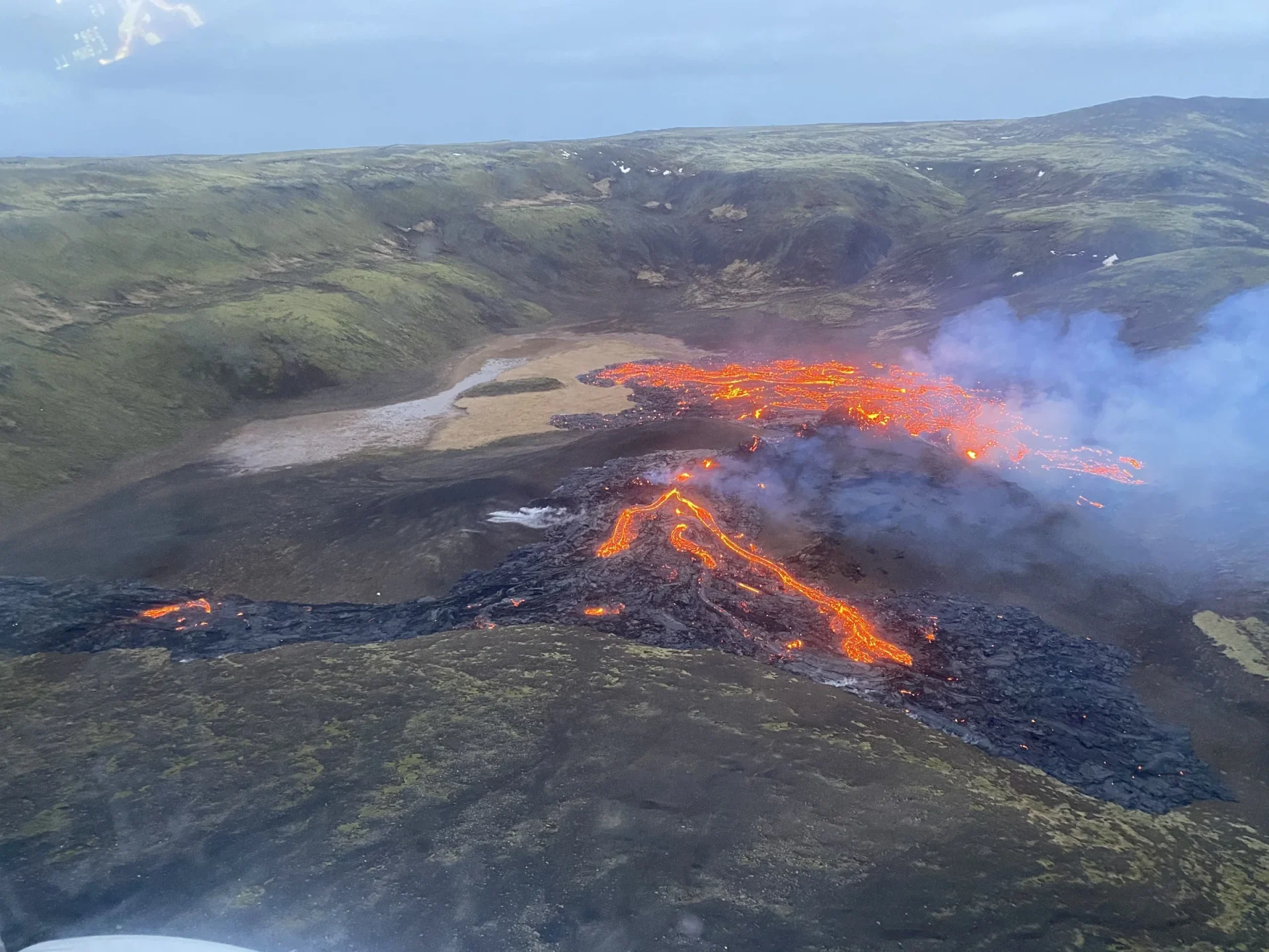
A webcam saw it first. On the evening of 19 March 2021 lava broke out on a slope in the Geldingadalur valley on Iceland’s Reykjanes Peninsula, and a camera on a nearby ridge caught the first images; a Coast Guard helicopter pilot soon spotted the embers “spitting and hissing at the sky.” It ended about 800 years of quiet on the peninsula, after 15 months of earthquakes, about 50,000 of them in the last three weeks.
The vent began as a fissure 200 m long that grew to 700 m and built three cones, with small fountains up to 100 m high. This was a birth in the capital’s backyard – “Fagradalsfjall is in the backyard of the capital of Iceland, Reykjavik,” as the volcanologist Pedersen put it – and it was measured relentlessly: Pedersen and colleagues completed 33 near-real-time photogrammetric surveys by late September 2021, with maps reaching the public and police within 3 hours. Thousands came to watch in person, along a hiking route pegged out within days.
The eruption ended on 18 September 2021 and left 4.8 km2 of new lava, about 150 million m3 of it. In early May 2021 the lava’s name, Fagradalshraun, became the newest entry in Iceland’s place-name database. The quiet did not come back: GVP lists new eruptions nearby from 3 August 2022 and 10 July 2023, and a run of eruptions on the Sundhnukur crater row near Grindavik from 18 December 2023. The peninsula had only been resting.
Ioto new island (Iwo Jima, 2023)
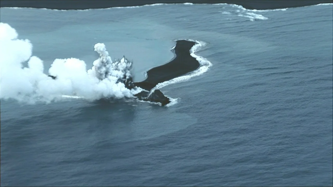
For at least 700 years the island of Ioto, the former Iwo Jima, has been rising out of a drowned caldera, but in October 2023 it produced something new: an island of its own, about 1 km off Okinahama. A satellite image of discoloured water on 18 October was the first sign, and JMA reported the eruption from 21 October.
On 30 October observers from the University of Tokyo’s Earthquake Research Institute, flying with the Mainichi newspaper, found the vent erupting every few minutes, and its ejecta had already built “a black-colored island about 100 m in diameter.” By 3 November eruptions were coming roughly once a minute. On 23 November the Japan Coast Guard measured the island at about 450 m by 200 m, with “torn lava fragments that seemed still molten,” and ESA, publishing a Sentinel-2 image, reported that it was being called Niijima, which means new island in Japanese.
No official name for it has turned up. By 15 December the main remnant was only about 200 m by 100 m, by 13 February 2024 all that was left was an arch about 25 m wide and 10 m high, and on 22 October 2024 the Coast Guard could not confirm the island at all. Plank and colleagues judged that it was too small to remain intact longer than 2 months. On a coast where the land itself has been climbing out of the sea for centuries, the newest arrival could not keep its head above water.
Frequently Asked Questions
Is Paricutin the youngest volcano on Earth?
No. Britannica calls Paricutin, which emerged in a Mexican cornfield on 20 February 1943, one of the youngest volcanoes on Earth, and San Diego State University calls it the youngest of the 1,400 vents in its own volcanic field. Twenty of the births on this list came after it, in Iceland, Japan, Tonga and elsewhere.
Why isn’t Showa-shinzan on the list?
Because the Smithsonian files Showa-shinzan as a dome on the east flank of Usu volcano in Japan, not as a volcano of its own, and this list excludes new vents on existing mountains. Its growth from 1943 to 1945 was drawn by the local postmaster, Mimatsu Masao, whose Mimatsu diagram became the first detailed record of a growing lava dome.
How can a volcano born 2,000 years ago count as watched?
Because what counts is a record that traces back to eyewitnesses, not a photograph. The Smithsonian files Hiera (about 197 BCE), Thia (46-47 CE) and Mikra Kameni (about 1570-73) as ‘Observations: Reported’, like Paricutin. Thia and Mikra Kameni rest on writers alive then or told by people who were; Hiera rests on a sailors’ story Posidonius recorded generations later.
Does a satellite count as watching a volcano being born?
Yes. On this list an eruption seen while it built new land counts whether the eyes were human or orbiting. NASA’s scientists followed the 2014-15 island at Hunga Tonga-Hunga Ha’apai closely by satellite, and Jadid Island in the Red Sea, born in 2013, has no known human eyewitness at all: satellites watched it alone.
Why did so many of these new islands disappear?
Because most were built of loose ash and cinders, which give the waves almost nothing to resist. Plank and colleagues found that most loose tephra islands formed since 1963 lasted around 100 days or less. Syrtlingur, born beside Surtsey in 1965, washed away because, in UNESCO’s words, no lava was emitted to harden into armour.
Can you visit Surtsey?
Not as a tourist. Surtsey has been, in UNESCO’s phrase, legally protected from its birth, human visits have been restricted since 1965, and scientists need permission before going ashore. UNESCO, which inscribed it on the World Heritage List in 2008, calls the island a pristine natural laboratory, a place where researchers can watch life arrive on brand-new land.
Sources
- Smithsonian Institution Global Volcanism Program – Michoacan-Guanajuato (Paricutin and Jorullo)
- U.S. Geological Survey – Bulletin 965-D: Birth and Development of Paricutin Volcano, Mexico
- NASA Earth Observatory – New Island Made of Tuff Stuff (Hunga Tonga-Hunga Ha’apai)
- Greek, Roman and Byzantine Studies (Duke University) – the ancient sources on Hiera and Thia
- UNESCO World Heritage Centre – Surtsey